WALK INFORMATION
DATES: April 1 - 4, 2021
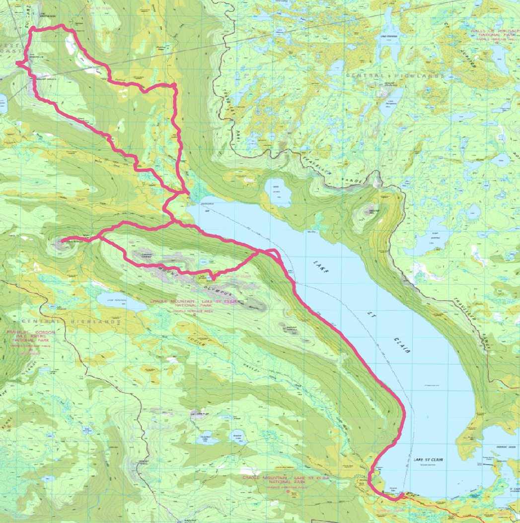
DISTANCE: 61km
WEATHER: Very nice. Sometimes windy.
Regular readers of this blog will know that Dash and I seem to like to do walks that are long, remote and often psychologically painful.
So when planning for this one, we were after something a little easier and relaxing. But as usual, even the best, well intentioned ideas go awry.
In the months leading up to this, we had discussed several options ranging from visiting Frenchman’s Cap and its friends, to a much more scrubby visit to places like Curvier, Manfred, Coal Hill and Goulds Sugarloaf. I’d recently been to Frenchman’s, and thankfully some sense prevailed on the Goulds Sugarloaf idea (it was not enough available time as much as anything) - so a visit to a few of the more famous mountains and areas around Lake St Clair was scheduled.
The plan was:
- Catch the ferry to Echo Point
- Paddle across Lake St Clair
- Finally get up Mount Ida
- Paddle back
- Go up Olympus
- Get back down somehow
- Make our way to Gould
- Go up there
- Go home
Those with a keen eye will have realised that the plan doesn’t quite match the headline of this post.
When we arrived at Lake St Clair visitors centre, we realised that it was … quite windy. The lake was choppy and waves were rolling in. This presented some potential problems with the second item on our list.
But, we were still going to give it a shot because maybe it wasn’t so bad once you were on the packraft and heading the nearly 2km across the water.
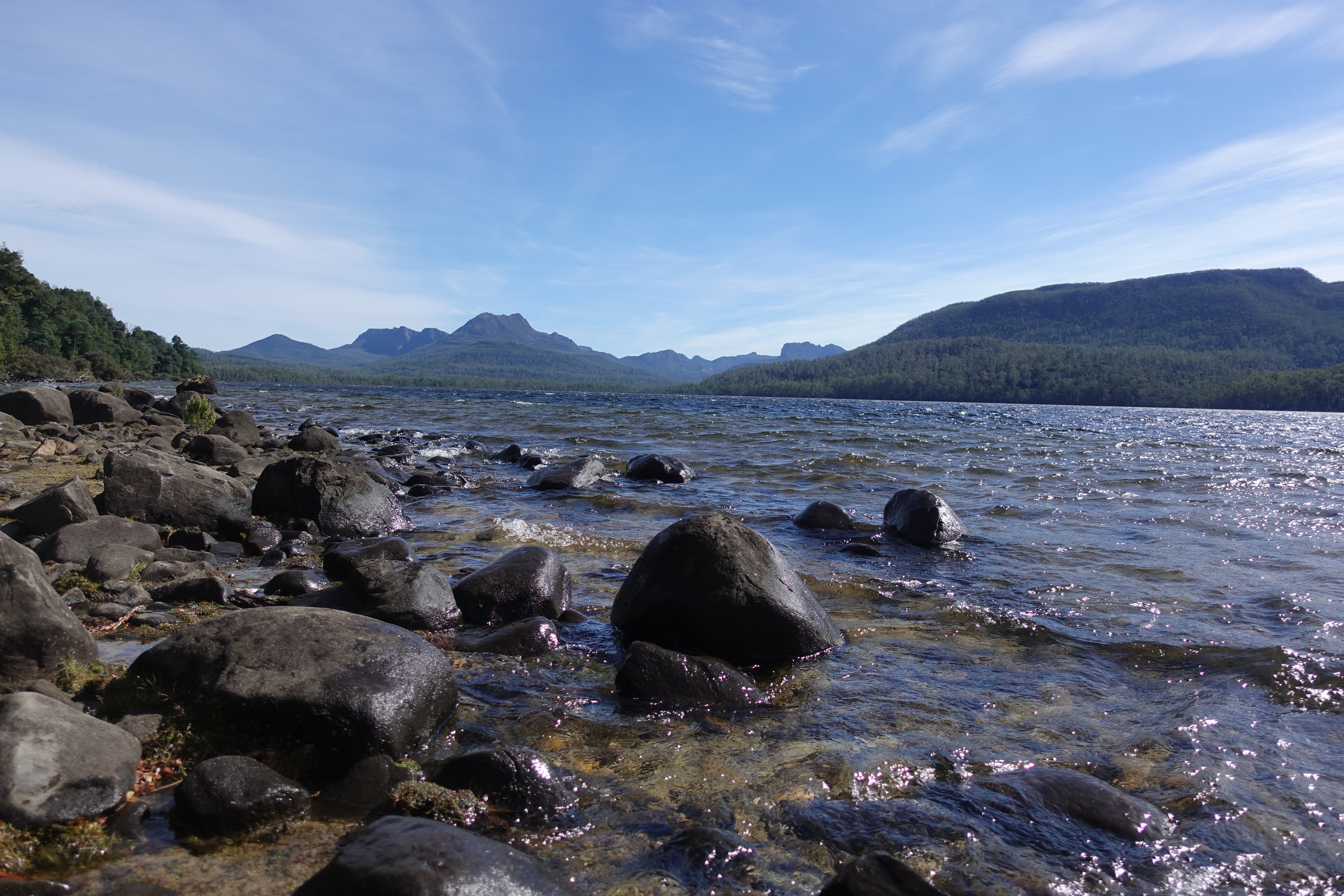
We got off the ferry, and took the captain’s advice to walk well up the track before launching our packrafts because we were sure to be blown south by the wind.
We lugged our bags, rafts and lifejackets up the track about 2km and found a little gap to a rocky beach and got to work blowing up the boats.
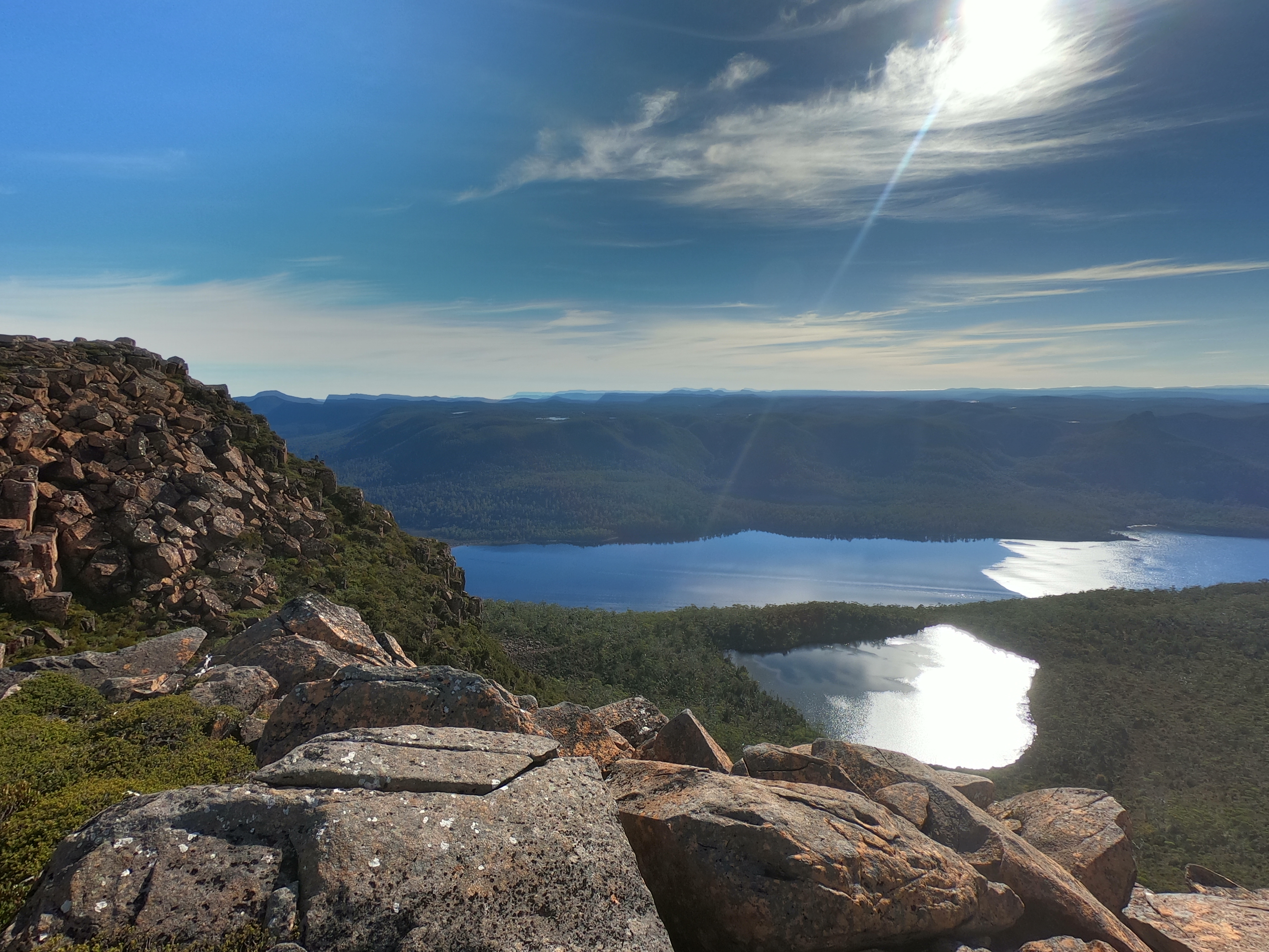
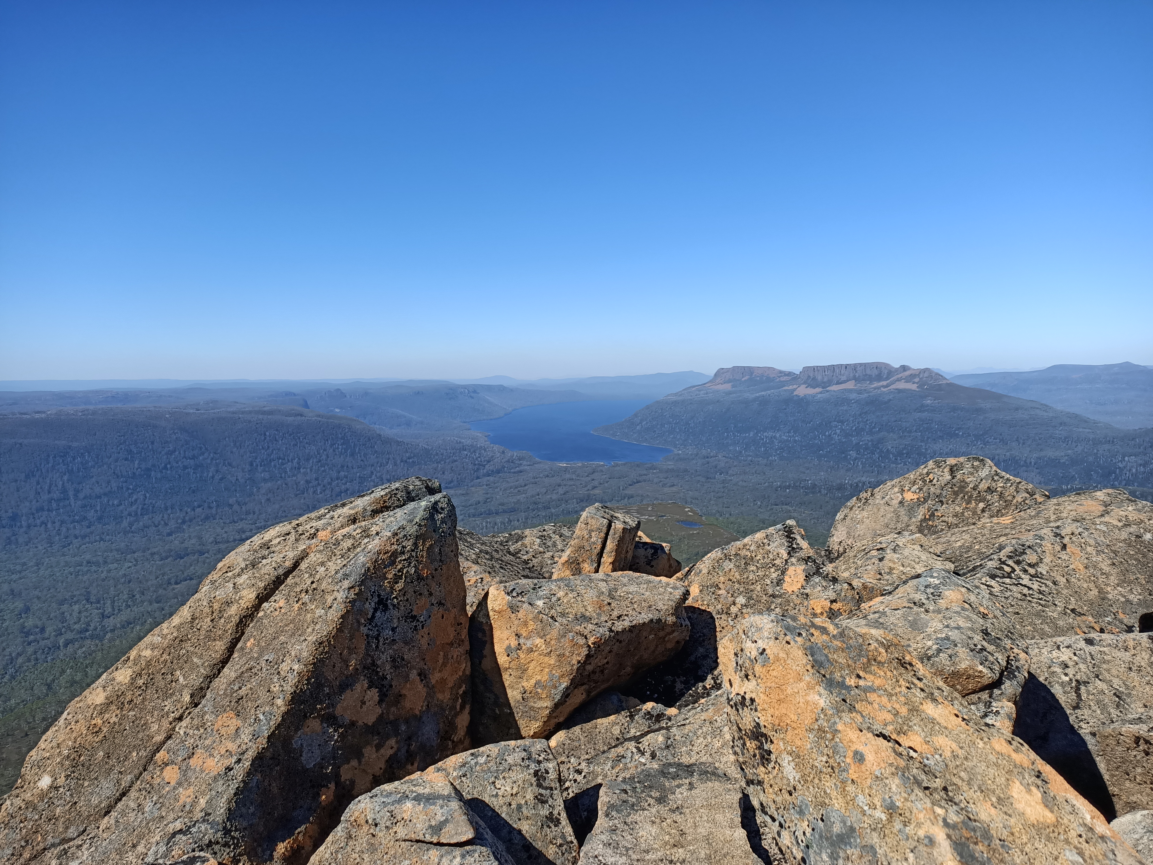
Our objective was Ida Bay, roughly 1,600 meters to the north east (ish)
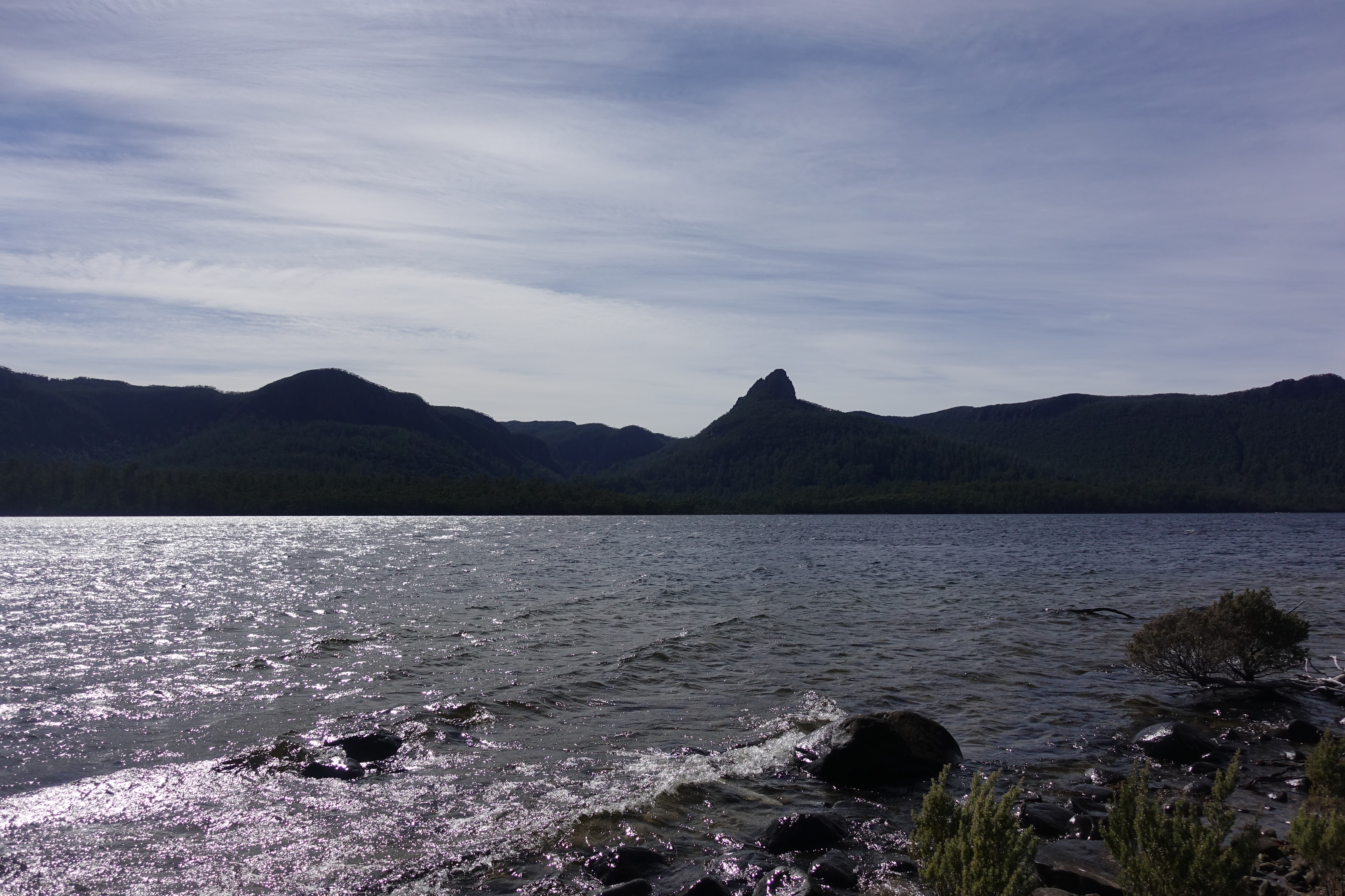
To our north was Mount Gould, lying in wait for us to arrive in a few days.
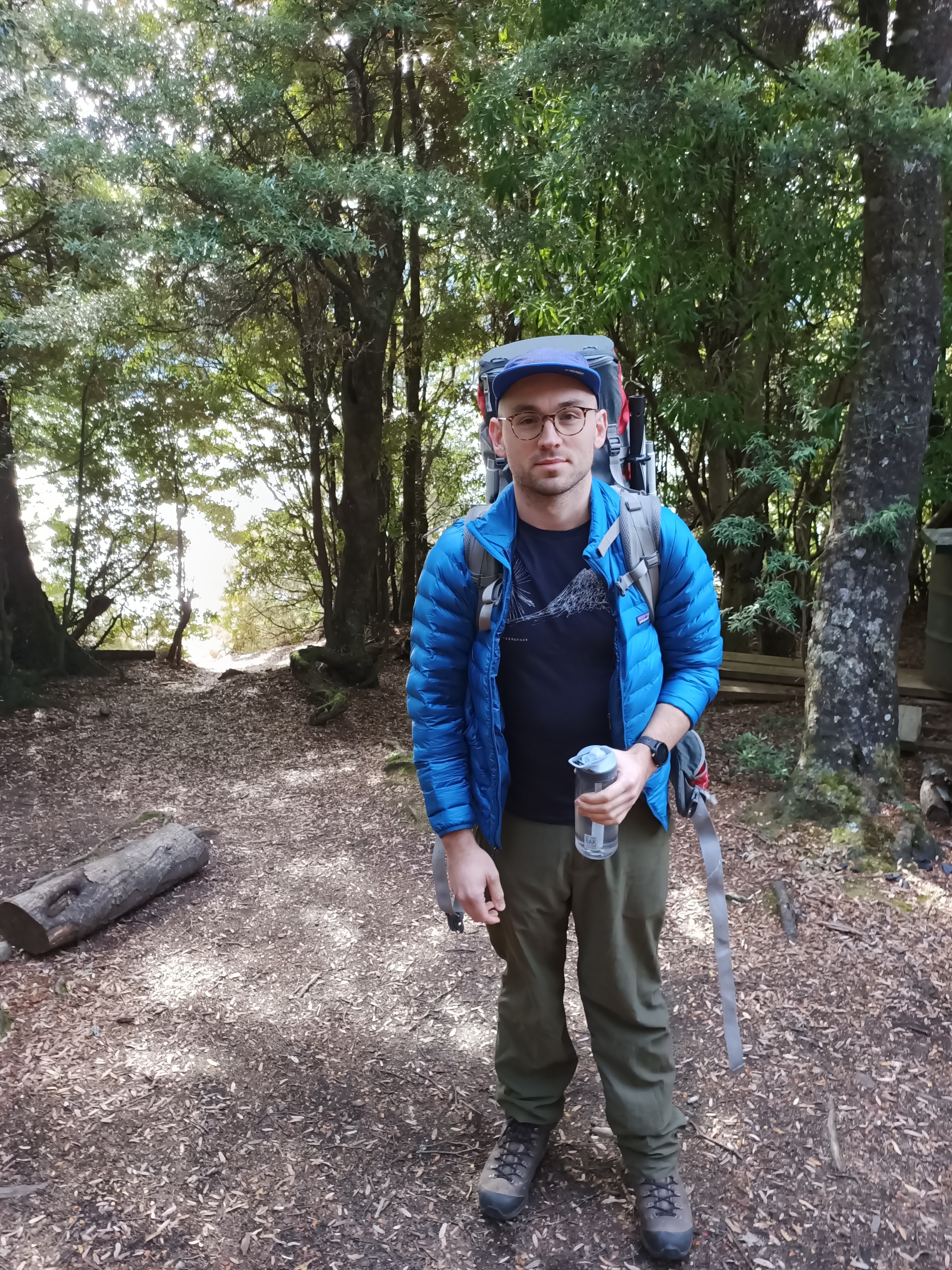
Now, the reason I’ve included those three photos is not because they’re the particularly good pics - but because they’re three of the five pictures I managed to take with that new (for me) fancy camera before I managed to break it.
How did I break it? Well, it got very wet in what can only be described as our utter failure of a lake crossing that was just about to happen.
As we prepared to launch, the wind got stronger. Waves were rolling down the lake, and - for some reason - we though now or never.
So we pushed off, and started paddling. It wasn’t super dangerous, but after about 150 meters we realised that the waves were too big, the wind too strong and there was a LONG way to go.
Looking at the GPS map, it’s actually pretty funny how far we didn’t actually go.
Even battling back to shore was tough.
So, I think we made the right decision. We were already off course, and if we had continued we’d have probably ended back up at the Lake St Clair visitor centre.
Sadly, I’d done a bad job water proofing my bag and water had found its way to the camera. It didn’t turn on. It hasn’t since. Sad.
Ida had beaten us again (we had originally planned to approach Ida from the Traveller Range on this walk a few years back but changed our mind)
So with Ida scratched, we packed up the rafts, life jackets and paddles. I stashed them in the bush for later retrieval and we figured we may as well skip ahead to item 5: Go up Olympus.
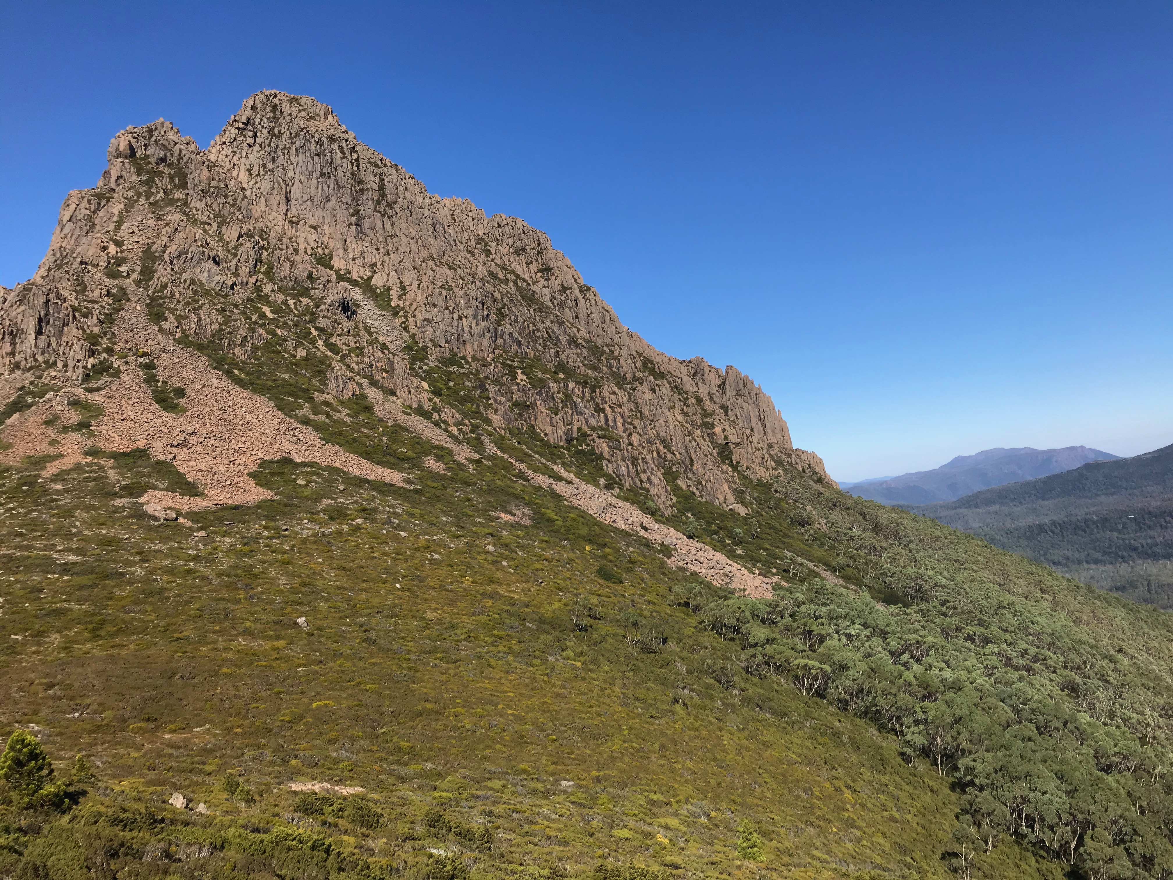
Climbing Olympus
Olympus is a fantastic mountain. I’ve looked at its heights many a time while flying past on the ferry.
It’s not a hard climb as such - sure it’s steep, requires rock scrambling up a few cliffs and has some heavier scrub in parts - but it’s a nice walk.
Lake Oenone was were we’d sleep that night.
After a few more failures on my behalf (I dropped my bag down a cliff, resulting in the death of my Kindle… sigh) we reached the lake.
In the morning, we had some delicious coffee and started up the ridge between Lake Oenone and Lake Helen which would take us up onto the Mount Olympus plateau.
The weather was amazing. Not too windy, not too hot. Perfect for walking.
We mournfully looked back across Lake St Clair at Ida, and what seemed to be much nice water conditions. But from such height, who knows.
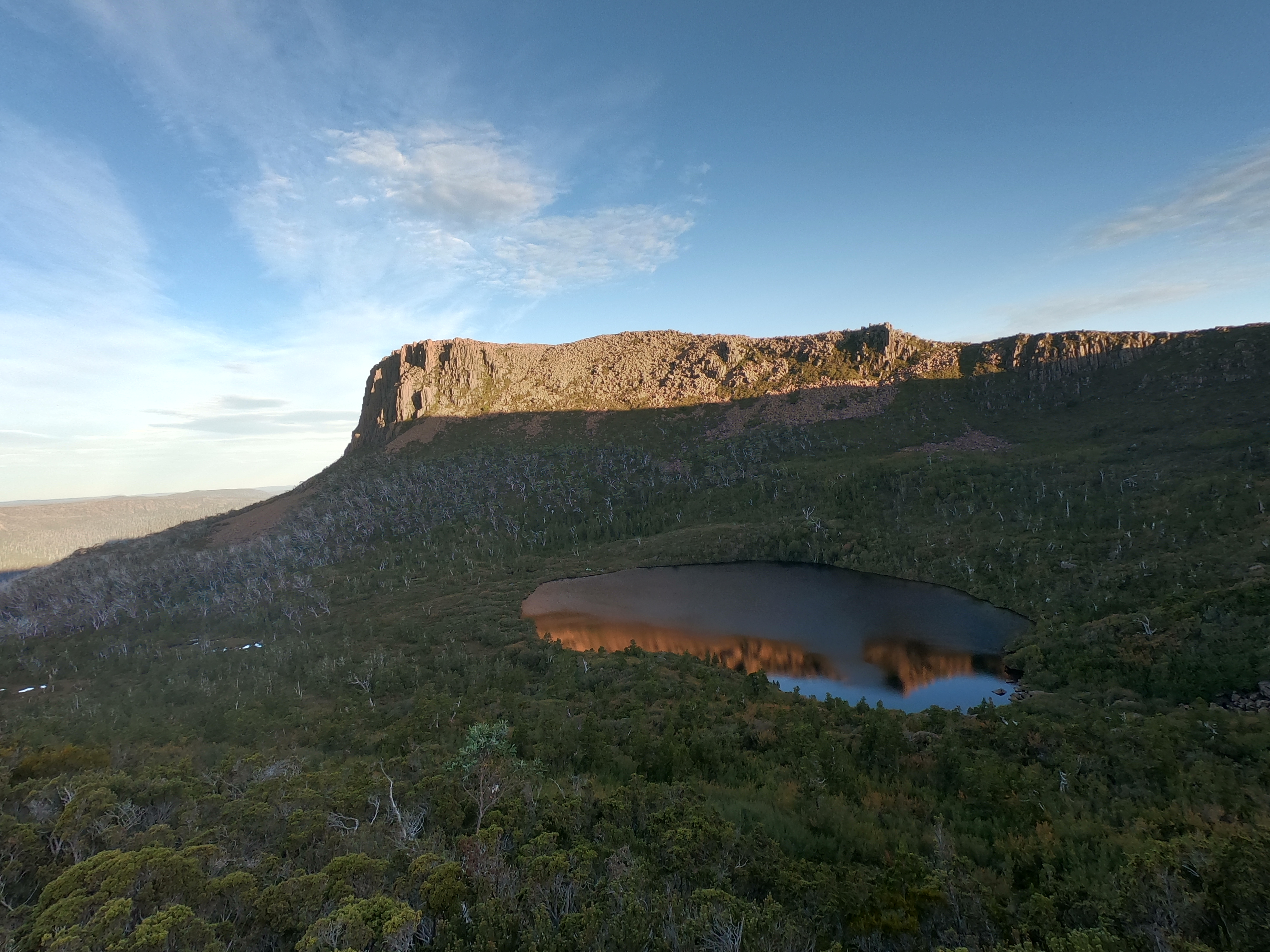
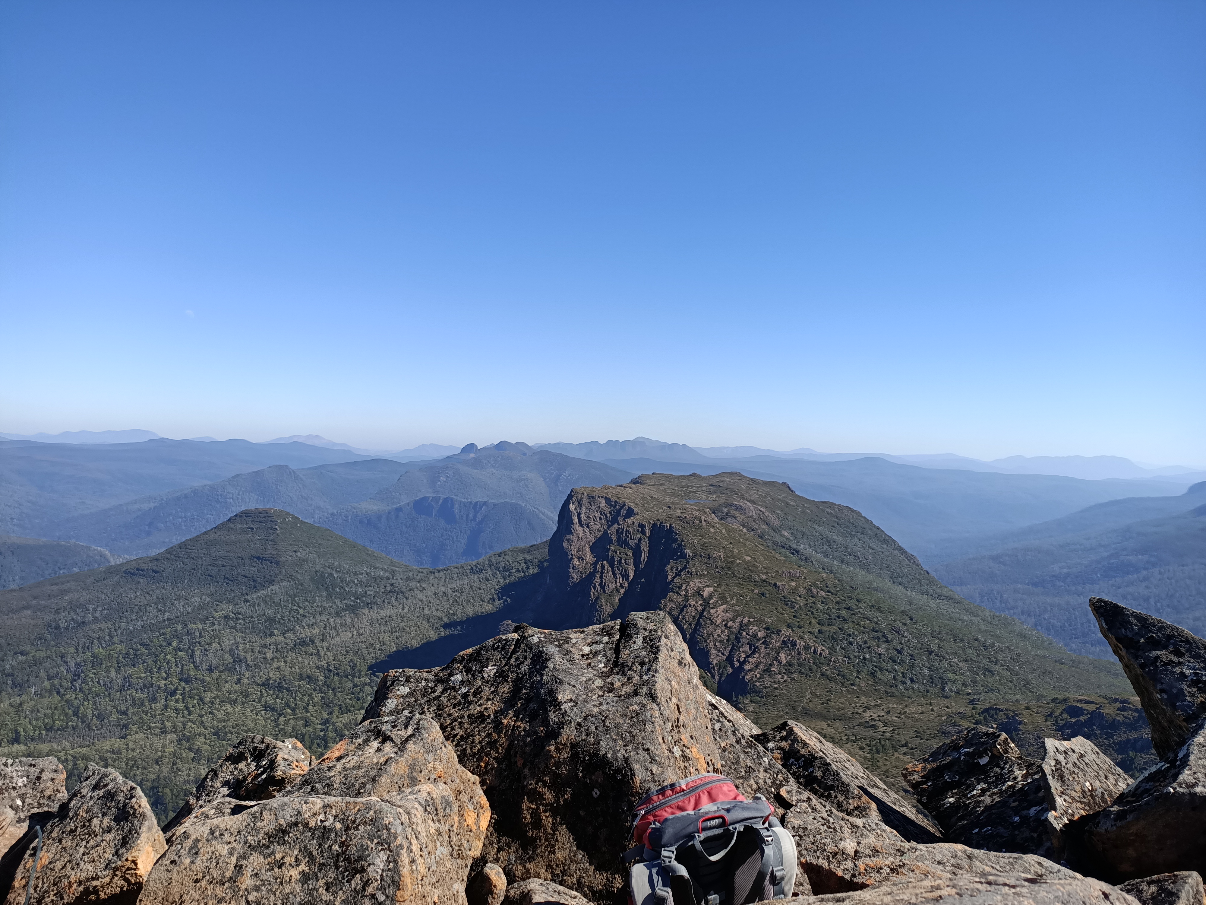
After a final slog up the ridge line, we made it up onto the start of the Olympus plateau.
It’s such a lovely area, with beautiful vegetation, lakes and interesting rocks.
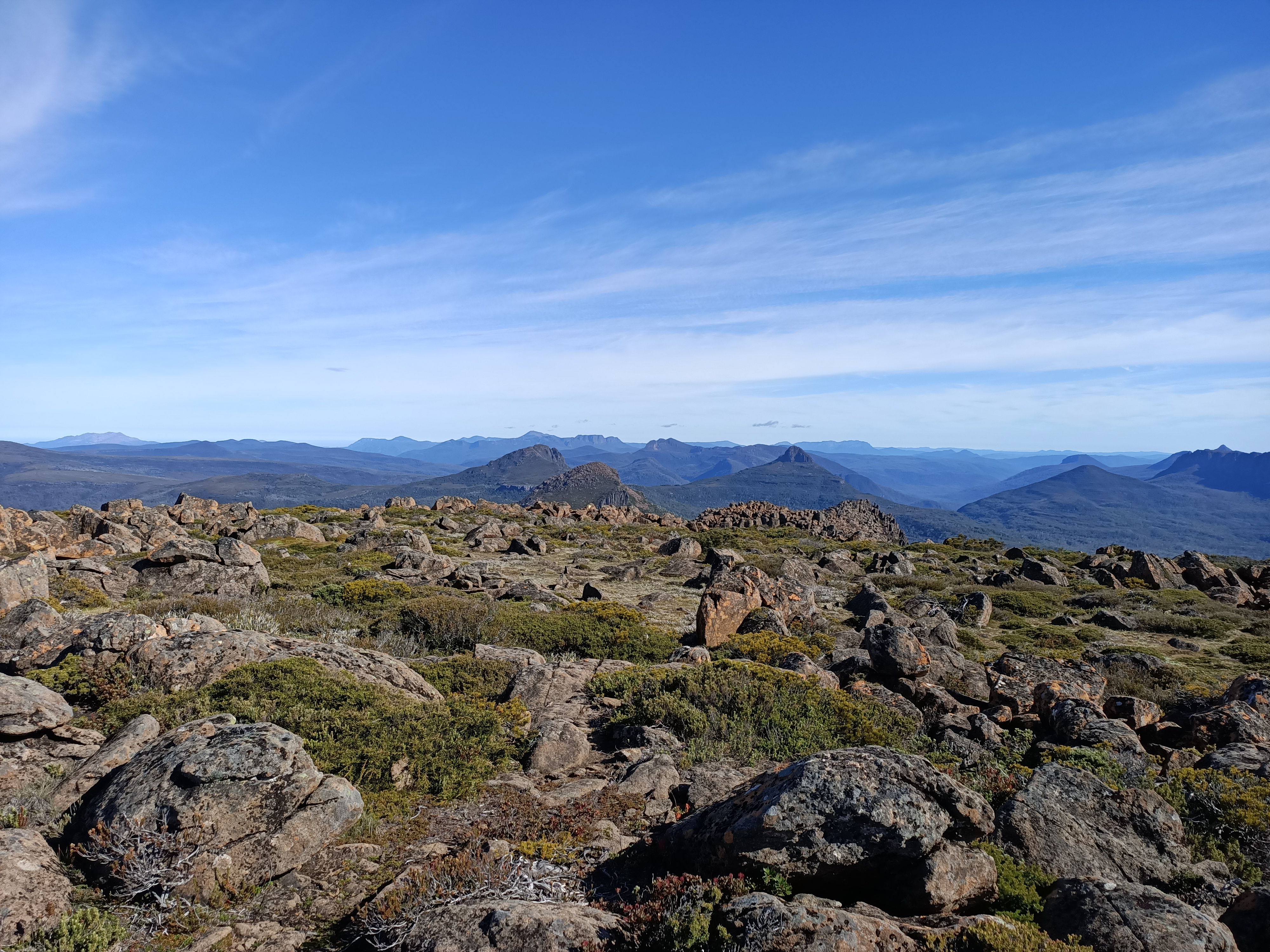
There was little reason to rush. After about two and a quarter hours after leaving camp we made it to the peak.
So lets revisit the plan: despite the Ida failure, we had successfully ticked item 5 off the list. Next? Getting back down.
Down Olympus, a different way
Instead of retracing our steps, we wanted to come down Olympus’ south side.
We knew it was possible, but only had found some vague notes about the route to take.
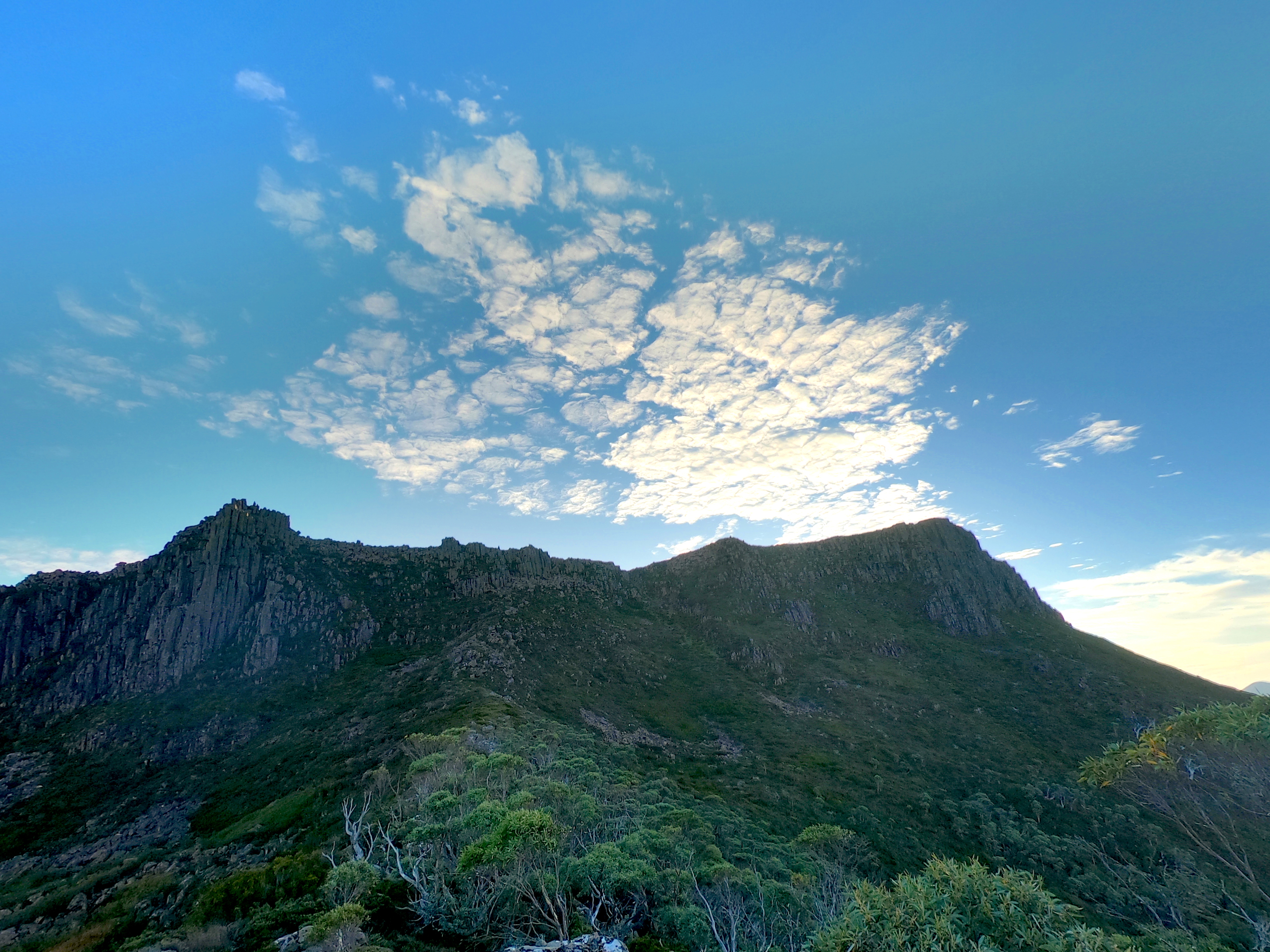
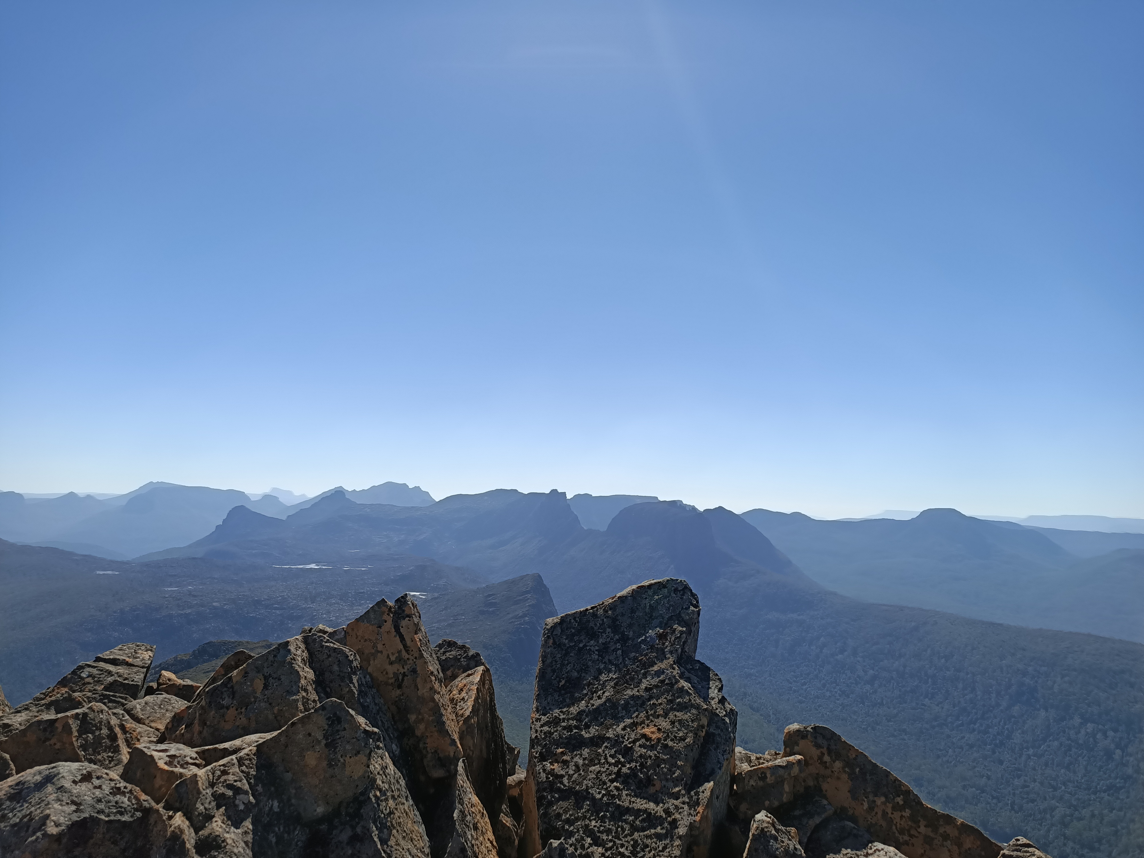
We set off in a broadly westerly direction, and it wasn’t long before the flat plateau of Olympus turned into a steep boulder field.
Hopping from boulder to boulder, we worked our way down and down passing through 1300m altitude, before coming to about 1250m where we followed the contour around the mountain.
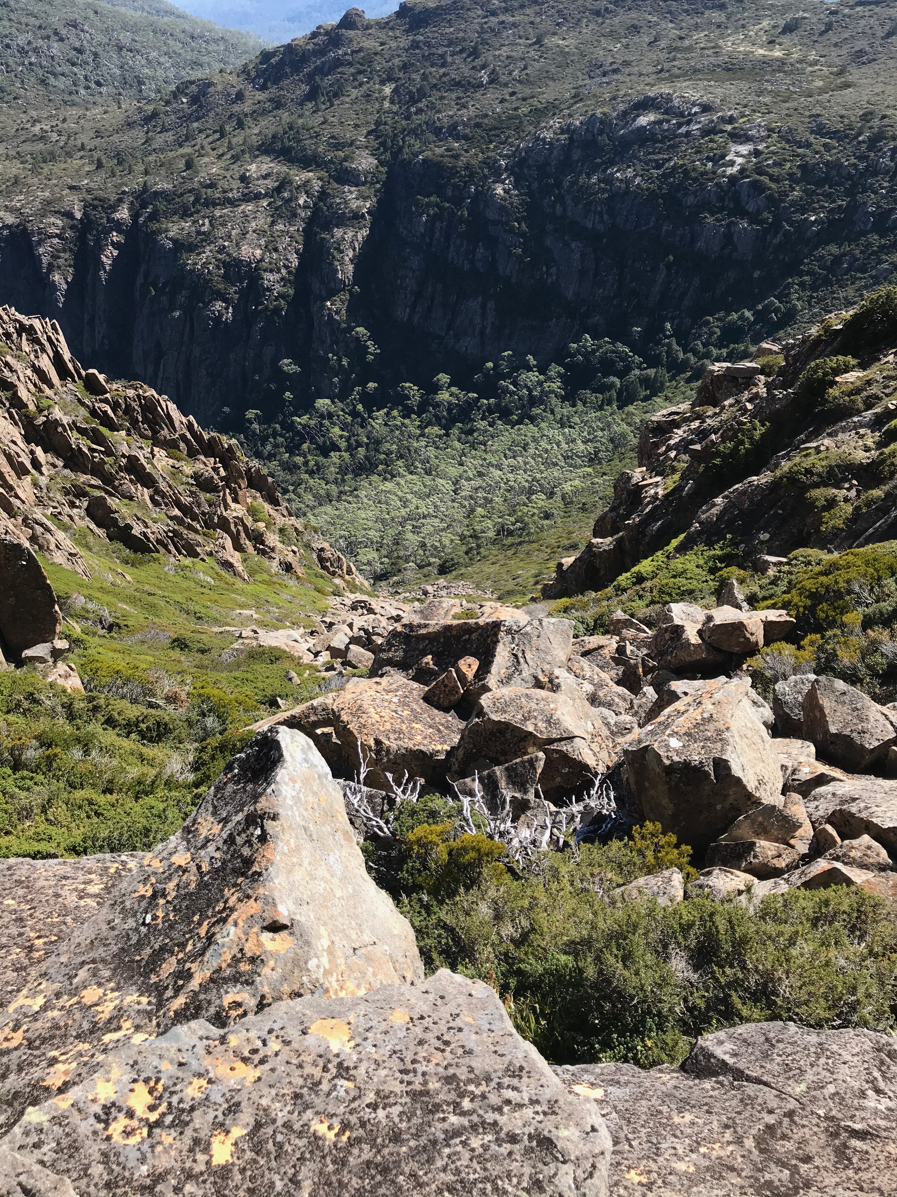
Just before the ridge heading to Lamonts Lookout, we turned for Byron Gap, dropping through increasingly thick scrub and avoiding several cliff faces.
We kept a pretty straight line, and found ourselves on the Curvier Valley track about 200meters from the “official” point that is Byron Gap.
Over lunch, we discussed our next move. I was keen to get up Byron - Dash was happy to start the walk back to Narcissus Camp, where we’d be staying the night.
Since the weather was lovely, we decided he’d set off towards camp and I’d fly up Byron and find him at camp.
Heading up Byron
Finding the turnoff to Byron was easy. Just head down the Curvier Valley track until you find some boards with chicken wire on them, and near there is a right turn. It’s pretty obvious.
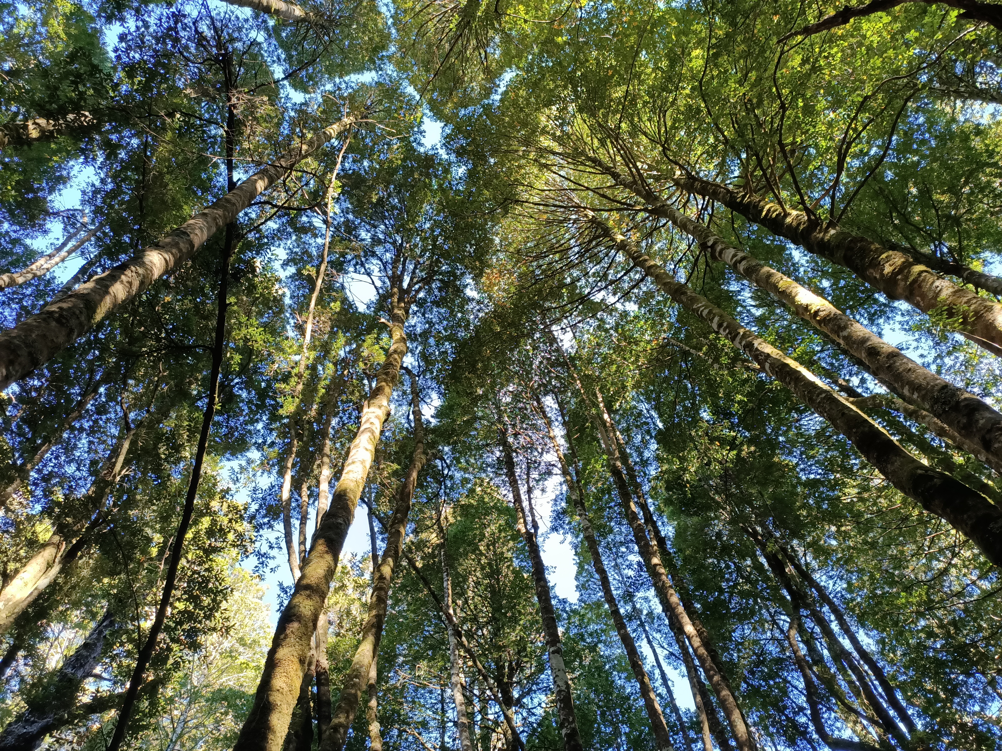
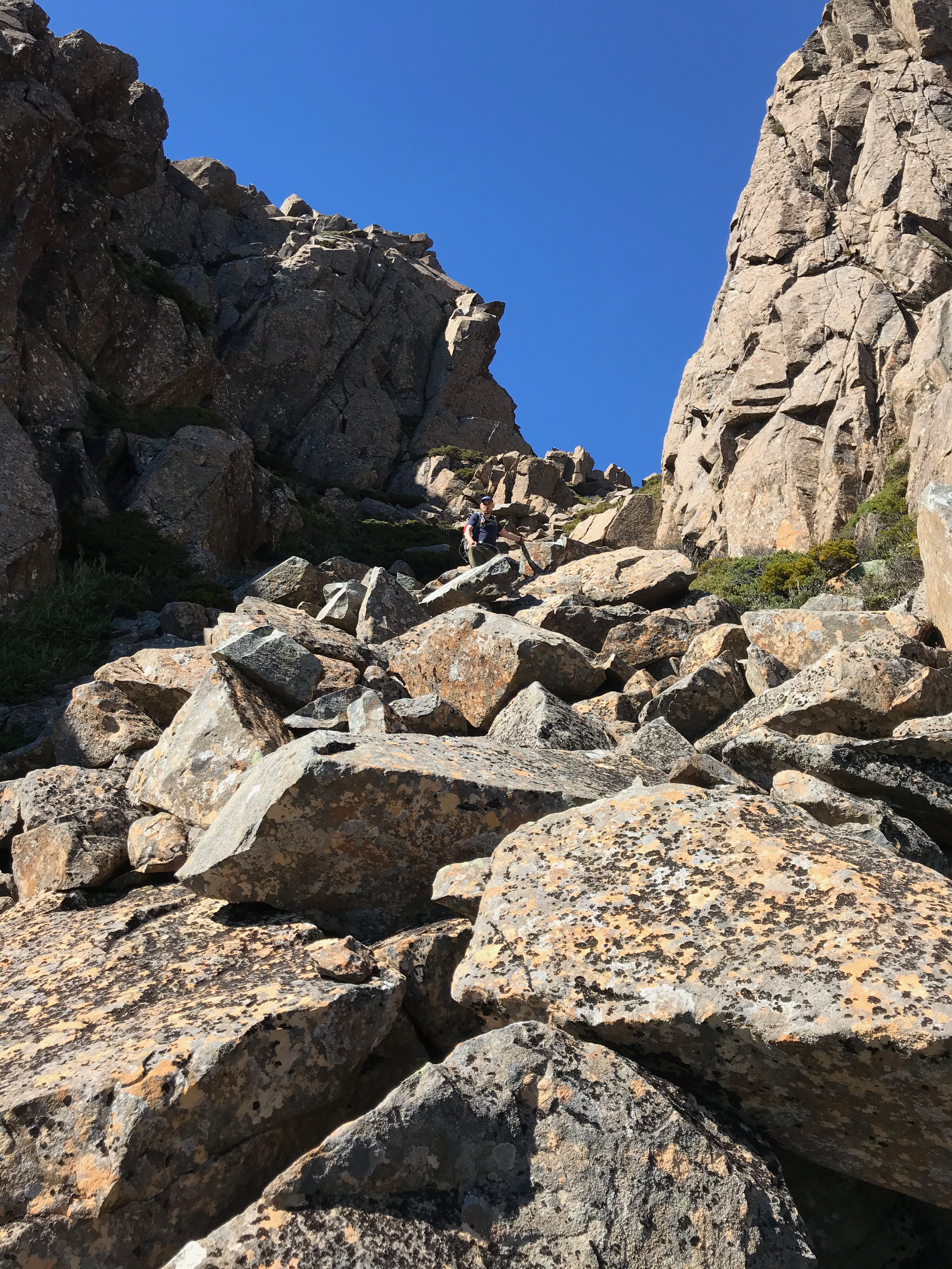
The walk up was wonderful. Passing through some amazing forest, it isn’t long before you pass the bush and start clambering up boulders and jumping from one to another.
It took me roughly 45 minutes from memory from the track (maybe a little more) - but I was moving pretty quickly and not taking many breaks.
I didn’t stop to take any photos either, sadly. Partly because my good camera was dead, so all I had was my terrible iPhone 7 camera.
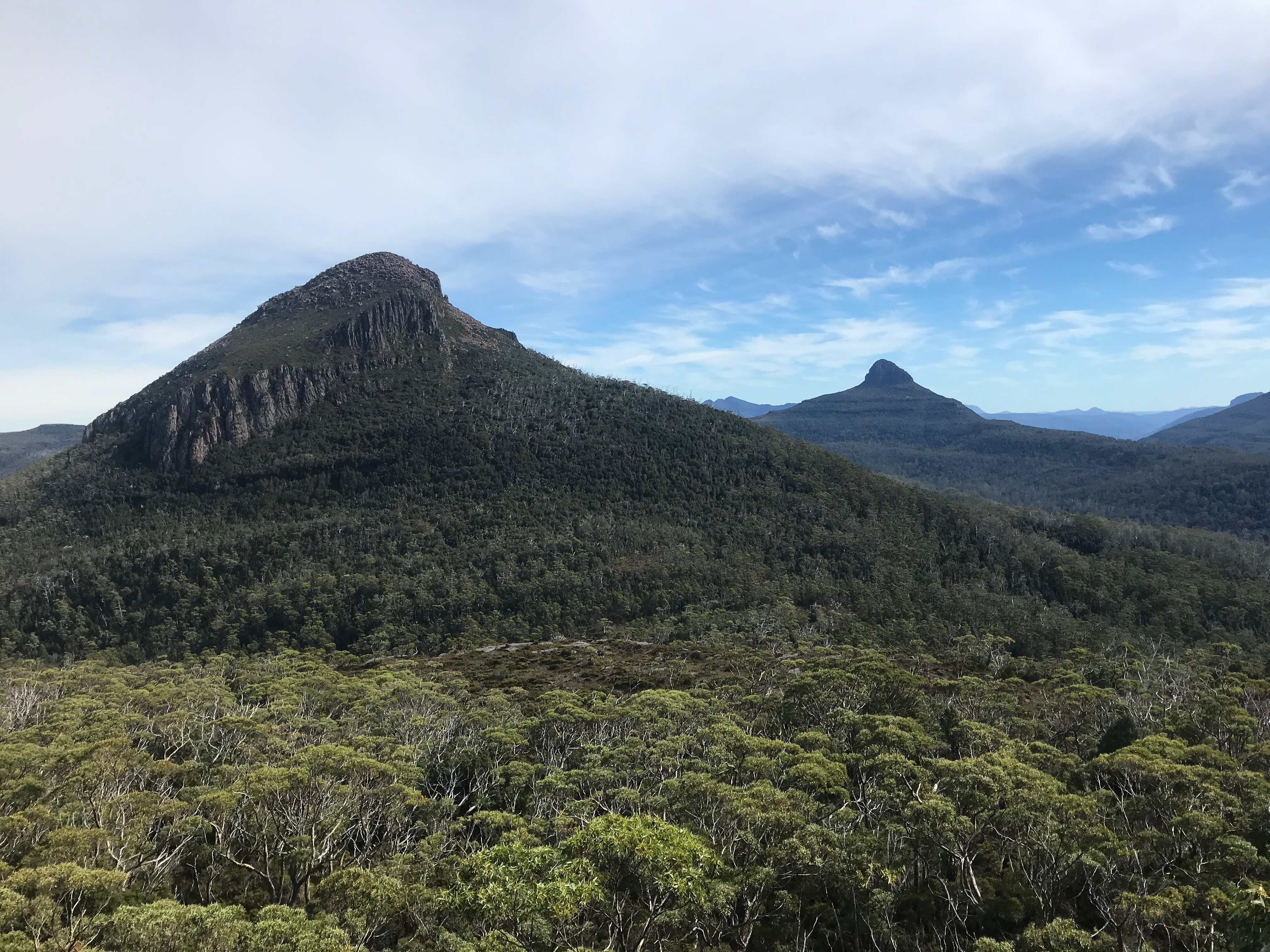
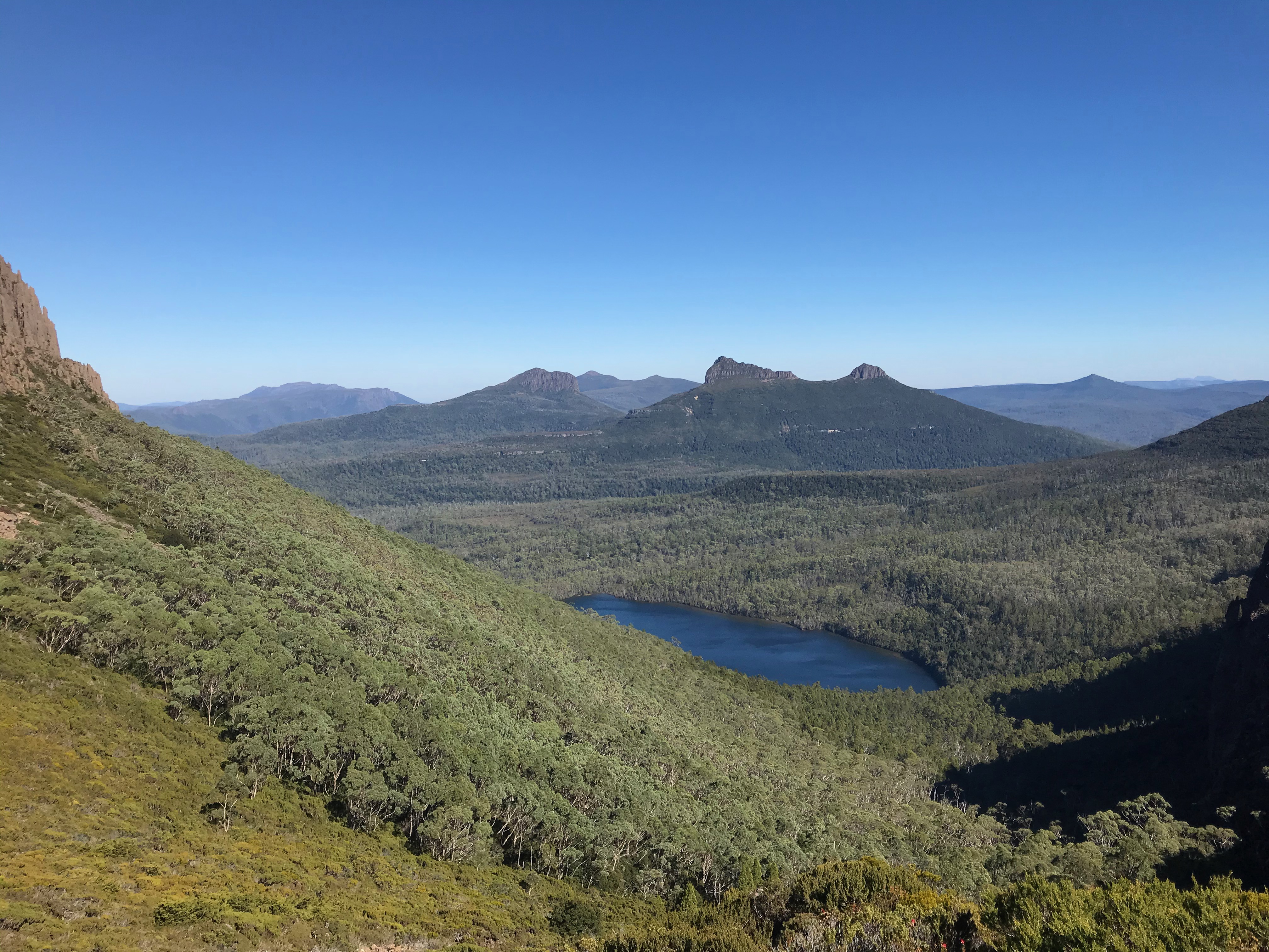
It was intereresting to look back at the way we’d come down Olympus a few hours earlier. From Bryon you can see the various plateaus, cliffs and vegetation clusters that we were trying to avoid.
You can also see why trying to stick to the 1250m contour when walking around Olympus is so useful - not many trees or boulders at all!
I’d love to know where the track from Lake Petrarch starts/ends too - as there’s apparently a way up from around there too.
Anyway, after 20 or so minutes at the top it was time to head back and get moving along the Curvier Valley Track to camp.
The track is now (officially?) not being maintained, but is still obvious in most areas. Though in some parts, it does get hard to follow.
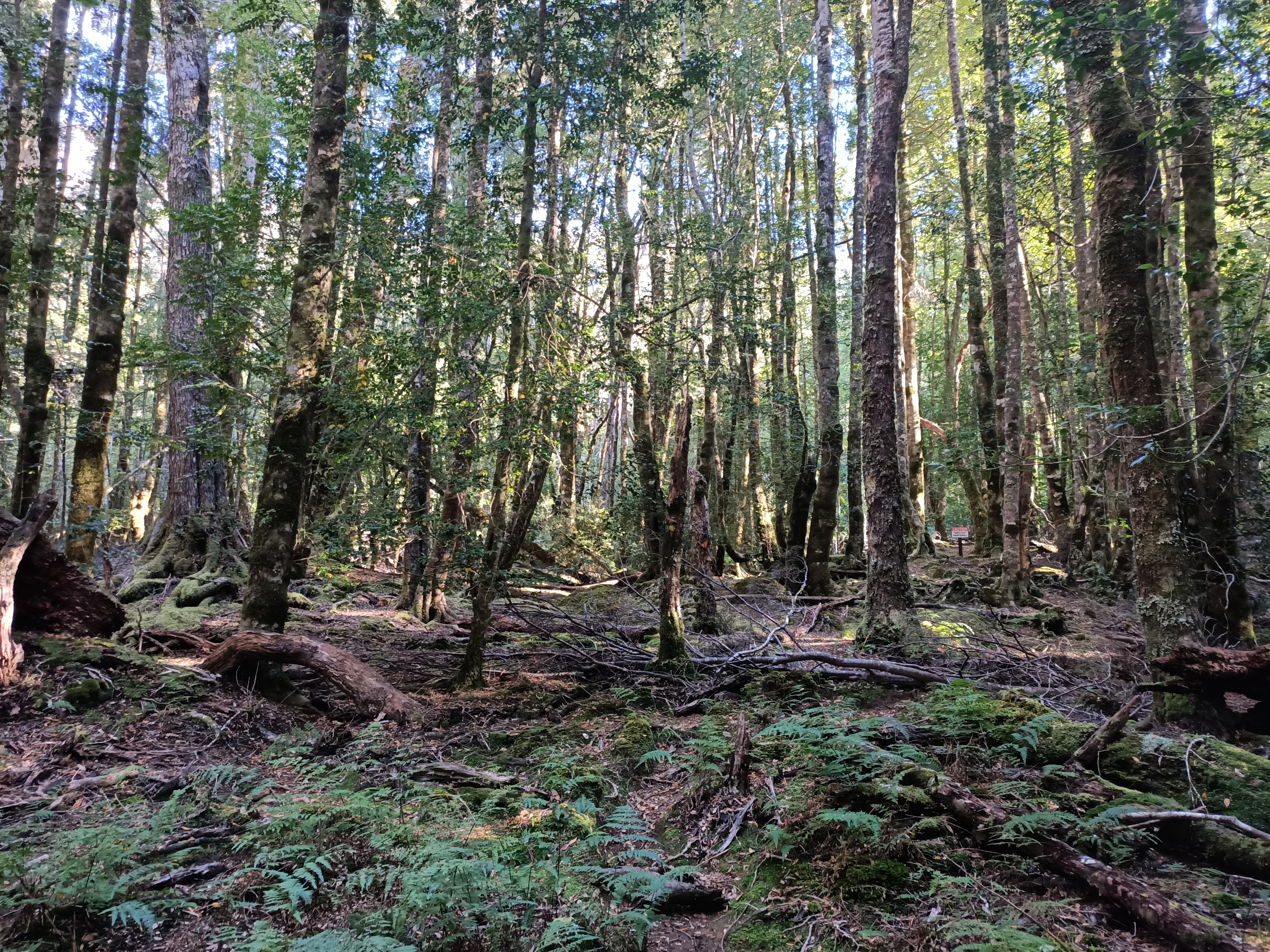
In any case, several hours later of a lovely forest walk, I hit the Overland Track and not long after that was at Narcissus for the night.
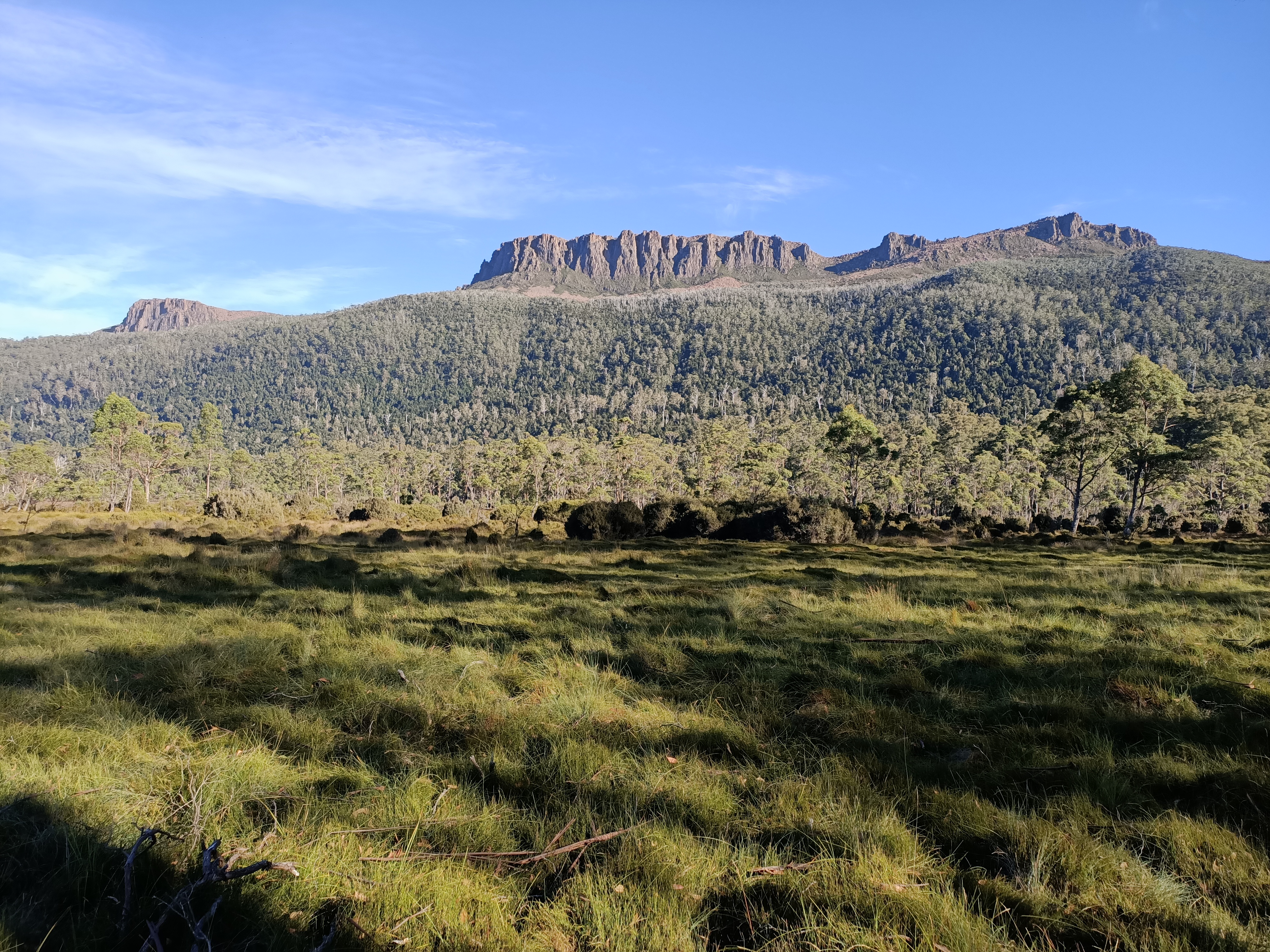
We had such amazing weather that night, and it was lovely to be able to look back up at Olympus and see where’d we’d been over the past few days.
Mount Gould (and a few unexpected extras)
The next day, we wanted to visit Gould. Originally the plan (yes, that old thing) was to camp up on the Gould Plateau, but we figured we’d stay the night at Narcissus and make Gould a day trip.
Why lug all our gear up there for a night?
So we set off towards Nichols Junction, before making the turn up to the Gould Plateau.
The Plateau is around 1080 meters, so it’s a bit of a climb through fairly light bush up to some beautiful little lakes/tarns towards the edge of the shelf.
Mount Gould itself is quite a long little bugger, and the peak is actually right at the end - which requires quite a bit of scaling very large rocks as you pick your way long the top (and later, eastern side) of the mountain.
It was a bit windy too, which always puts me a little on edge.
Climbing up to the top is relatively easy - with a few false leads to seemingly impassible boulders - but eventually you make it to the top. From there, there are some moments of terror as it dawns on you that a slip could have you falling off the side, or down a massive hole between rocks.
But after an hour and a half or so (including lunch) and with no serious issues, we eventually found ourselves at the peak and it was glorious.
So, we’d finally made it! Which raises the question: what next?
Well the original plan, the next step was “go home”. But… which way?
We’d spoken to a few blokes on the way up, and they’d reminded us that it was possible to keep going off the front of Gould, and travel over The Minotaur before exiting via Pine Valley.
That sounded pretty good! So we set off slowly, finding our way down (you want to head east from the peak before coming round the side of the valley and dropping into a very steep chute)
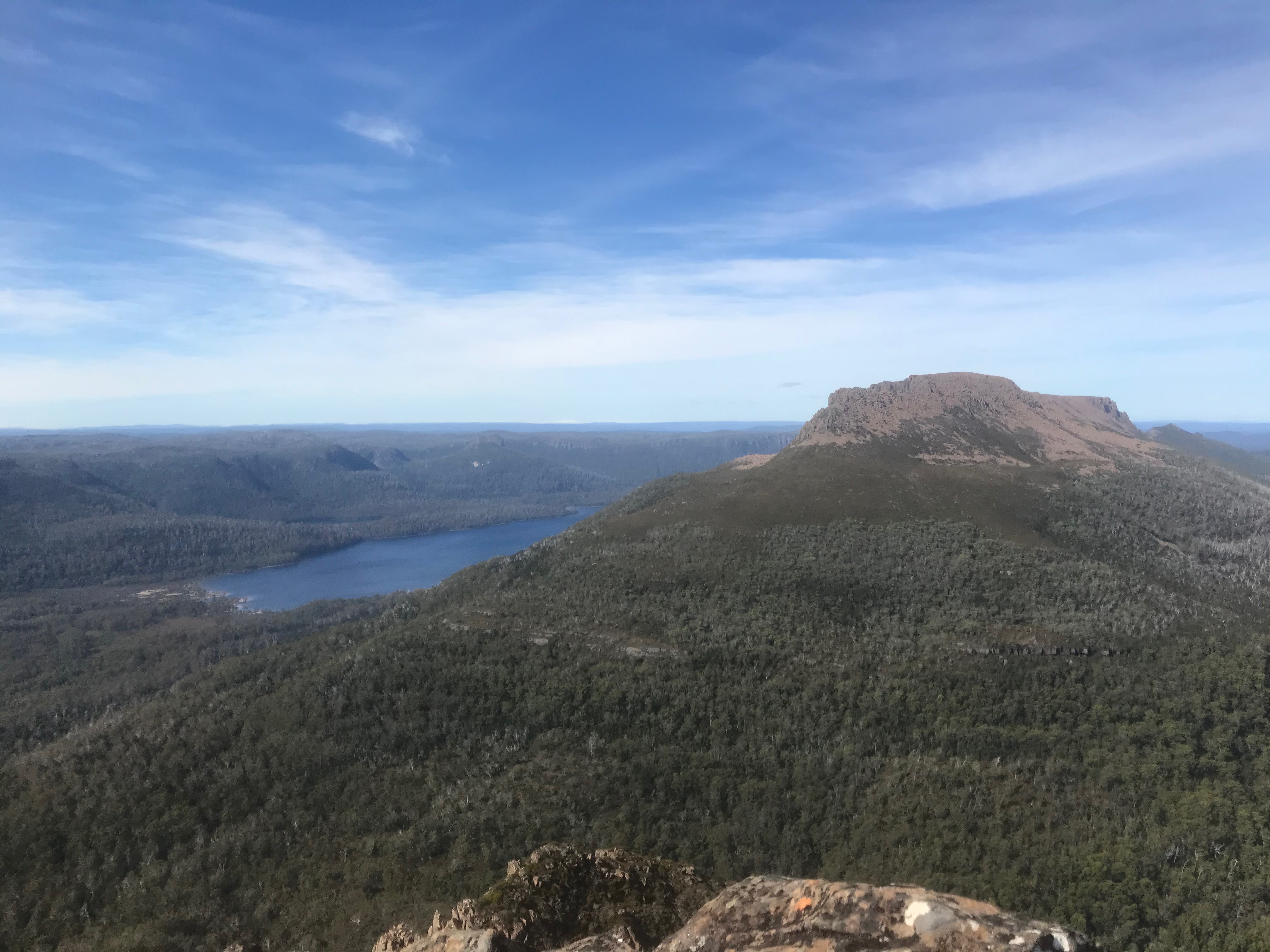
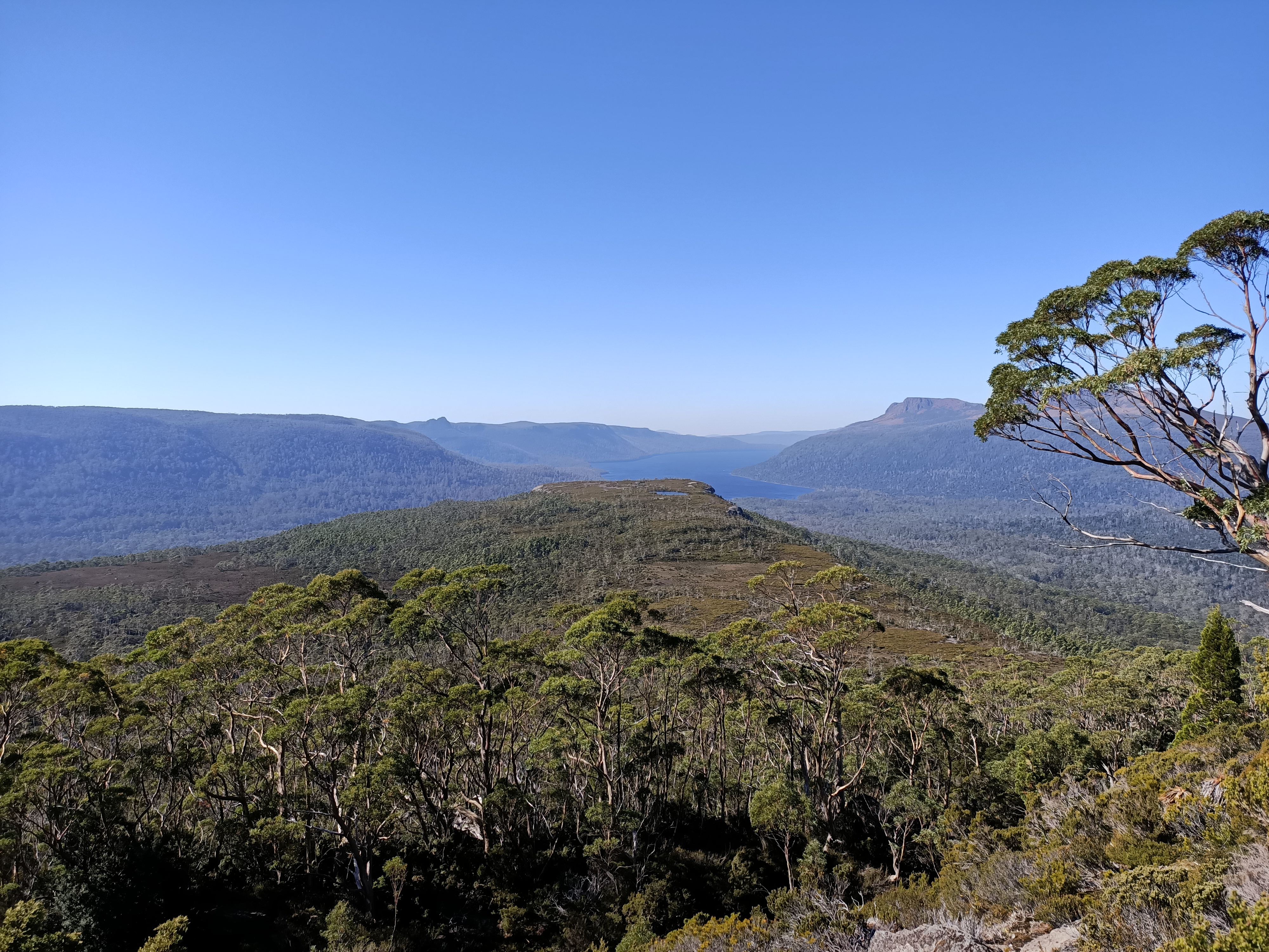
Overall, not too hard and after passing through the saddle between Gould and The Minotaur, you get an amazing view of Gould.
And again, what a view point to look at the mountains we’d ruled out on this trip, and perhaps inspire us for our next journey.
It was about 2:15pm, and we realised we were a long way from home, so we put the pedal down a bit.
Despite a small navigational error on my behalf (oops), we were back at Pine Valley hut about two and a quarter hours later.
From Pine Valley hut, we were back at Narcissus about two and half hours later just in time for darker than usual dinner.
But it’s not over, quite yet!
Remember the stashed packrafts/gear from the start? Well, they needed picking up.
So I got up nice and early and walked back along Lake St Clair to pick them up, giving Dash a sleep in (he’d catch the boat home)
The walk is not something I’d want to do regularly, but it wasn’t too bad.
I got to say goodbye to some new friends, who were covered in their cloud doonas before waking up for a new day.
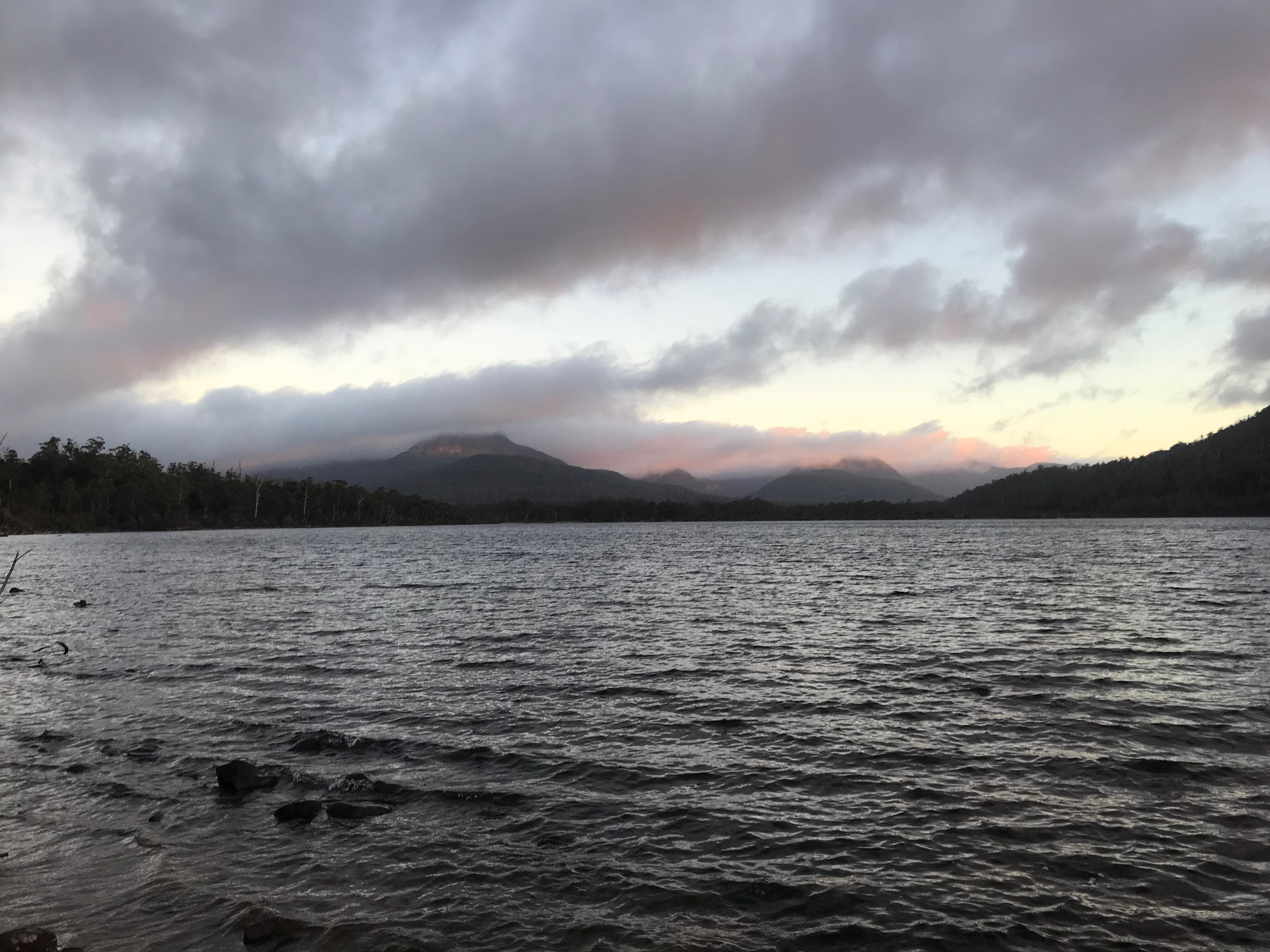
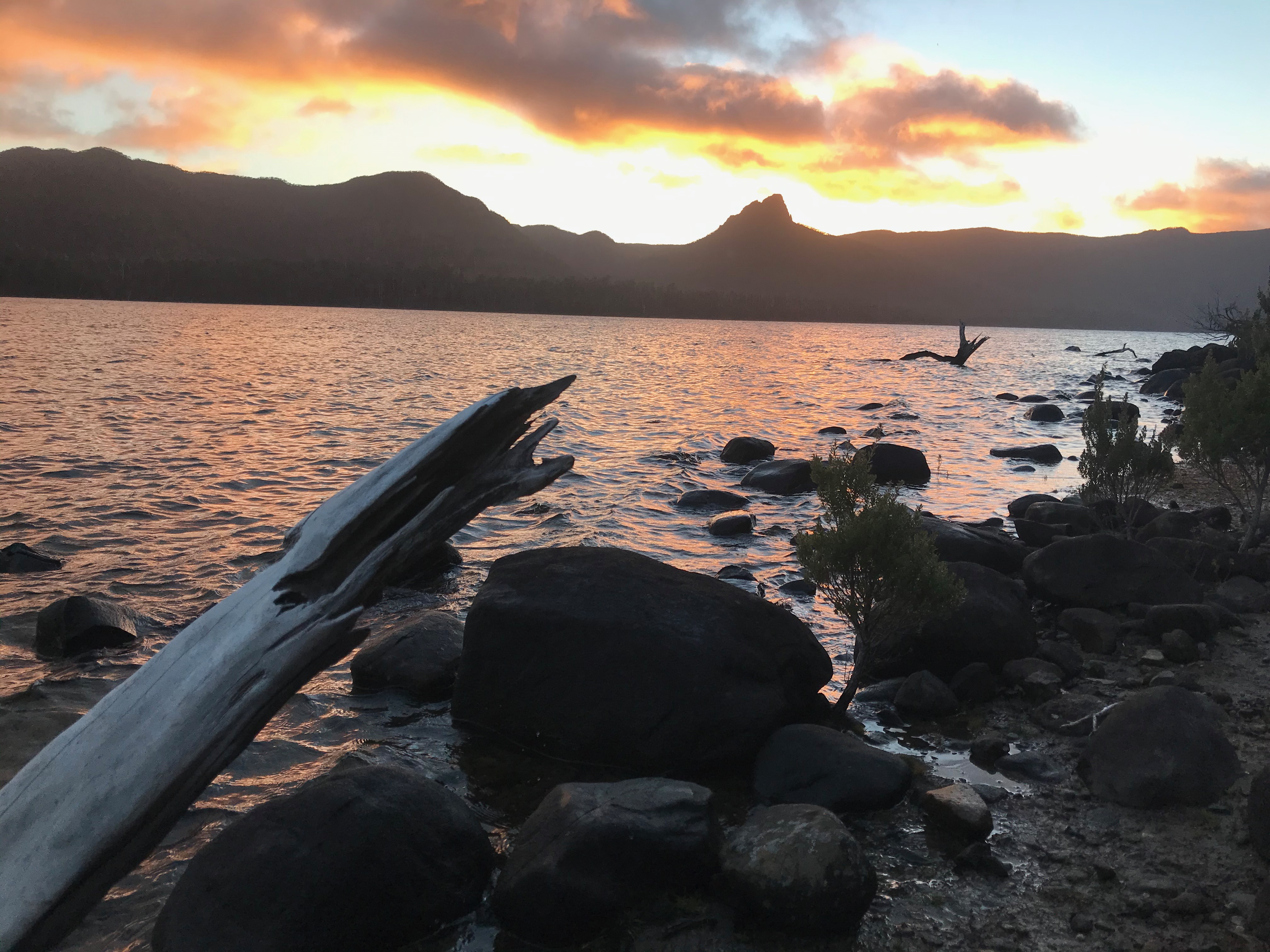
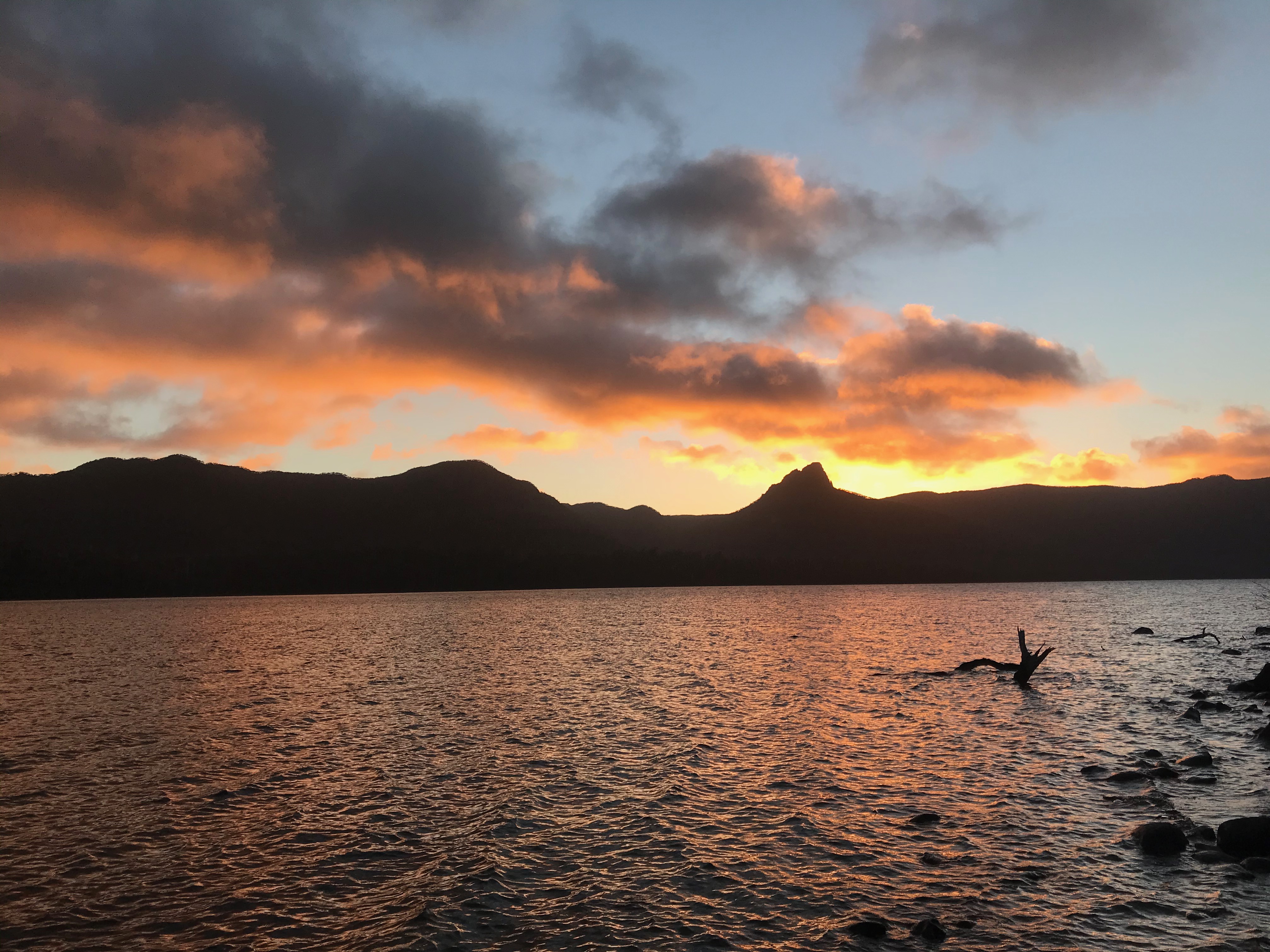
And of course, the a lovely sunrise and view of the mountain that, once again, has remained elusive.
Walk Map