Lake Rhona is one of those famous walks.
Not globally, obviously, but within the circles of people who like bushwalking - Lake Rhona is very well known.
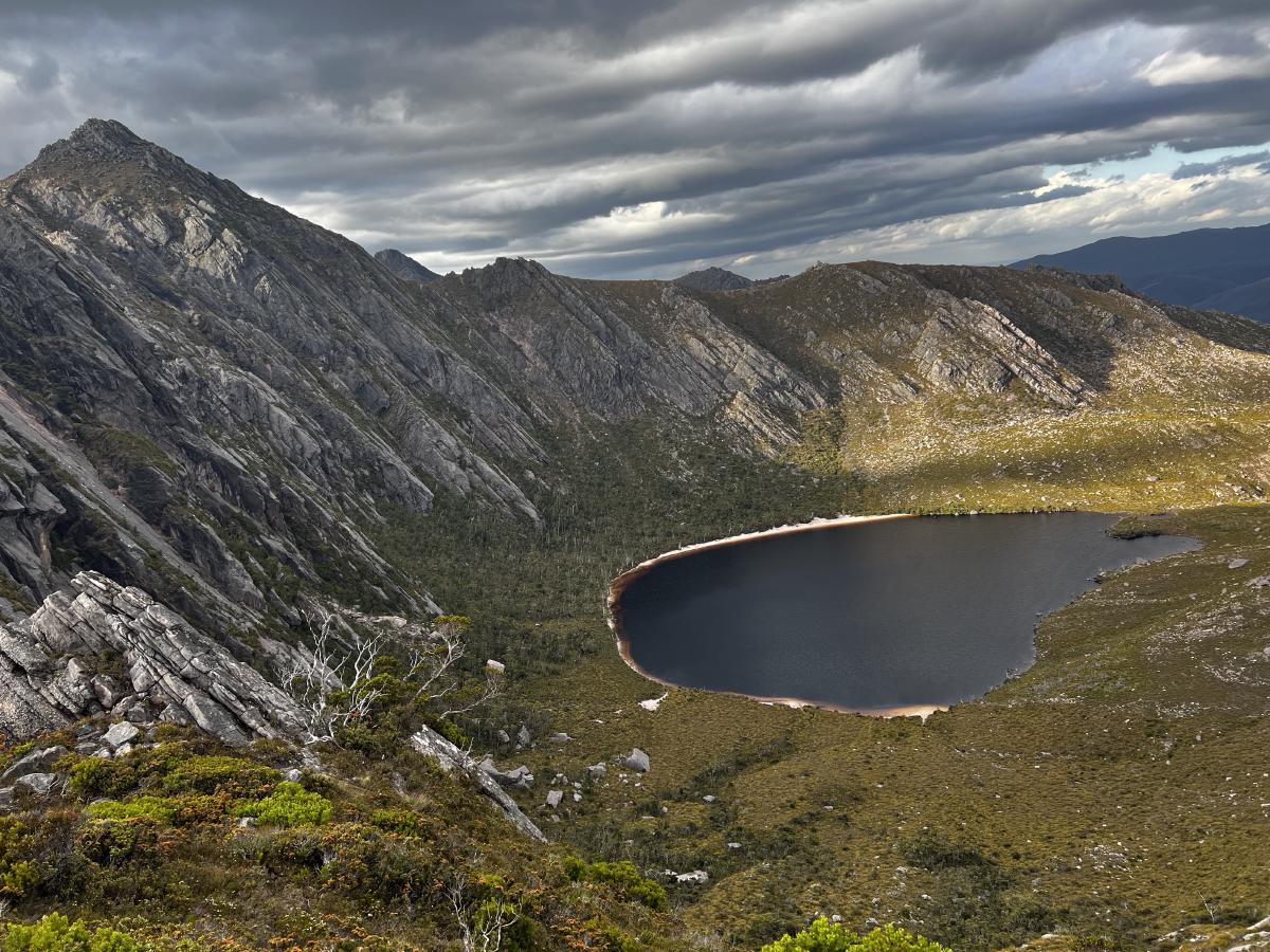
It’s famous for very good reason: it’s got an amazing beach which meets an equally amazing lake. It’s got huge cliffs that dominate the skyline nearly all the way around it.
And if you take the time and effort to walk up onto one of the ridges, you’ll get amazing views of the area.
So when I couldn’t get Lake St Clair ferry tickets (to finish up the southern part of my “lots of mountains” walking series) I started looking for something else.
Luckily I found some booking slots for Rhona so I jumped at the opportunity.
I’ve really, really enjoyed walking in this area in the past.
I’d been here a year or so back visiting Clear Hill and The Thumbs and slightly more recently when I spent a lovely overnight trip scaling Wylds Craig and Mount Shakespeare.
When we turned up, the car park wasn’t what I’d call chockers - but it did have quite a few cars. We’d also meet quite a few people coming out, meaning the lake shouldn’t be too packed.
The first 30 minutes or so of the walk is getting to the Gordon River crossing.
There’s often a slight worry that the river will be too high or too dangerous to cross but when we got there the infamous log was high and dry.
It was one of the best log crossings I’ve ever had: very stable, very dry, nothing to slip on and no weird or steep angles to worry about!
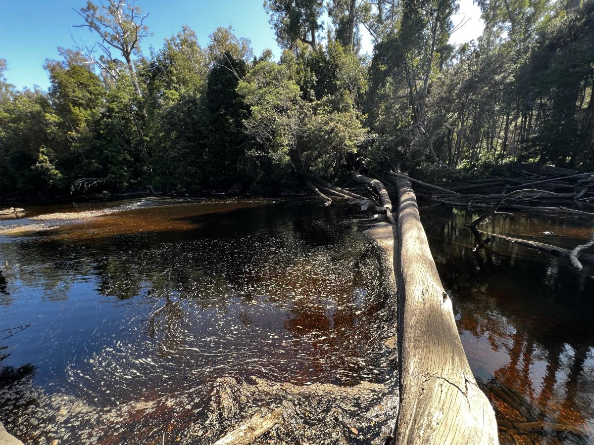
After a quick walk through the forest on the other side, we popped out onto button grass plains where we’d be spending the next several hours traversing.
The track was in good condition, and because it’s been fairly dry (which is why the crossing was easy) there wasn’t much mud to worry about either.
I had vague notions of climbing Mount Wright and Stepped Hills the next day, but they quickly disappeared one I saw the reality of the situation. It’s a big hill to climb, and with the temperature climbing quite high over the next few days my plans were thankfully jettisoned. I’ll be back to this lovely area to check them out sometime in the future.
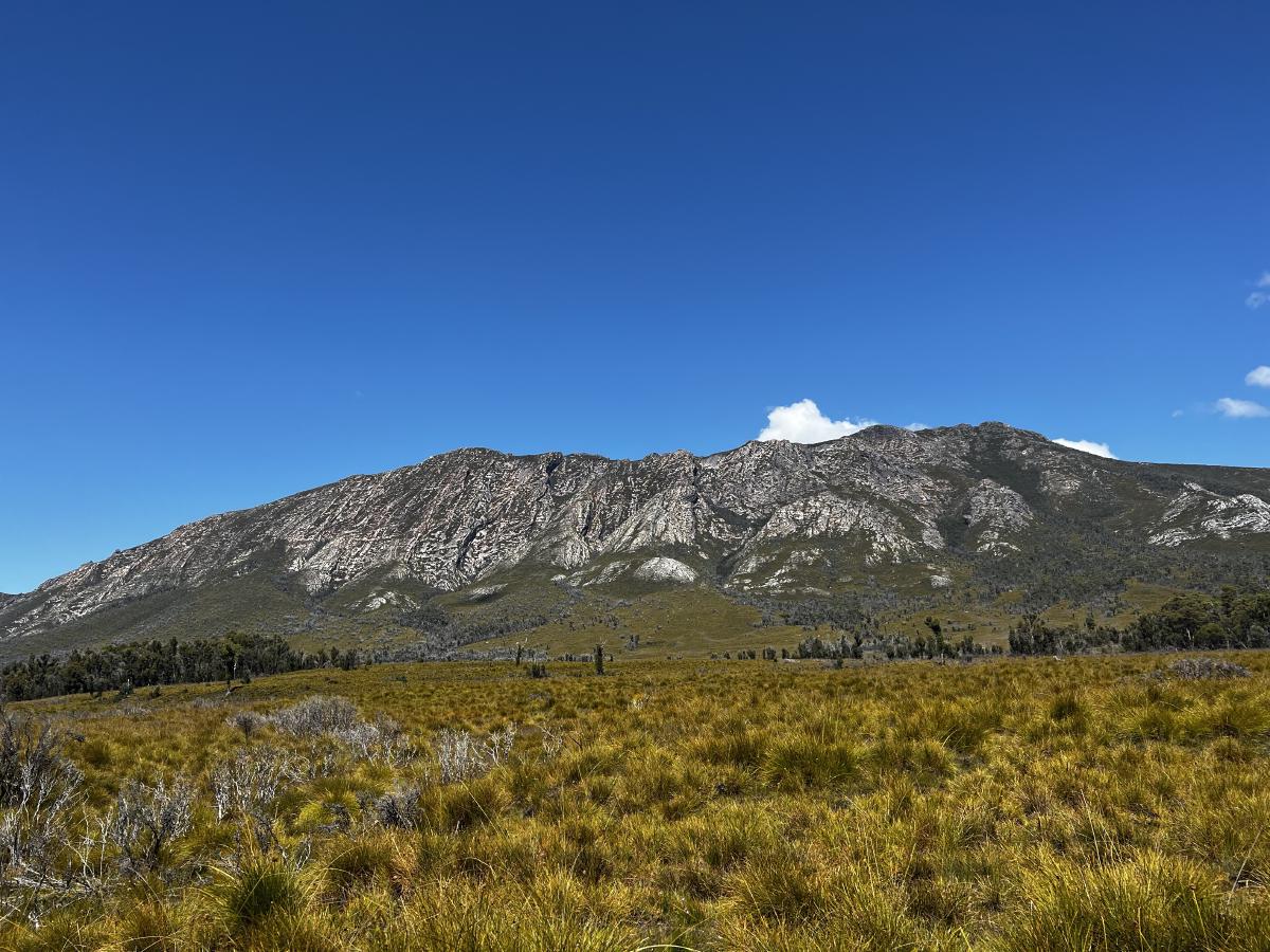
We made it to Gordonvale - a lush little oasis from the button grass marshland, though with no obvious clean water points nearby - and had a quick look about.
There were no buildings anymore - the only thing remaining from the old home of Ernie Bond is an old plow and a rusty shovel plunged into the lush green grass next to it.
From here, the slow climb began. Slowly we gained a bit of elevation, winding our way over the plains.
It’s a gentle 100 meter gain by the time you cross the last little river/stream before the Rasselas Track starts climbing fast to reach Lake Rhona.
People we’d met along the track had warned us that it was going to be a bit of a slog. They warned us of false peaks, and that it keeps going on and on before you get there.
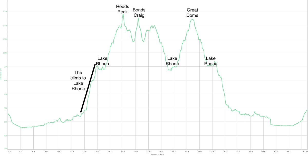
Armed with the warnings, I began the climb. It starts around 560 meters above sea level and by the time you reach the saddle with the first view of Lake Rhona, you’re at 900 metes. Simple maths tells you it’s about a 360 or so meter climb in total.
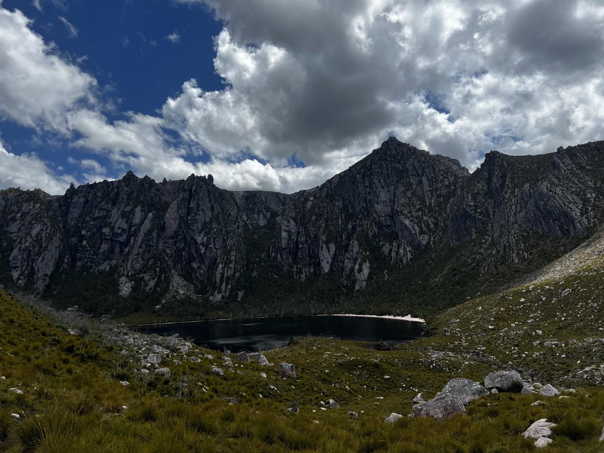
I plodded up the hill, finally making it to the top and made my way around the lake to the beach.
I dropped my bag and had a very quick look around. There were people swimming and relaxing. Though not too many, which was nice.
I grabbed some snacks and my day walking gear and shuffled off. I was hoping to get to Reeds Peak and Bonds Craig today, while the going was good.
I initially tried climbing the steep hill behind the campsites to try and make the trip a little shorter but I saw a sign saying that way was closed because of fire damage a few years earlier.
So I turned around and headed off the normal way - up the ridge and right around Lake Rhona, slowly gaining height all while the views get better and better.
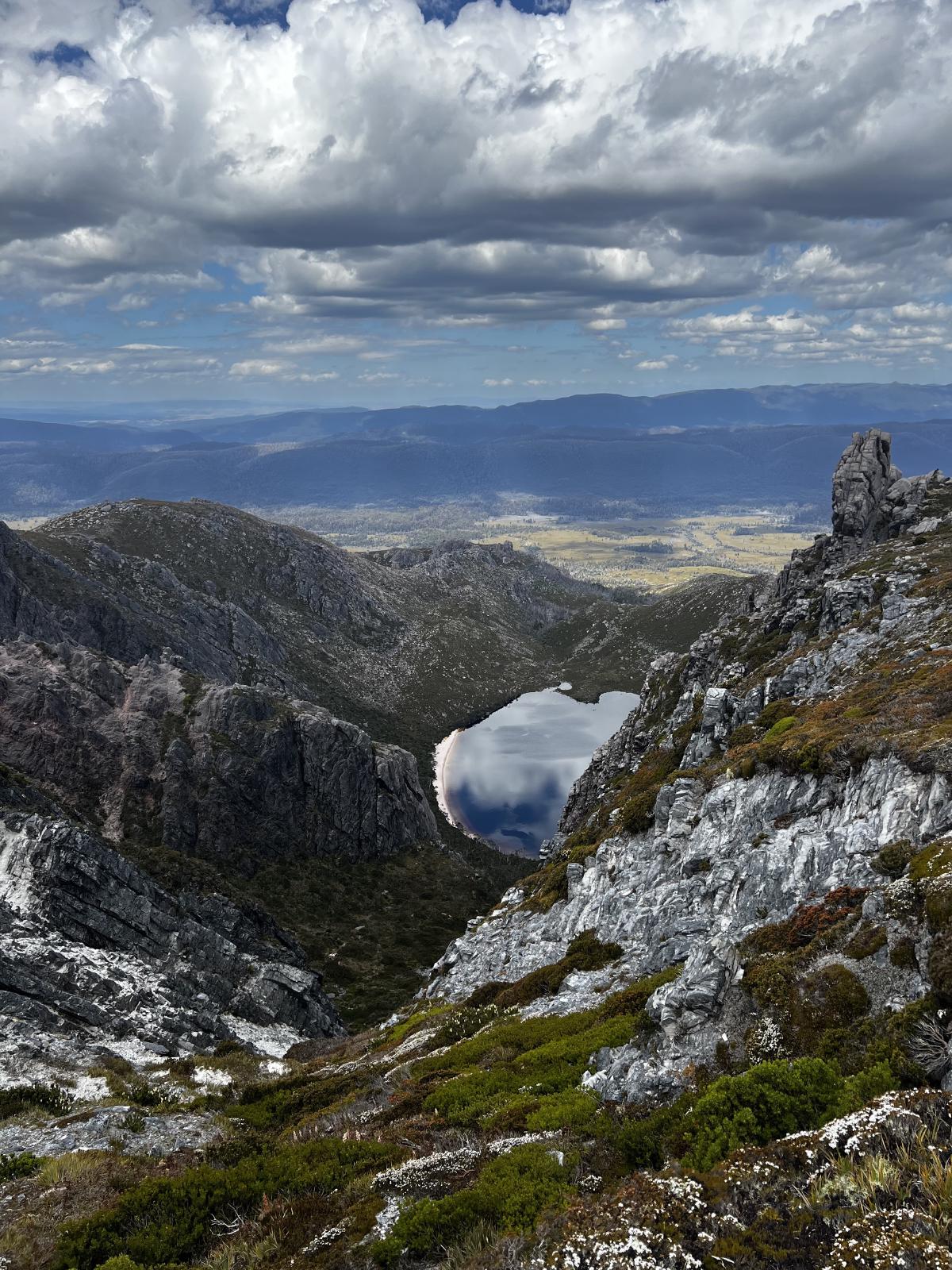
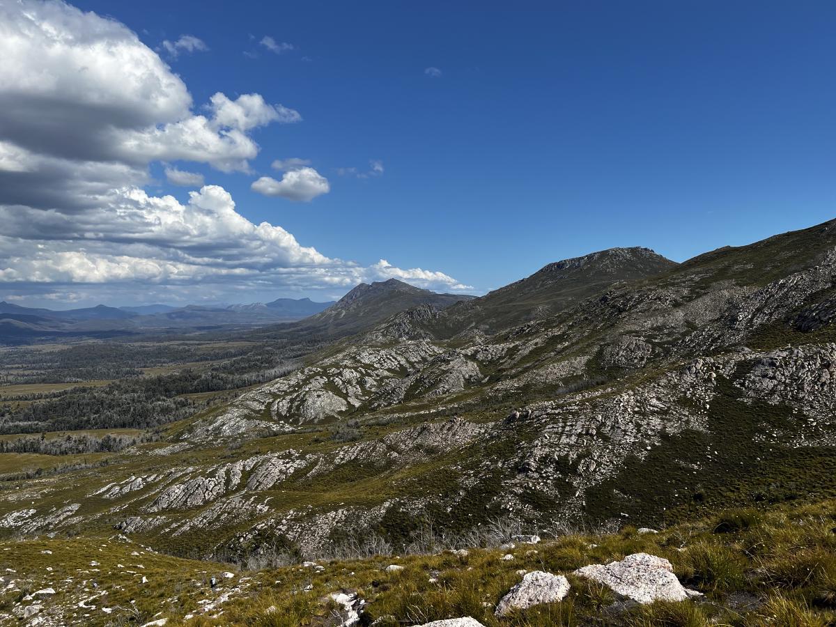
Walking around the top of the ridge and then past Great Dome as pretty magical.
Everywhere you looked were fascinating little rock forms or expansive views of the lake.
The final push up Reeds Peak gets you to the top of the mountain, and the hard work pays off.
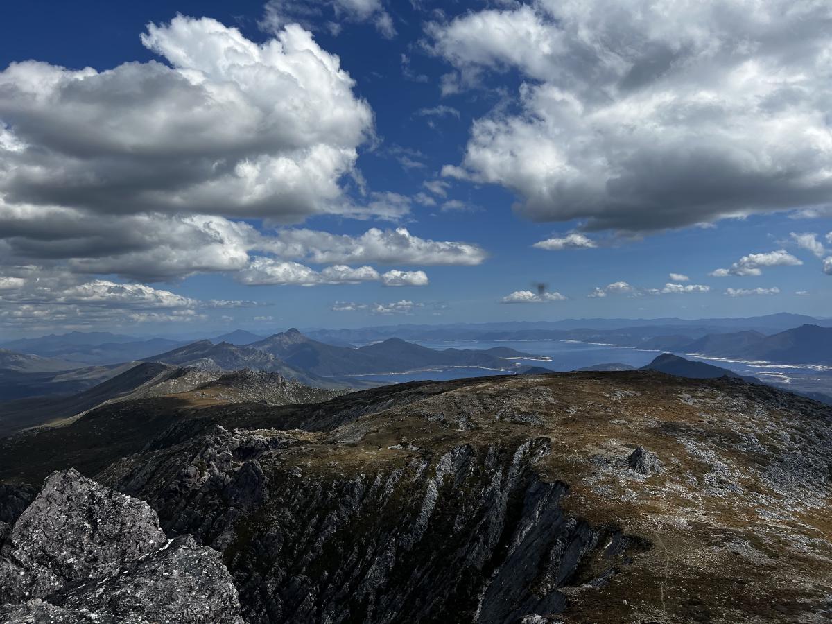
But I’d suggest climbing forward a little bit - down from the high point - if you want the best view of where you came from.
It also sadly shows the damage from the fires several years back. You can see in the middle of the picture below a straight line where to the right there’s vegetation and the the left, lots of stark rocks.
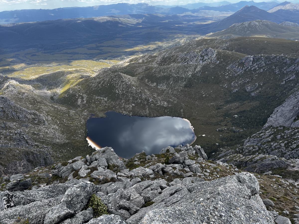
Apparently, that’s where the remote firefighting team managed to lay a hose before pumping water from the lake up it and through sprinklers in an effort to protect the cliff areas.
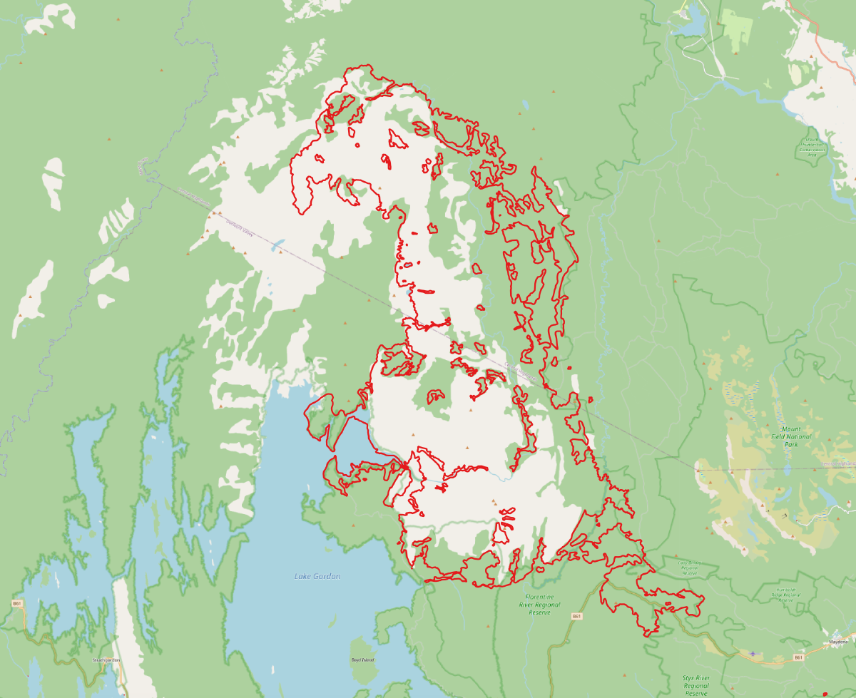
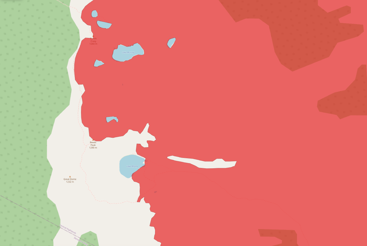
Looking at the fire records on the list shows there was fire here in the early 1980s, and again in the 2019-19 season.
Huge parts of this area were burnt, and there remains scars from bushfire like you can see in the photo above.
But thankfully much of the scrub around the north, west and southern parts of Lake Rhona were saved.
But to zoom out a bit, here’s what the fire burnt back in 2018/19. A huge amount of land.1
Or for a close up view of Lake Rhona area:
With that somewhat depressing little thought done, I started the walk over to Bonds Craig.
It wasn’t too hard - there are cairns most of the way, but when I lost them the way was pretty obvious.
After making my way across I came to the final bit.
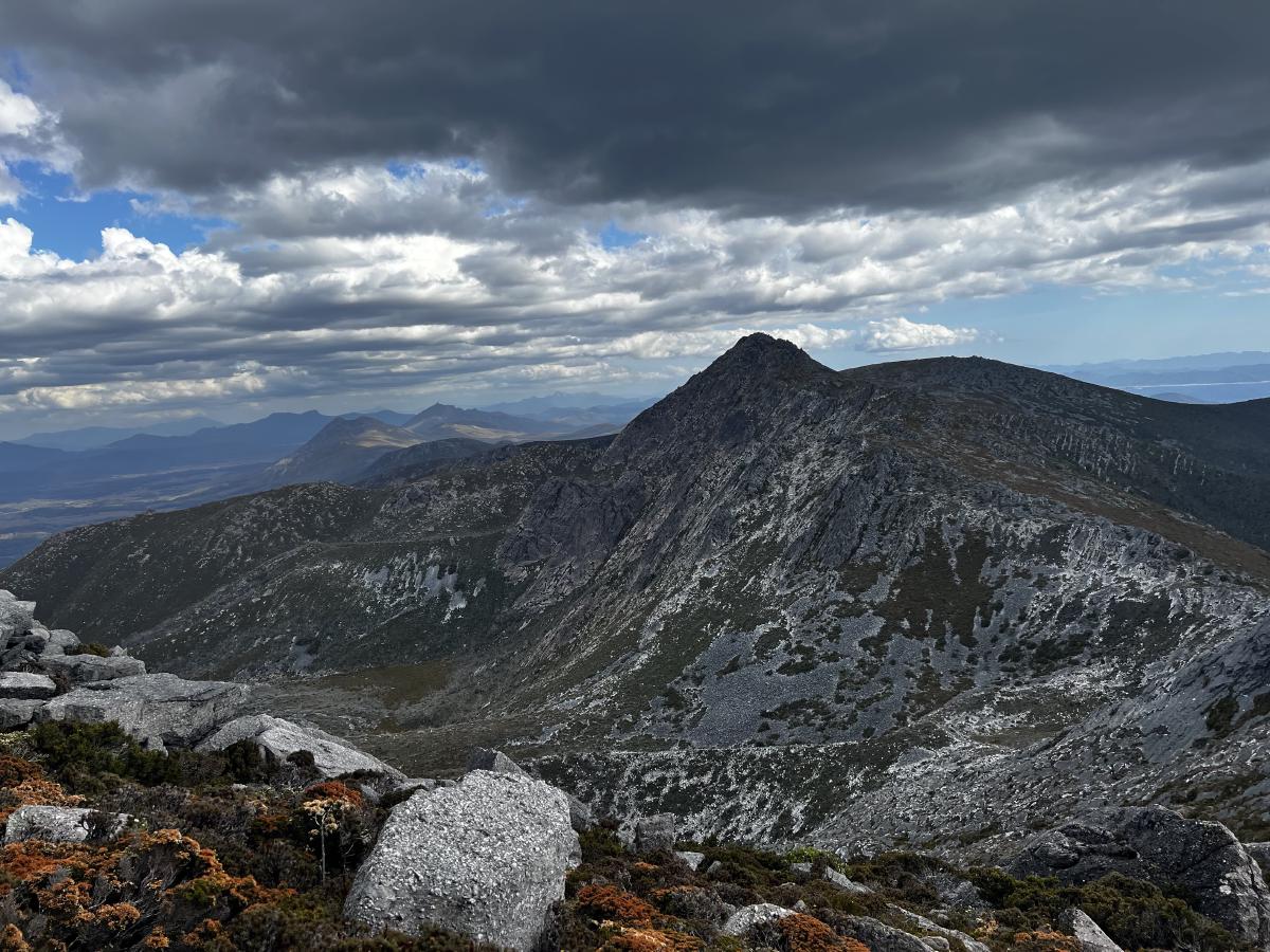
I climbed and climbed and reached the saddle between the two parts of the mountain which both seem could hold the true high point.
I picked the right one (which is the correct one) and made the final little scramble to the top.
It’s an amazing view to look back at where you just came from.
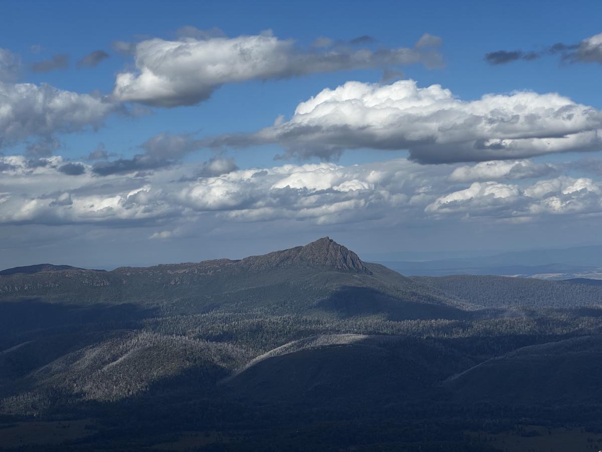
And over the valleys, I saw old friends from previous trips.
After hanging around on the peak for a while, I realised I had a fair way to go to get back in time for dinner.
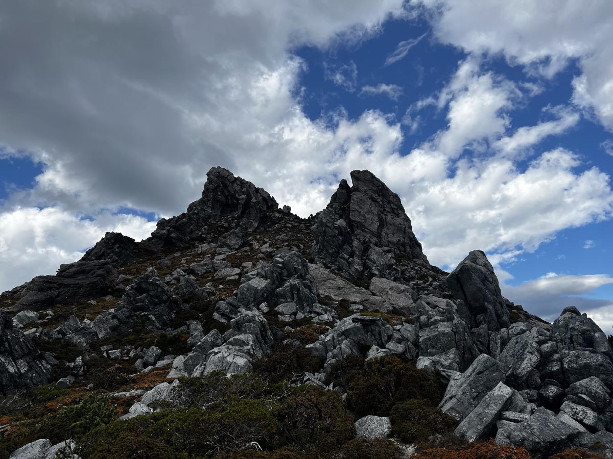
So I slowly made my way back down, and picked my way through the rocks and bushes back to Reeds Peak and then down the ridge to Lake Rhona.
The night was comfortable and still.
We spent the next day just poking about a bit and again climbing the ridge but this time paying a quick visit to Great Dome.
I also had a swim, which was very nice (and way warmer than I expected - so long as you kept to the top 30 centimeters of the water).
As the next day was forecast to be even hotter, we wanted to put the worst of the button plains behind us so we left the lake and walked back to Gordonvale for the night.
It was a pleasant night’s stay and thankfully the walking we did the day before paid off. Even the short walk to the Gordon River in the morning was hot!
After a couple of hours, we were back at the car and driving down the road for a much needed swim in the Florentine River.
Trip map2
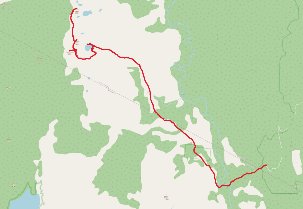
Walking times:
- Car park to Gordon River: 30 minutes
- Gordon River to Gordonvale plow: 1 hour
- Gordonvale plow to Lake Rhona: 3 hours (9km)
- Lake Rhona to Reeds Peak: 1 hour
- Reeds Peak to Bonds Craig: 55 minutes
Elevation map
Access2
It’s not too hard to get to the car park, just keep an eye on which road you’re on. The signage isn’t great, but there aren’t tooooo many turn offs.
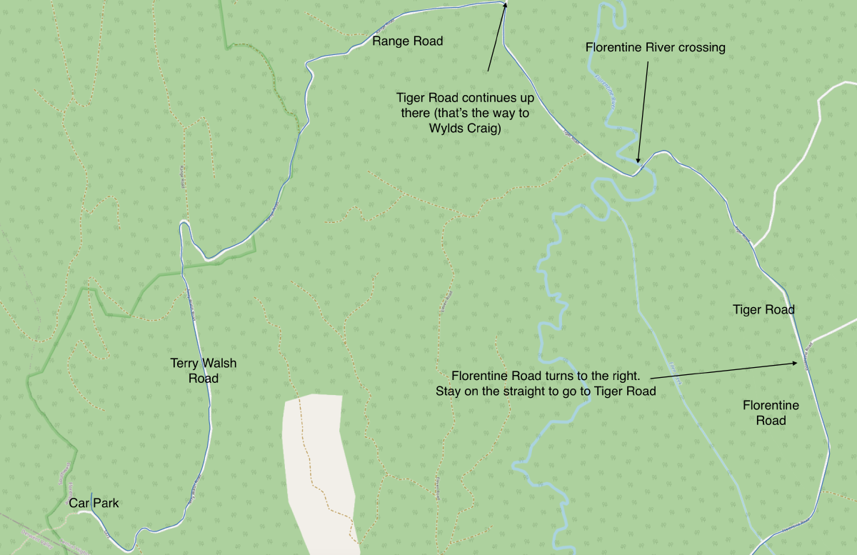
If you need, here is a GPX file of the road route from Maydena to the car park
Comments
Footnotes
© OpenStreetMap contributors terms. Fire data from LISTdata Open Data or see Fire History for more information. ↩︎