Some mountains are easy. Some are hard. Some mountains decide to fight you nearly every step of the way.
Mount Inglis might seem easy enough at first glace, but it’s not. And it fights dirty.
Especially if you do something silly like go the wrong way and end up deep in a forest when you could have chosen nice open walking options. Silly me.
But first, lets rewind.
So many more mountains!
Find all the walks from that series here
I woke up at Waterfall Valley Hut, after yesterday’s succesful trips to Mount Emmett and Barn Bluff
I knew today would be a fairly long way, so wanted to get going sooner rather than later.
I packed up my gear, filled up the water bottle and said goodbye to the hut. The hut has recently been entirely renovated and is very fancy.
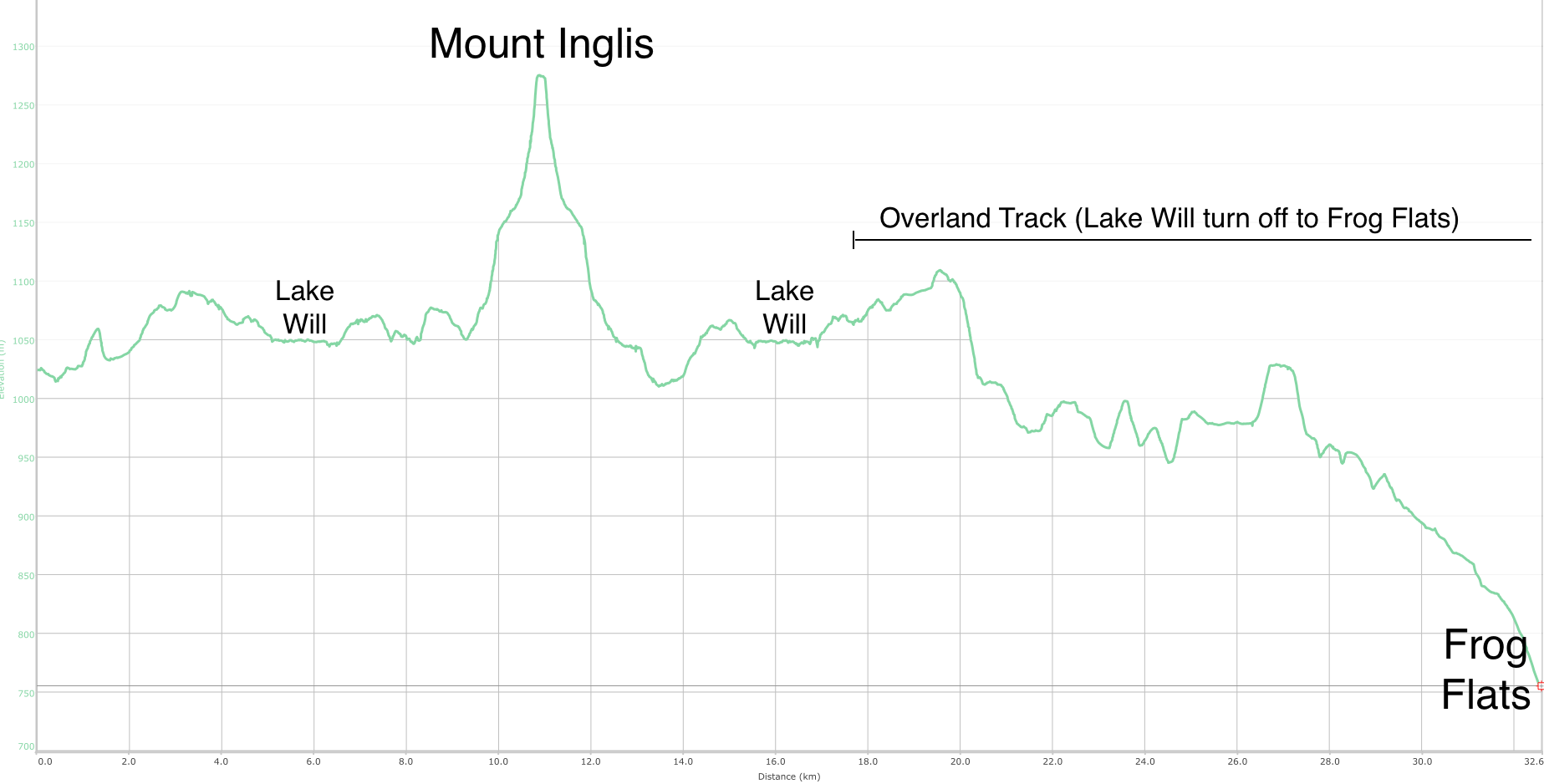
Not long after I started, I was turning off towards Lake Will1 - (the best named lake in the state.. for no real reason).
I’d skipped this part the first time I walked The Overland many years ago (2015), mostly because it was very wet.
It wasn’t like that at all this time though, and I was already planning a swim from one of Lake Will’s1 fabulous looking beaches.
I entertained myself by dreaming of a swim as the track occasionally diverted to wander over the find sands of Lake Will1
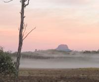
Eventually, I found myself at Innes Falls - which were pretty interesting. I spend a bit of time trying (and failing) to get a good photo.
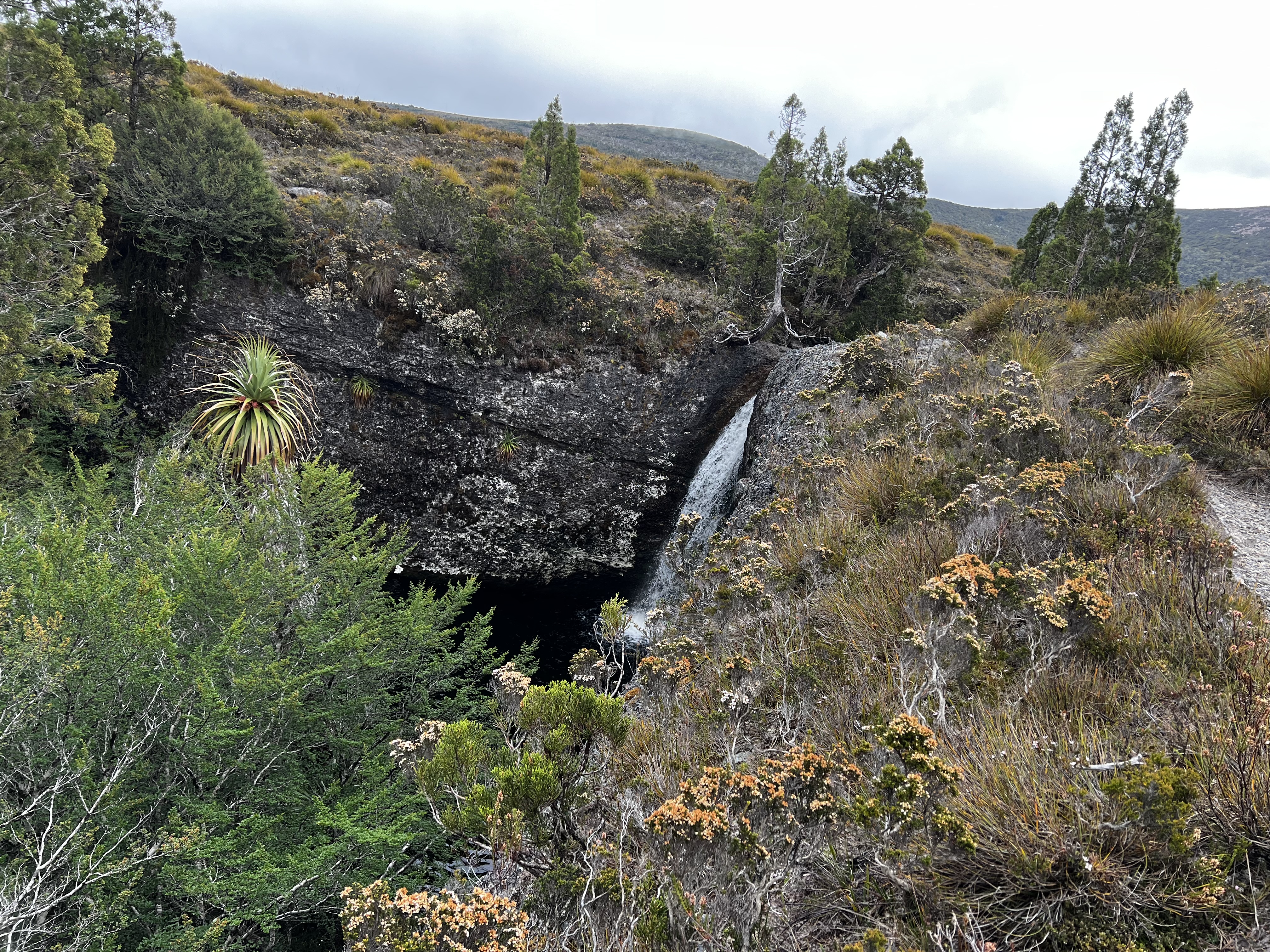
If you are doing The Overland, it would be worth visiting here. If you could work out how to get down, it looked like a nice private swim in the dark pool below.
But I pressed on, and this is where the fun2 started.
There are no real tracks to Inglis as such, just vague pads (occasionally).
I took a line and started the trudge in the direction that seemed the right way to go.
It was mostly low level bushes to push past, but at some point I must have thought that going high to get up onto Fury Divide would be the best plan of attack.
Wrong.
I ended up bang smack in the middle of what the TasMap shows as “native pine”. It was unpleasant going and slow. I should have stuck to the lower sections, which I occasionally could see from my thicket prison. They looked much easier.
Eventually I had enough and just went north (up hill) thinking I should just try to get out of it and then work out where to go from there.
The scrub fight came to an end, and the easy walking resumed once I was high on Fury Divide.
Though the good times were not to last.
As you begin the walk up the first spur to Inglis - the scrub turns (again) to a mass of plants and going is again slowed.
You can slowly pick your way across, and reach yet another challenge: higher scrub.
I went the wrong way here, and just fought it as I slowly climbed. I know it was wrong, because the way I came down was far better and easier.
I don’t usually publish GPS coordinates, but if you get in contact I’ll send you the exact spot to aim for before heading up. You’ll have a much better time.
But I was about 100 meters north of that point, and had mostly scrub to contend with until the final (very steep) climb to the peak.
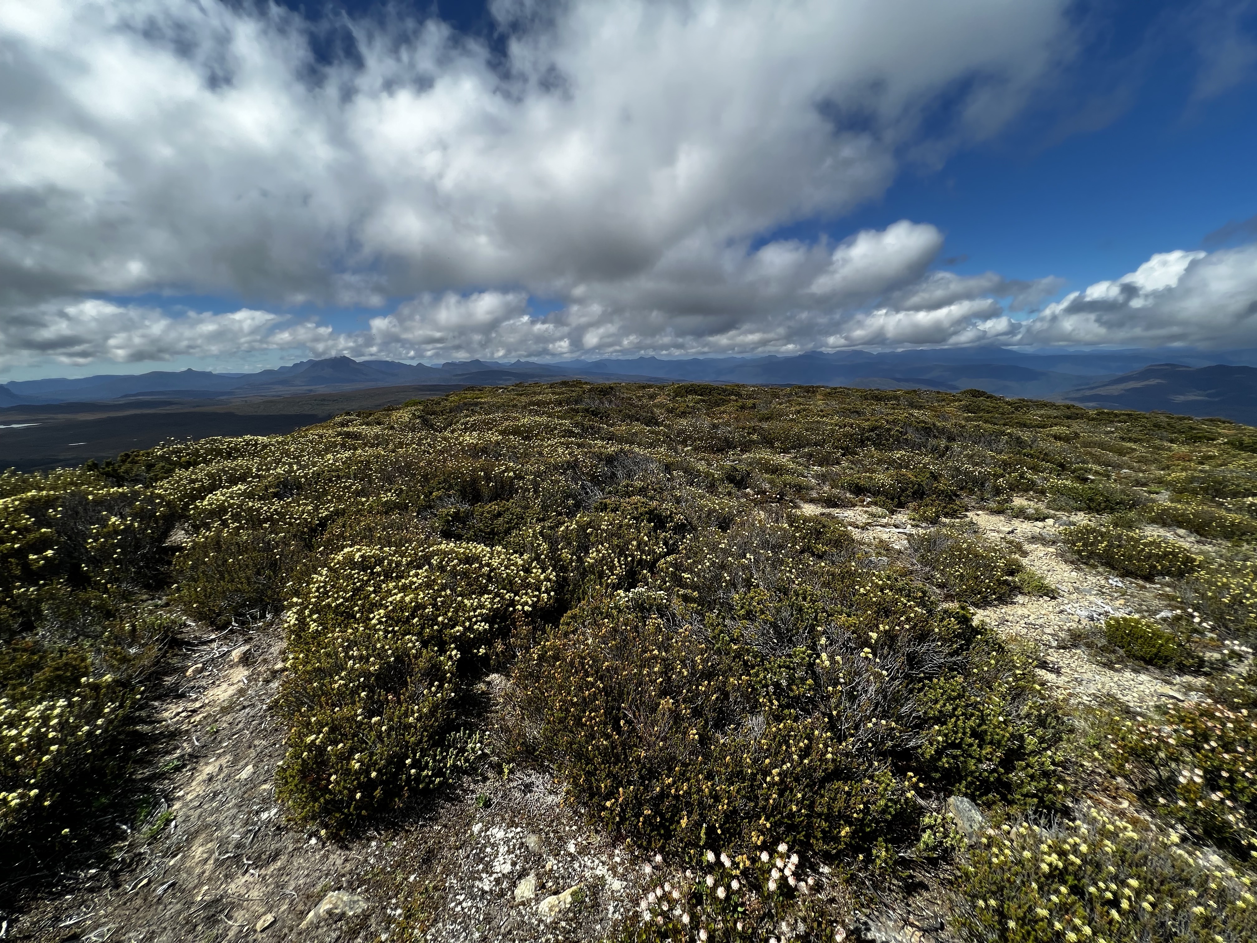
The final climb just seemed to go on and on. But eventually progress was made and I made it to the plateau on the top.
And, unlike most of what Inglis as thrown at me so far, it was fairly easy going.
You might have realised there aren’t exactly a lot of photos from this walk. That’s often a sign it’s either freaking cold (so gotta keep moving) or rough/tough going.
Anyway, after a few minutes I found the rather small little cairn that I trust marked the top of the mountain.
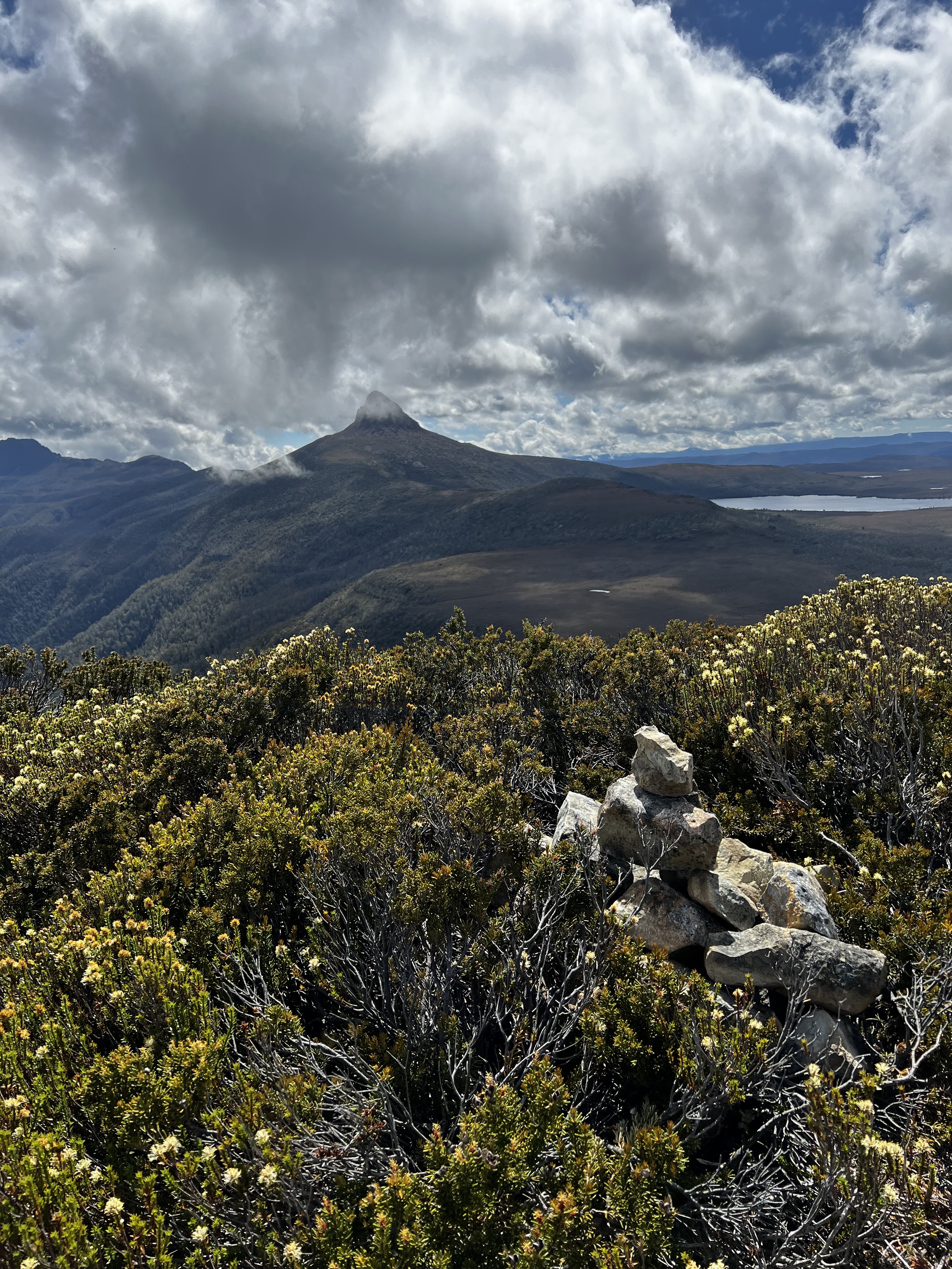
The view was awesome. Amazing view over the Lake Will1 and Barn Bluff. And amazing views to the south-east towards Pelion West.
After a quick bite to eat, I sighed and started the long walk back.
It was much better in return. I could fix most of my mistakes of the journey out. I successfully skipped the damn forest I got stuck in and eventually found myself back at Innes Falls.
I was very much looking forward to that swim, but when I came across the beach - it was full! People were everywhere. As I didn’t have my board shorts with me, I felt it may not be appropriate so I thought I’d move on to the next beach.
That was full too!
The next beach was empty, for 10 seconds, before more people arrived. Uh oh. What to do.
I figured, I’d just been off track for the last several hours - I’d have to do it again.
So after a quick little walk, I found a nice secluded beach all to myself. Finally I got that swim in 3.
After the swim, it was time to start walking again. After a brief stop at Windermere, I continued on to Frog Flats campsite.
I was planning on Proteus the next day.
There was another group staying there too. They’d just done Proteus! How was it, I asked, hoping for a good answer.
Rough, was the reply. Damn, I though. After fighting Inglis, it seemed tomorrow I’d be fighting again.
But sometimes things turn out better than you expect.
Walk times
- Lake Will turn off to Innes Falls: 35 mins
- Lake Will turn off to Inglis peak (the dumb way): 2 hours, 36 mins
- Inglis peak to Lake Will turnoff (swim not included): 2 hours, 30 mins
Elevation map