WALK INFORMATION
Date: January 3 - 6, 2017
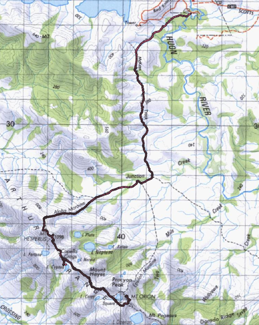
Distance: 46km
Weather: Fantastic. Could not have asked for anything better.
Day 1 (3rd January 2017):
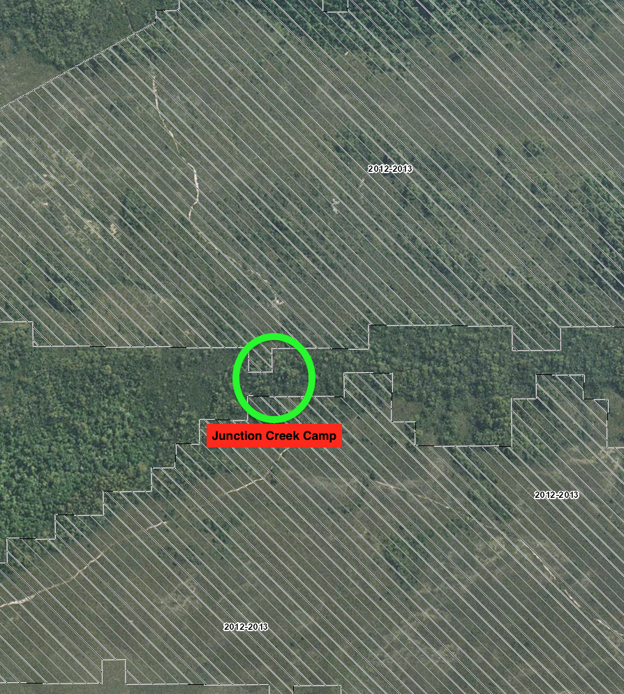
For me, the walk into the Western Arthur range began along a familiar track. The walk to Junction Creek is around 9km from the Scotts Peak dam car park, and is tolerable.
I’d previously been to Junction Creek camp a few years back, when Dash and I did the Port Davey/South Coast Track walk. It wasn’t very exciting then, and it hasn’t got any better.
It’s best described as a warm up. The few steps that need to be taken to get to the destination. The brussel sprouts you’ve got to eat, before you can get to the delicious main meal. The starter motor which gets the engine going. The … well you get the idea.
Me, my mother Angie, my father Clive and friends Pete and Jimmy set off towards Junction Creek. Finally. It was the late afternoon, and after the messing about getting ready - which always takes longer than you’d hope - we were about to leave.
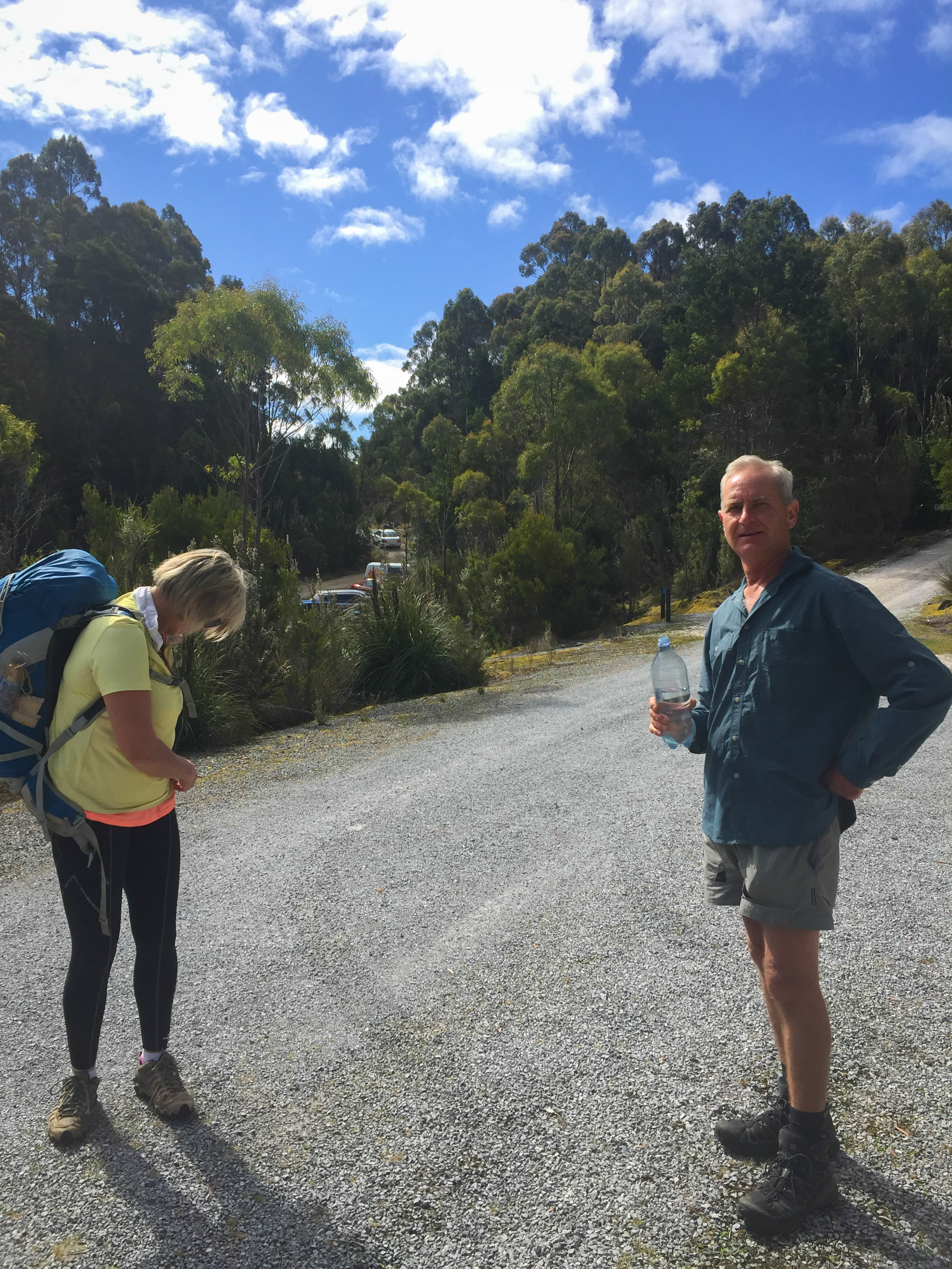
As you can see, Clive doesn’t have his pack on here. Sick of waiting for him, the rest of us - minus Clive - walked up to the walker registration booth to sign in (the track goes just behind where Dad’s water bottle is pointing).
But when we turned around he’d gone. He was no where to be seen. He hadn’t walked past us, he’d disappeared. We hadn’t even got out of the car park and already we’d lost someone.
“CLIVE!” we yelled, to no response. “HELLO?”.
I sprinted up the track to the Huon Campsite, and found him.
“Wrong way,” I said. We both walked back to the group.
It was not the best start we’d ever had. Lesson learned: don’t leave someone - especially Dad - behind.
After wasting another 15 minutes on that little journey, we were finally off. We walked through the lovely little forest that bridges the car park with the Junction Creek track.
I remembered walking this track before. You can look up at the road, which winds up the hill to the Red Knoll lookout. It doesn’t feel quite like a bushwalk until that’s gone.
But it isn’t long until it’s just you, some lovely boardwalks and the clear blue sky (if you’re lucky).
From here, most of the rest of the track is spent avoiding mud and bog.
The mud begins about 2km after the car park, and rarely lets up.
In a way, we were lucky. It hadn’t really rained all that much before we got there, and so parts of the track had started to dry out.
But it wouldn’t be a post about a walk in the South West National Park, without complaining about it. So that KPI is now achieved.
My feet got wet pretty much straight away. It’s probably because I was wearing shoes with more holes in them than a plot of a Dan Brown novel. The rest of the group seemed to be fairing pretty well. Maybe because they were avoiding them better than me, but probably because they had better shoes.
Anyway, we walked along slowly counting down the kilometers until Junction Creek camp.
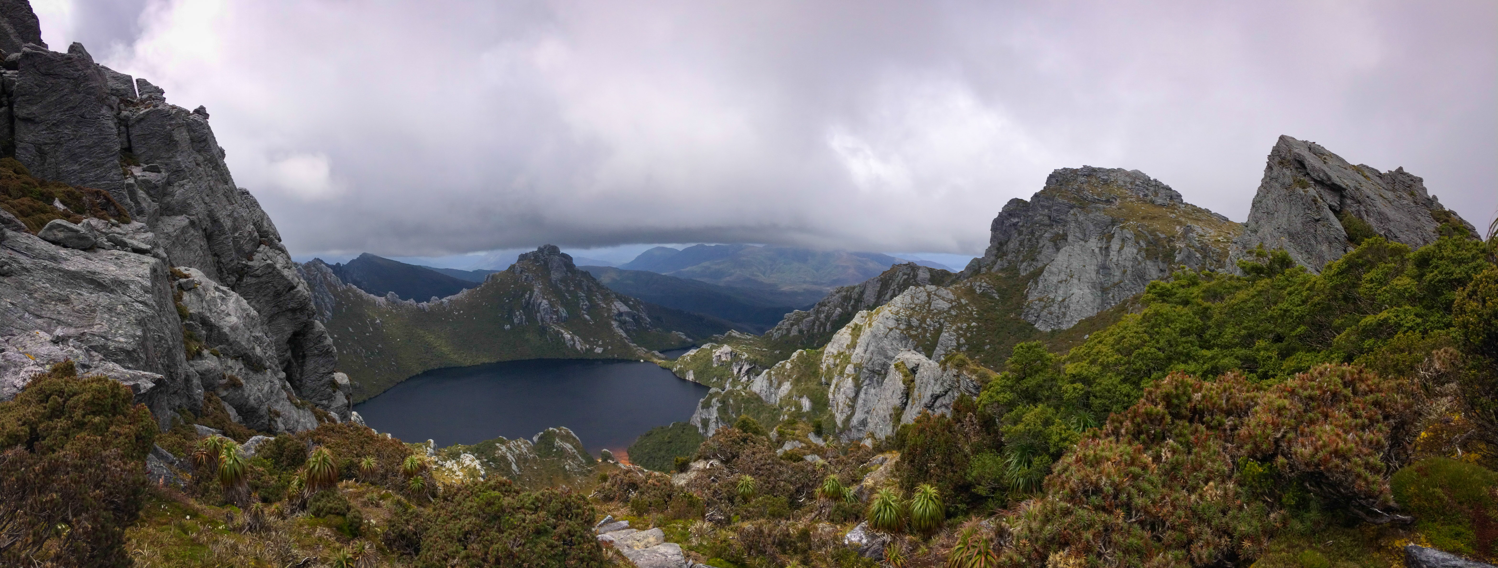
As we walked up and down a few smaller hills, I knew the Western Arthur Range would soon be coming into view. Finally, it did. And what a sight!
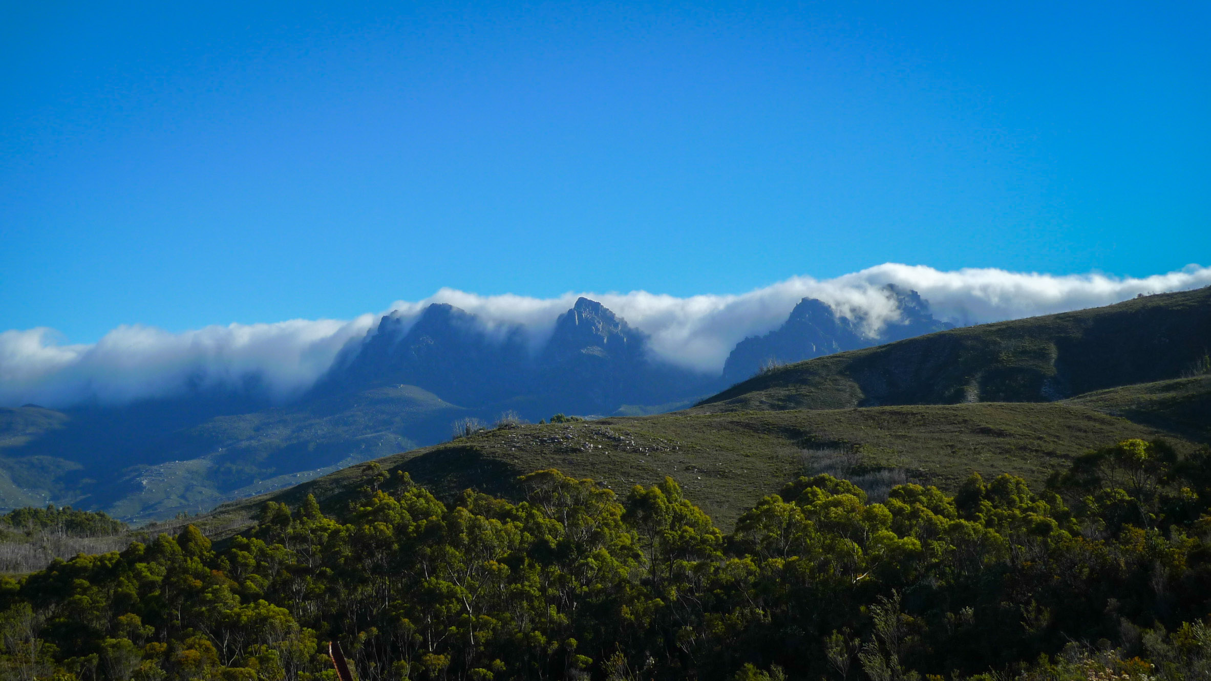
The Western Arthur range comes into view
The clouds were rolling in from the south-west, and spilling over the range. It was as if they were hugging the mountains and lakes hundreds of meters up, insulating them from the cold space above.
Reality was different. For the walkers already up on the range - as we’d later find out - it was Yet Another Day In A Long Line Of Days of constant mist, rain, wind and pretty much zero visibility. Rather unpleasant walking; I know the feeling.
For us though, it was spectacular. And as it turned out, was pretty much the last bad weather for a while. For the next three days of our walk, the weather was amazing.
As I cleared the final hill before the walk down to Junction Creek, I reflected on the last time I was here. I was interested in seeing the campsite again. When I got there, it had changed a fair bit and wasn’t nearly as nice as it once was.
Since our last walk, there’d been a destructive fire in January 2013, and what seemed to be few floods. Small logs litter the campsite, and the canopy and cover than once existed had gone.
Fire all around Junction Creek camp in 2013
Dash and I slept up the hill a bit, and so I wandered up there to have a look. It was also a much sparser place. It lacked the same cozy feel.
This time round, the camp was also a lot more full. We’d had the place to ourselves back in March 2012. Now, we struggled to find a spot. We took the last few remaining places near the river (which is to the left).
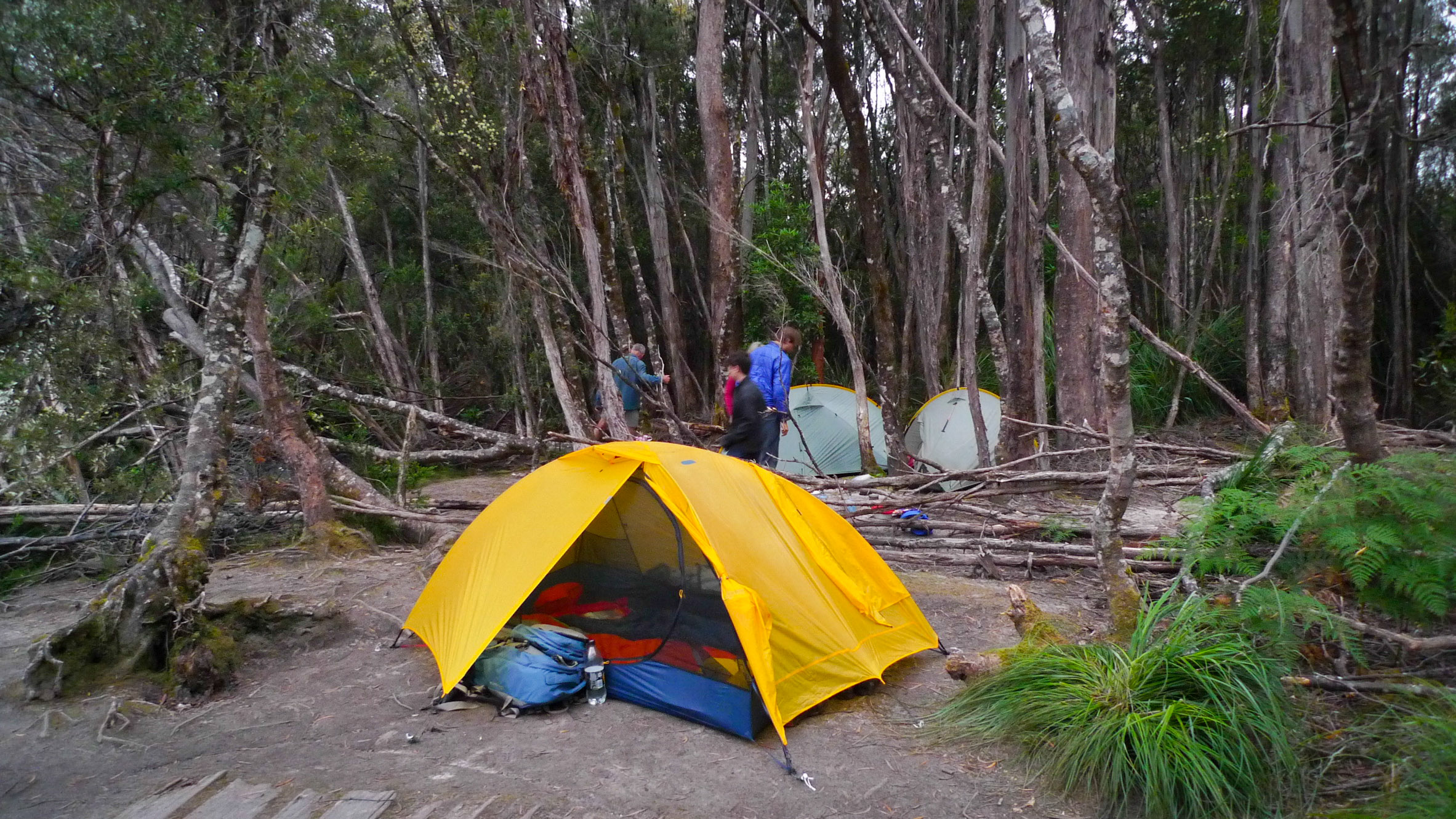
Junction Creek campsite was not as I remember it.
“There’s going to be a lot of tents up on the range,” one camper told me as I wandered by. “How many tents do you have?”
“Three,” I answered. “Five people.”
“I’ve been counting the tents this afternoon,” he said. “There’s at least 10 here now. Most people are going up tomorrow.”
Hm… it seemed as if it would be a very tight squeeze at Lake Cygnus the next day.
We had a pretty late dinner and went to bed. For me, sleep came quickly.
Day 2 (4th January 2017):
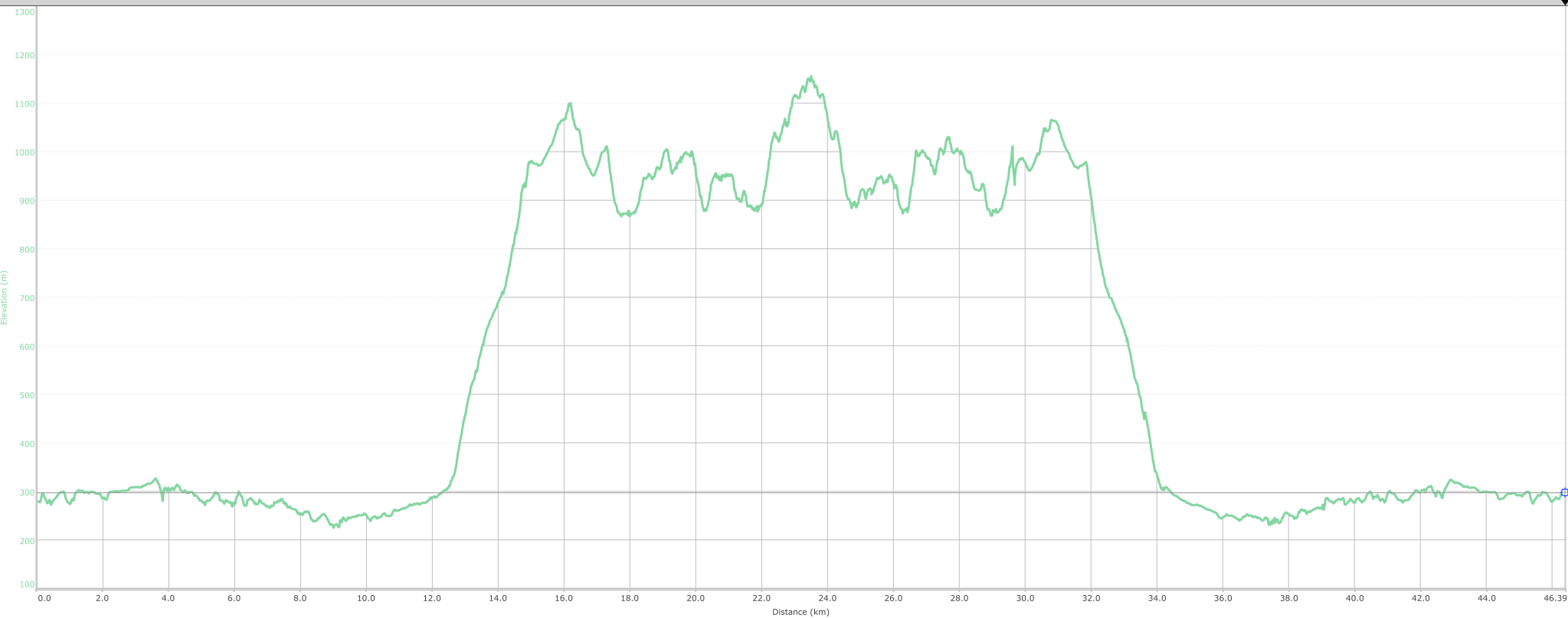
Today we had to walk up Alpha Moraine. It’s a whopper of a walk. At least 700 meters of altitude to conquer, as the roughly 2.3km track winds its way up to the top.
No one got lost today, which was a bonus.
We were the second group to leave camp, and we got away at a pretty good time. I always like leaving early, as it means you can get going in the cooler morning and so you don’t have to slog it out too much under the hot afternoon sun.
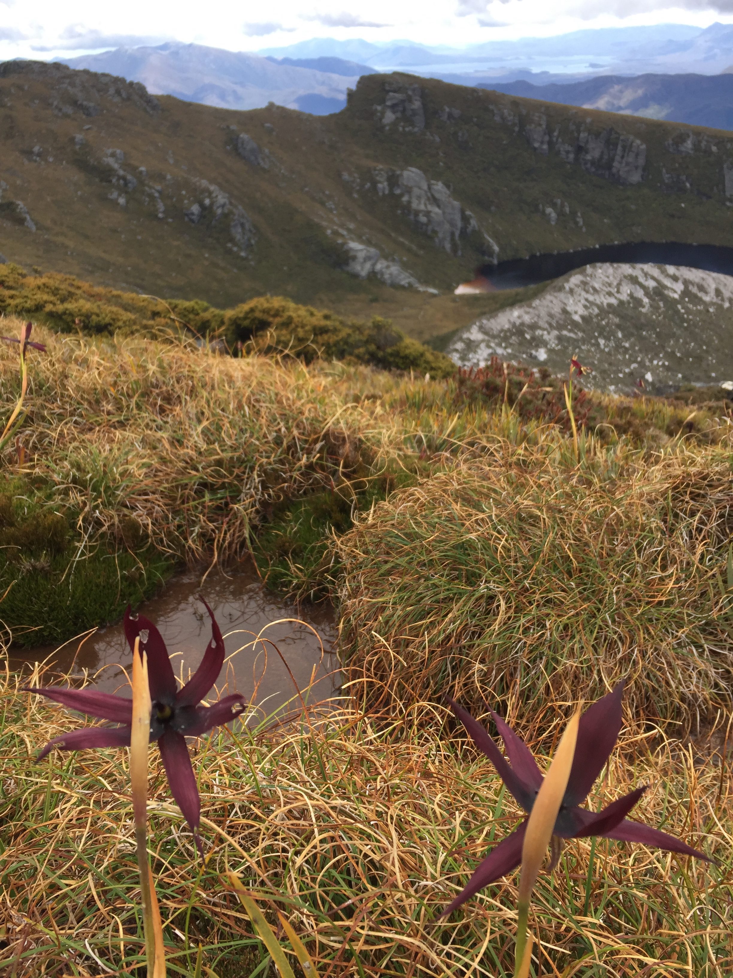
Out destination today was Lake Cygnus. We were to walk past bluffs, crags of quartzite and alpine flora.
This is when the walk starts to get more interesting! It’s why we were here.

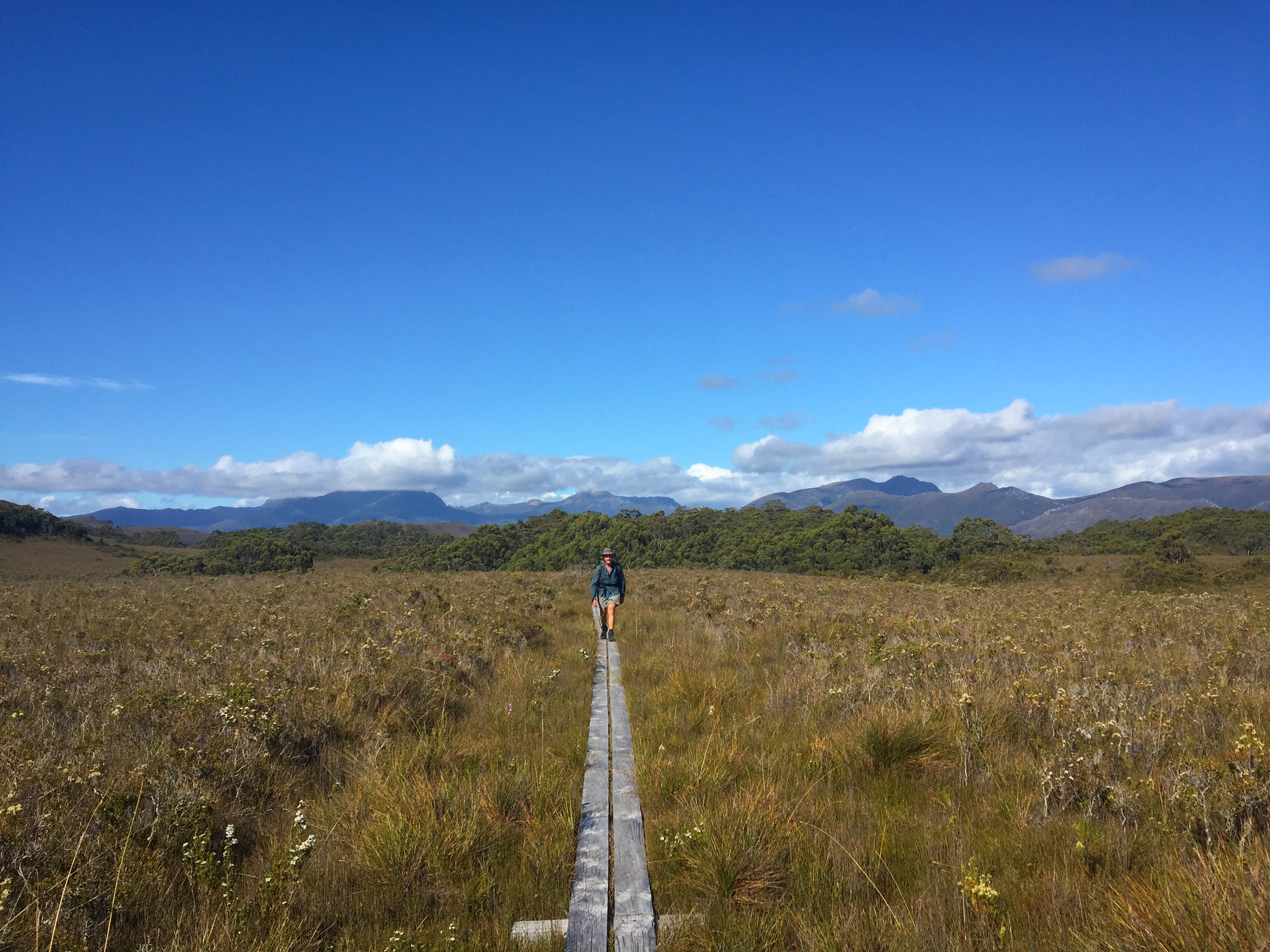
The day begins with a quick walk (compared to what’s coming a bit later) across the Arthur plains along the Port Davey Track.
You eventually come to a fork - the track either goes up Alpha Moraine, or down towards Bathurst Harbour.
It was slow, but solid going up the mountain. Behind us, we could see the other groups that had left a little later. They were slowly gaining on us as they walked the flats and we had the hills, but they never did catch up.
There was still a morning mist, so the top of the mountain was obscured behind cloud. It wasn’t long before people who had walked out from Cygnus that morning started to appear.
In traditional walker style, one had to stop to chat (and have a break). We heard that the weather had been horrid over the last week. Rain, hail, winds. Everything under the sun, except for the sun itself.
For one man who stopped to chat, it was the first time he’d seen further that 50 meters in four days. He said he originally went up to Oberon to take some photos, but ended up getting stuck in his tent for a few days. Eventually he pulled the plug and was on the way out.
If only he’d waited one more day.
It took us about an hour to get from Junction Creek to the turn off, so we started the ascent at about 9am.
An hour into it, I’d done about 1.5km. Another hour later, I’d done another one. It’s not exactly quick walking, but we were at the top having a look at the amazing views by midday.
We ran into a woman, who was waiting patiently for her partner who was a professional photographer. He too - like the people we met coming up - was finally seeing things he could take photos of, and was making the most of it.
After a quick snack, we pushed on walking across the flat and wonderful ground at the top of Alpha Moraine.
I took the opportunity to quickly run up Mount Hesperus, and was rewarded with an amazing vista all the way down to the south coast.
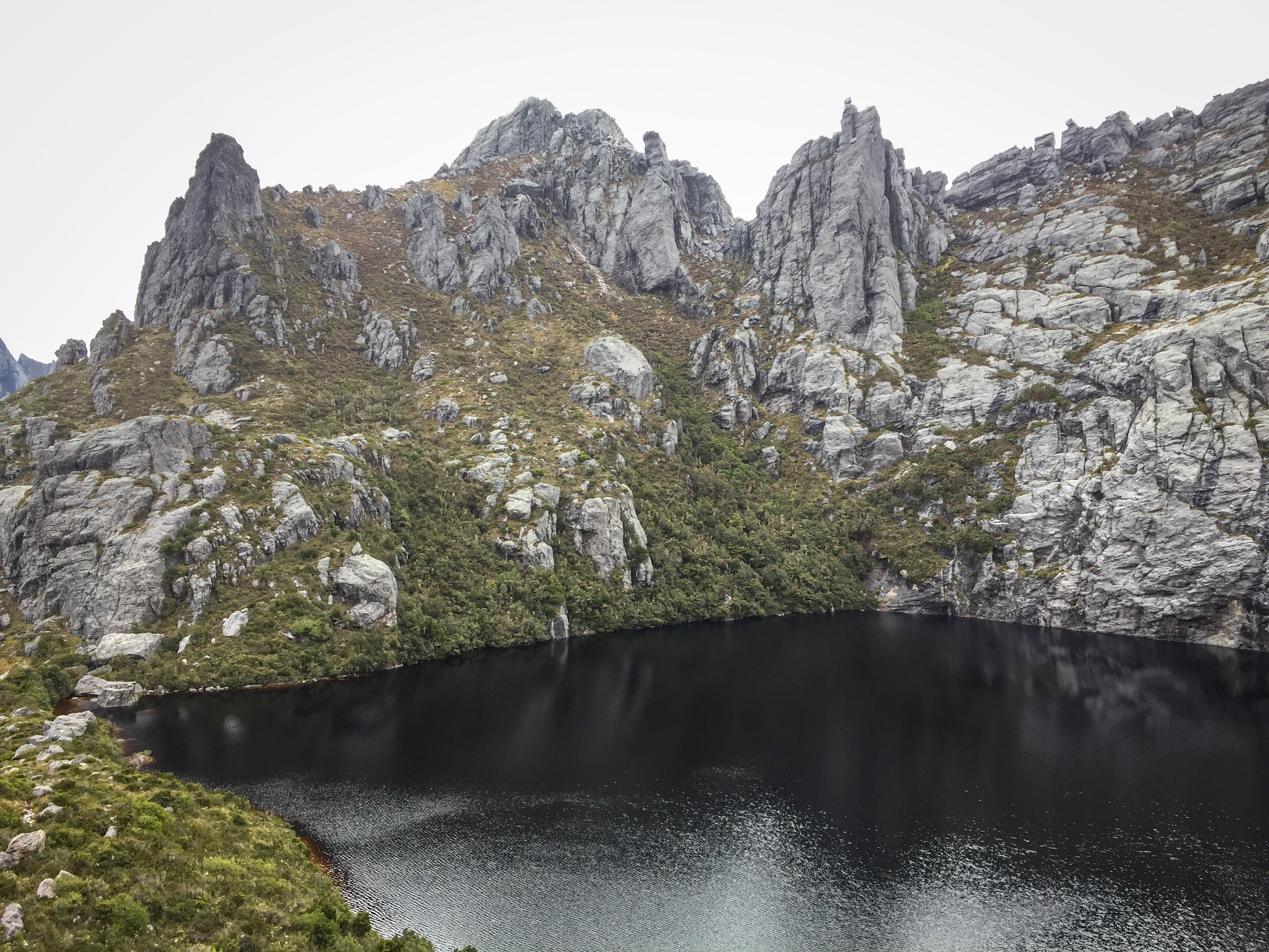
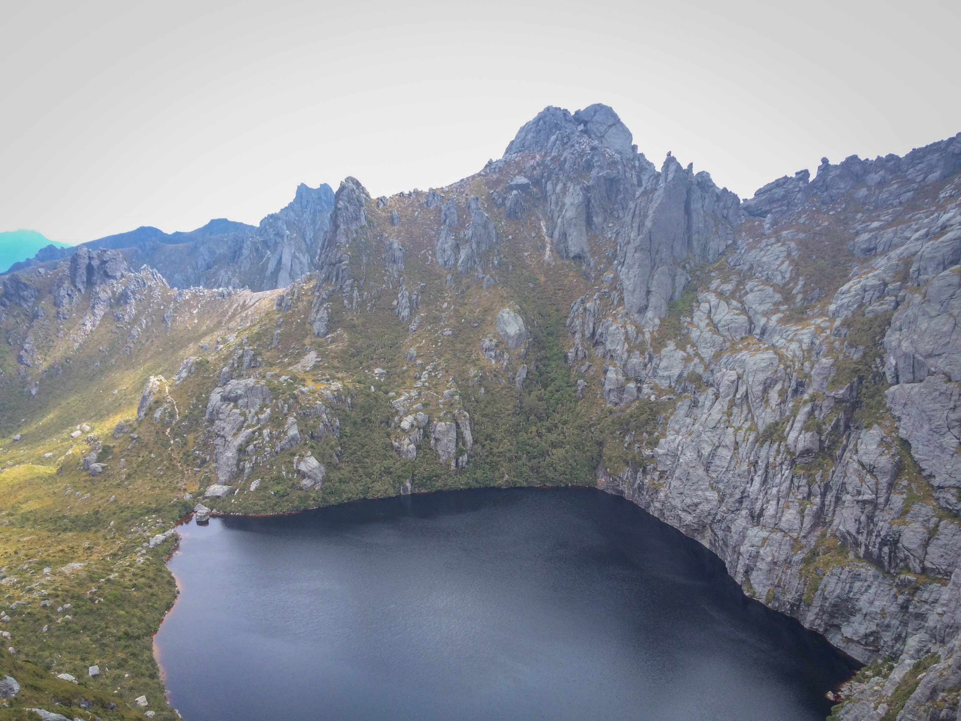
We finally cleared the last ridge, and were greeted to the site of Lake Cygnus, a lovely little spot. We arrived around 2:15pm, where we had lunch.
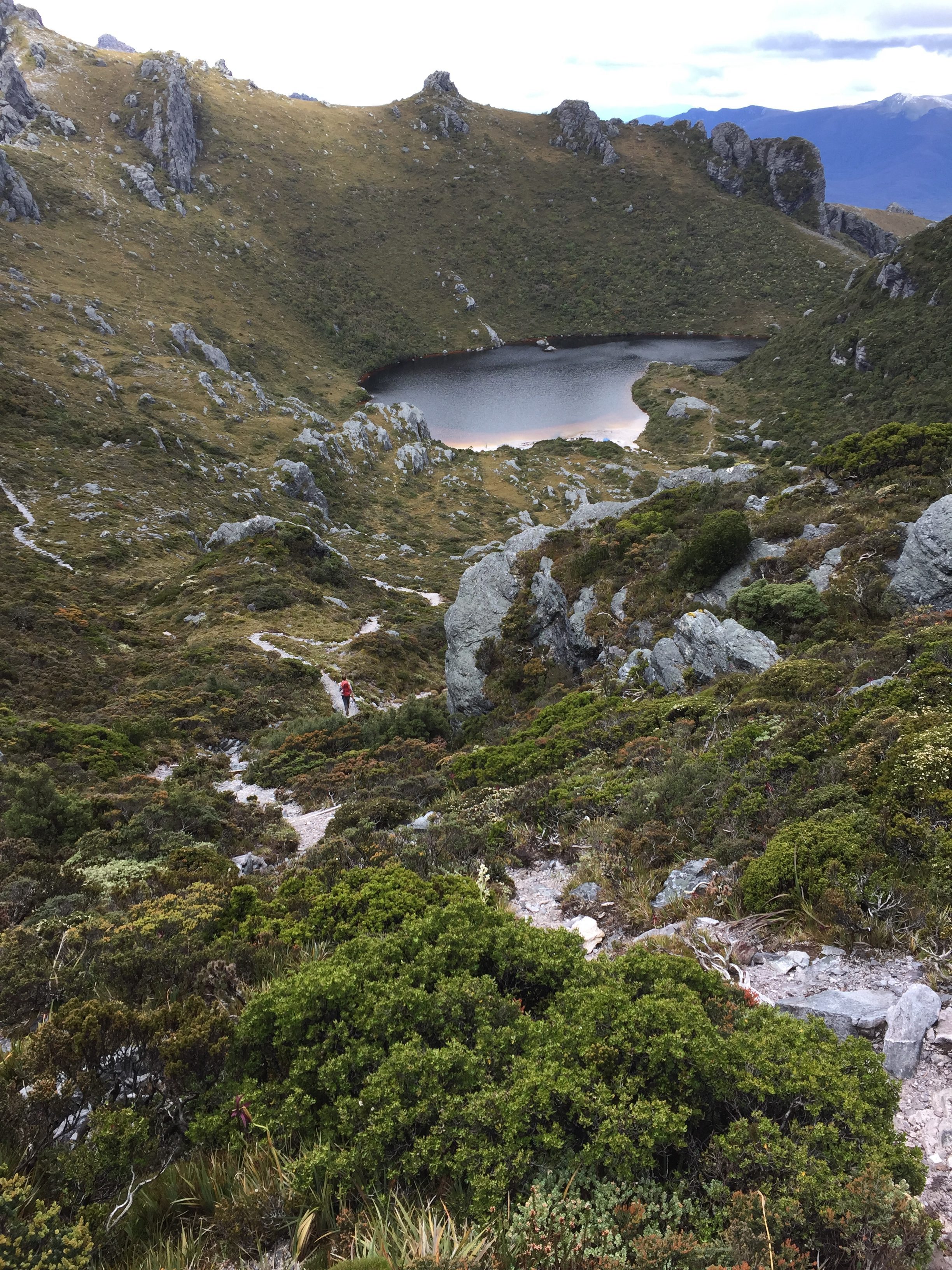
Despite the fear the night before that Cygnus would be packed, we were the first ones there. There was a family that was going to stay another night, and they had taken the spot down on the beach.
We picked the smallest of the platforms, and squeezed our three tents onto it.
The idea was to use the space as efficiently as possible in case other groups turned up, but we needed have worried. The huge area with the rubber mats - which could sleep 6-7 test - wasn’t used at all that night.
It seemed that half the people skipped Cygnus and went straight to Oberon. The others apparently stayed at Lake Fortuna - an old campsite that’s not on the “official” list anymore.
Lunch was down at the beach after a quick swim in the very cold water. It was lovely.
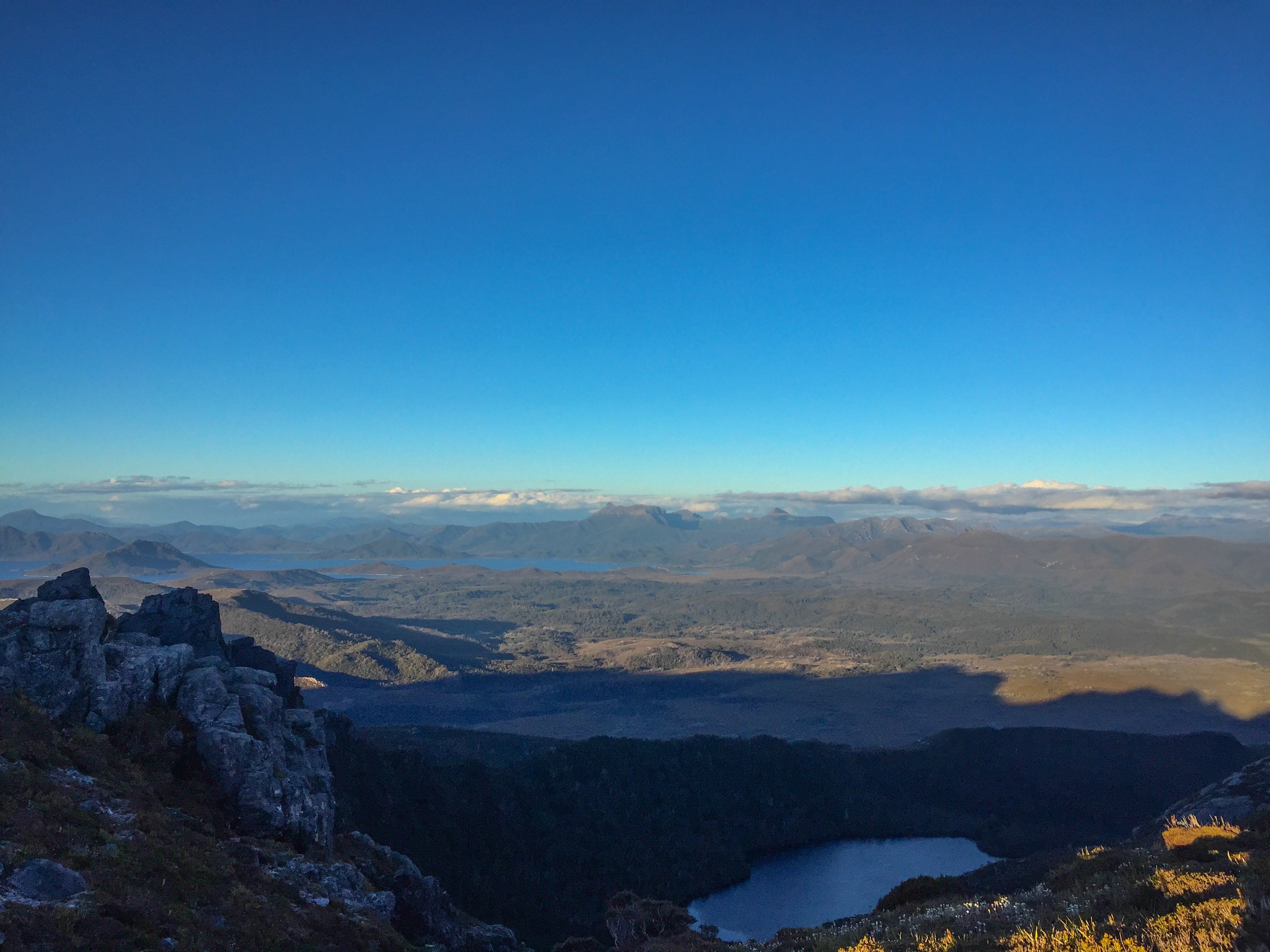
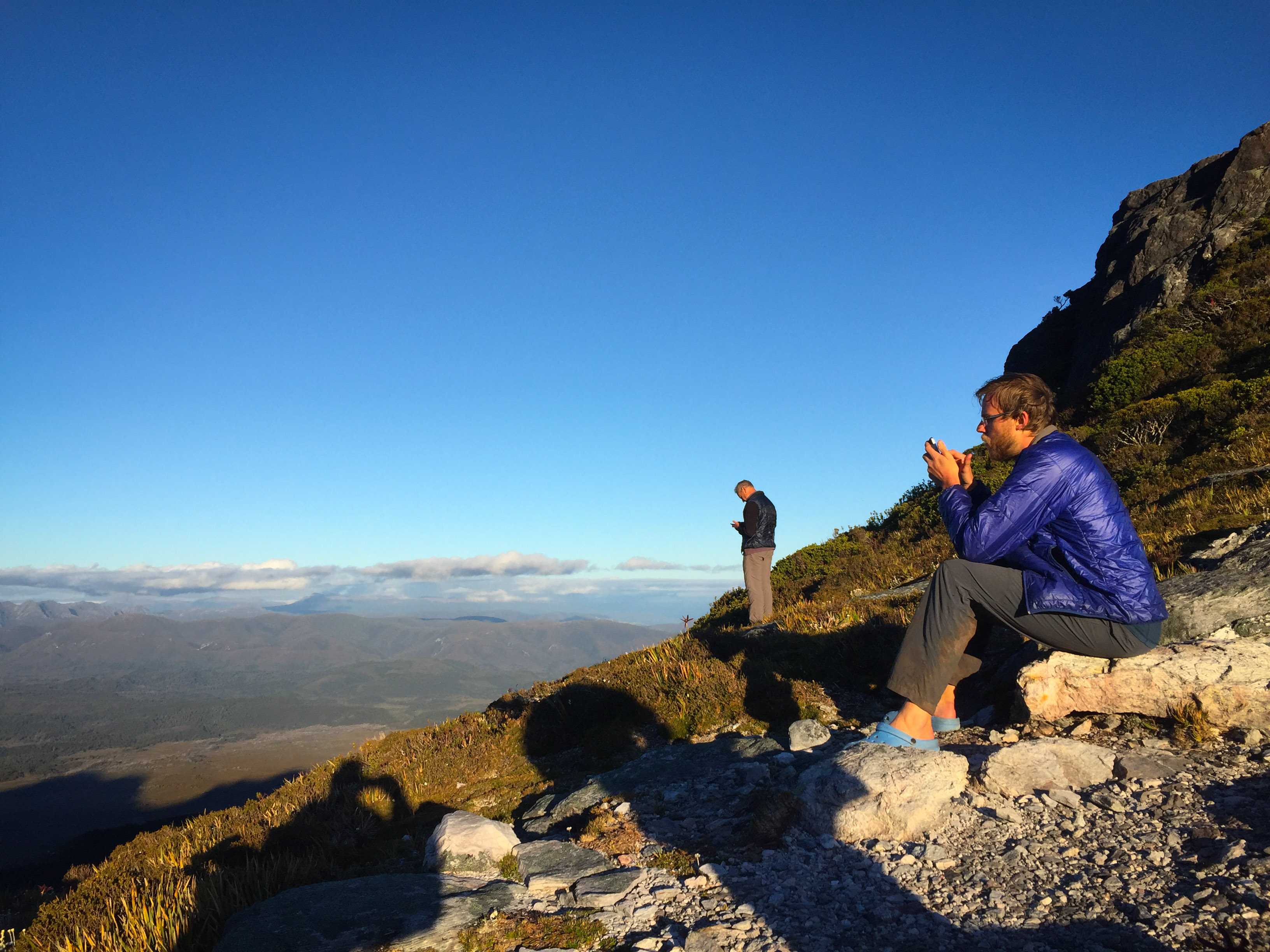
Eventually it was dinner time. Everyone ate and went to bed. I wanted to have a quick look at the weather forecast, so walked up to the ridge above Cygnus. The general rule of thumb is that if you can see Lake Pedder and if you’ve got a Telstra connection, you’ll probably get reception.
Weather forecast for the next day was wonderful. We were in the middle of two highs, and the outlook was “partly cloudy, 20-26 degrees, light winds”. Perfect.
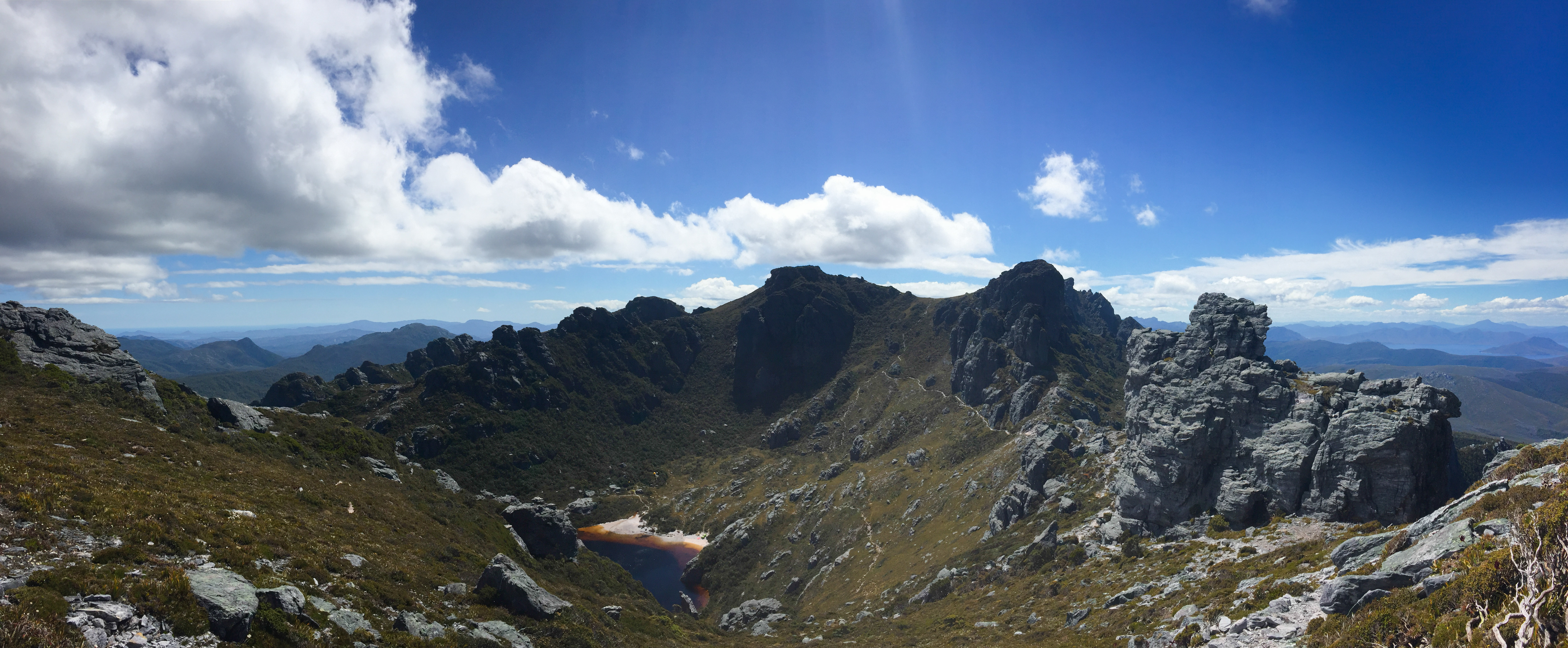
It was a stunning night, so I walked a little further up the hill to get this panorama.
When I got back, everyone was in bed. It was about 9pm.
Day 3 (5th January 2017):
Today’s plan was a day trip (return) to Lake Oberon, the lake we’d all been waiting for.
We set off around 8am to walk the 4.5km route.
The walk to Oberon isn’t too hard by Western Arthurs standards. Apparently it starts to get far more difficult, exposed and technical after you’ve passed Oberon. Lucky for us, we weren’t going that far.
The walk starts by climbing out of the Cygnus bowl, and heading over the ridge towards Mount Hayes. Mount Hayes is a 1119 meter high peak I’d quite like to climb, but I didn’t get the time/opportunity this time round - so it’s on the list for next time.
There are moments on the walk where you go over a ridge, and you’re presented with a whole new vista. Then, as you gaze around you wonder “where the hell does the track go?”
This is one of those. The track just drops down this gully, with scree and rocks everywhere. It’s steep and slow going. You can see Dad just (wearing a green shirt)
This is the view from the saddle looking back up.
It’s hard to know how the first people navigating the area worked out where the hell they were going. These days we just follow a trail.
It must have taken a long time.
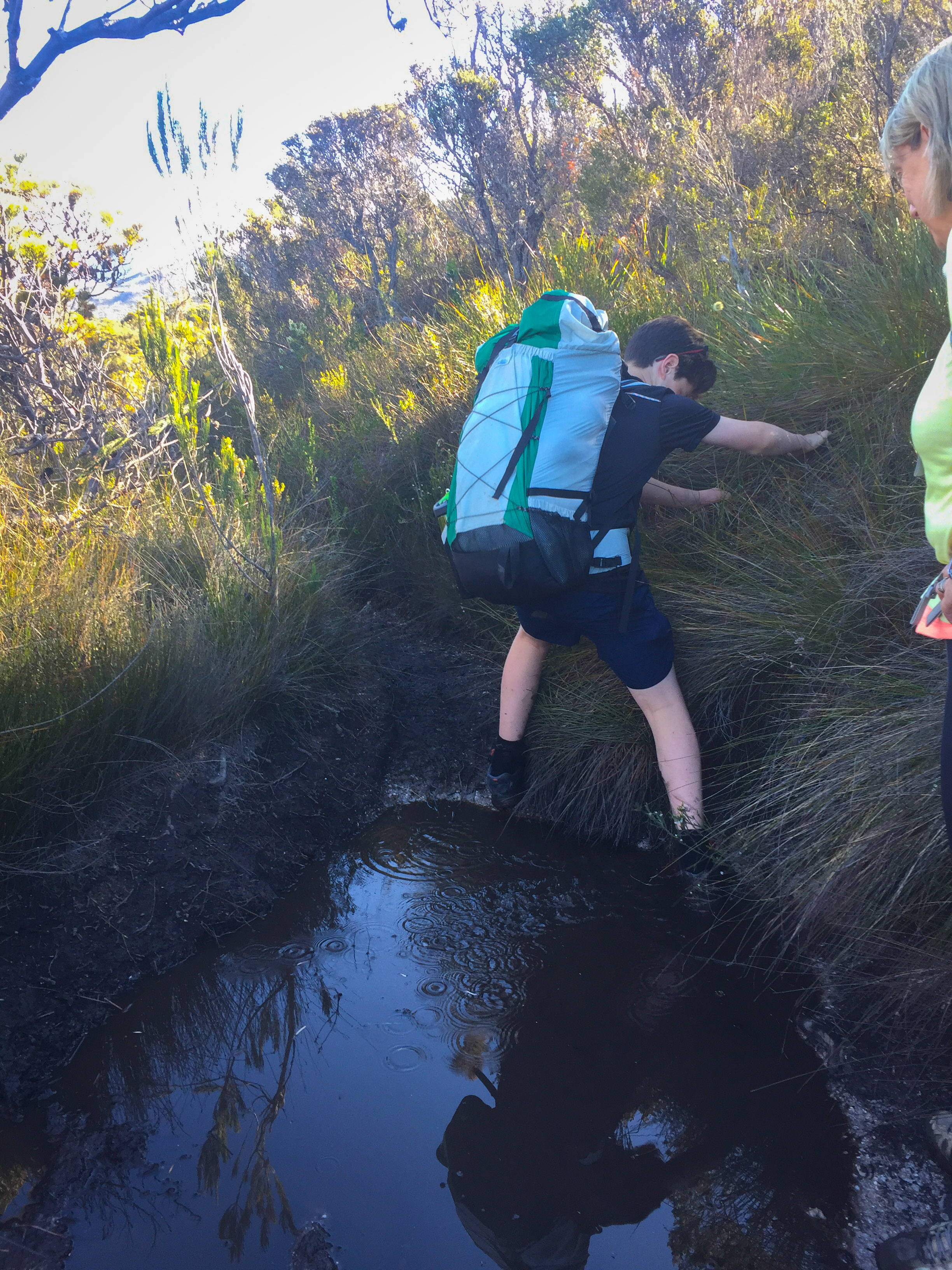
Over the next hill, we come to a longer section before dropping down into Square Lake.
A wonderful area that has a few stops for camping at a pinch. There’s a lovely bit where you go trough some think scrub, and have to clamber over the stream that runs from Square Lake down the range.
Square Lake. We all agreed that while it’s a bit square, it’s more of a rectangle with an oval bit
We debated if Square Lake really deserves the name. It was a silly discussion.
Up one more hill, across it a little bit and up some more and we were finally where we wanted to be: looking down at Oberon!
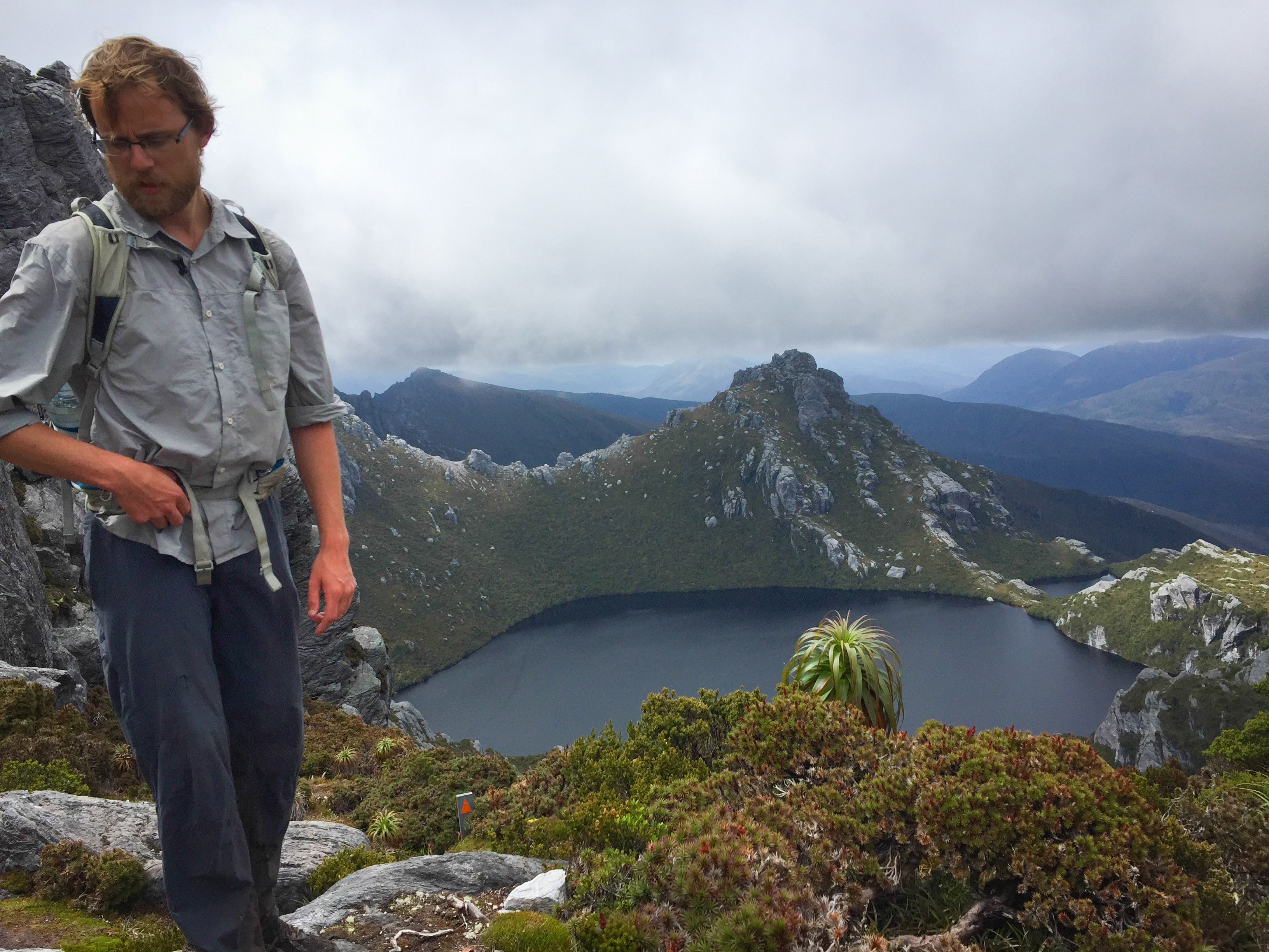
I made it
This is as far as we’d go this trip. We didn’t bother the long trek down to the lake’s edge. It apparently takes 30-60 minutes one-way, and there wasn’t really any reason to do it. The view is what we were after, and it’s what we got!
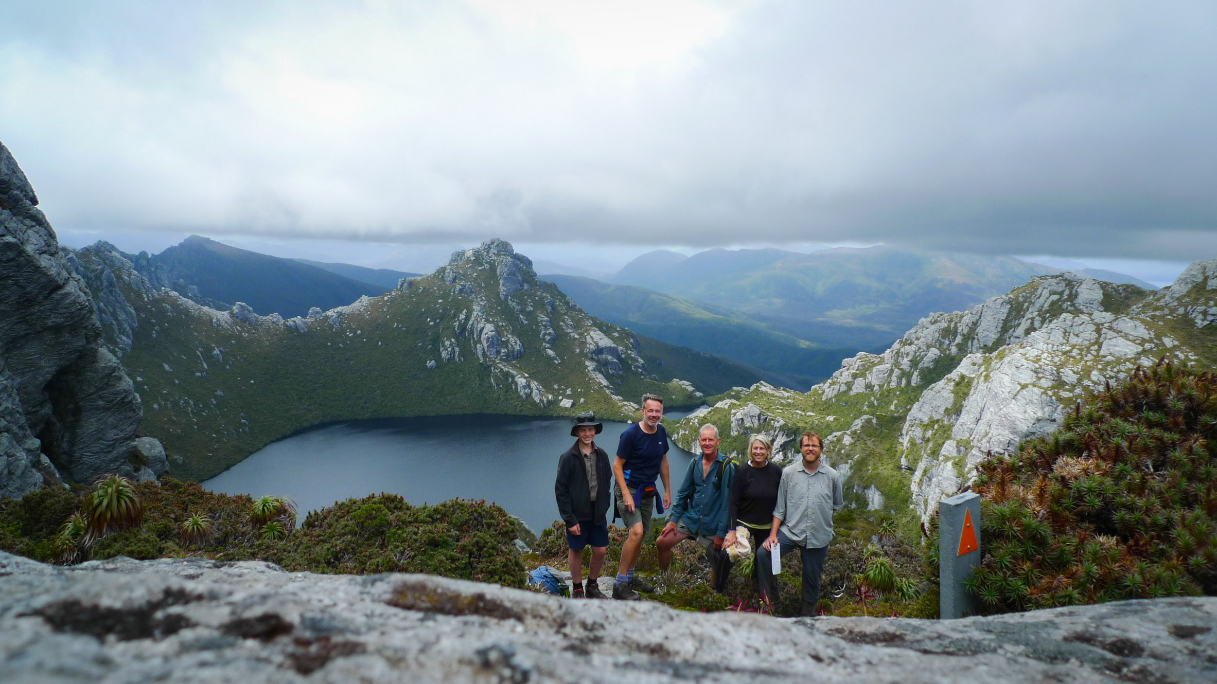
Pete set the camera up for a group shot, giving himself 10 seconds and legging it. He just made it!
We had lunch, and then… started walking back.
I took the opportunity with Dad for a quick summit attempt up Mount Orion. It took us about 20 or so minutes, and we were rewarded with amazing views back to Pedder and of the range.
We had a brief discussion about taking the ridge back to Pyocyon Peak, but Dad had left his bag back at the lunch spot so we didn’t - luckily as it turned out. It would have taken hours.
I was curious as to where Epsilon Moraine started, as apparently this is the section where you get onto it for either a decent/assent - though Parks discourages that these days, as it’s not a maintained route.
An hour behind, I wanted to catch back up so I flew down Orion, rounded Square Lake, and caught back up with Mum somewhere a before Mount Hayes.
Another break was had at the top of Lake Cygnus. We ate chocolate in the sun. It was magical.
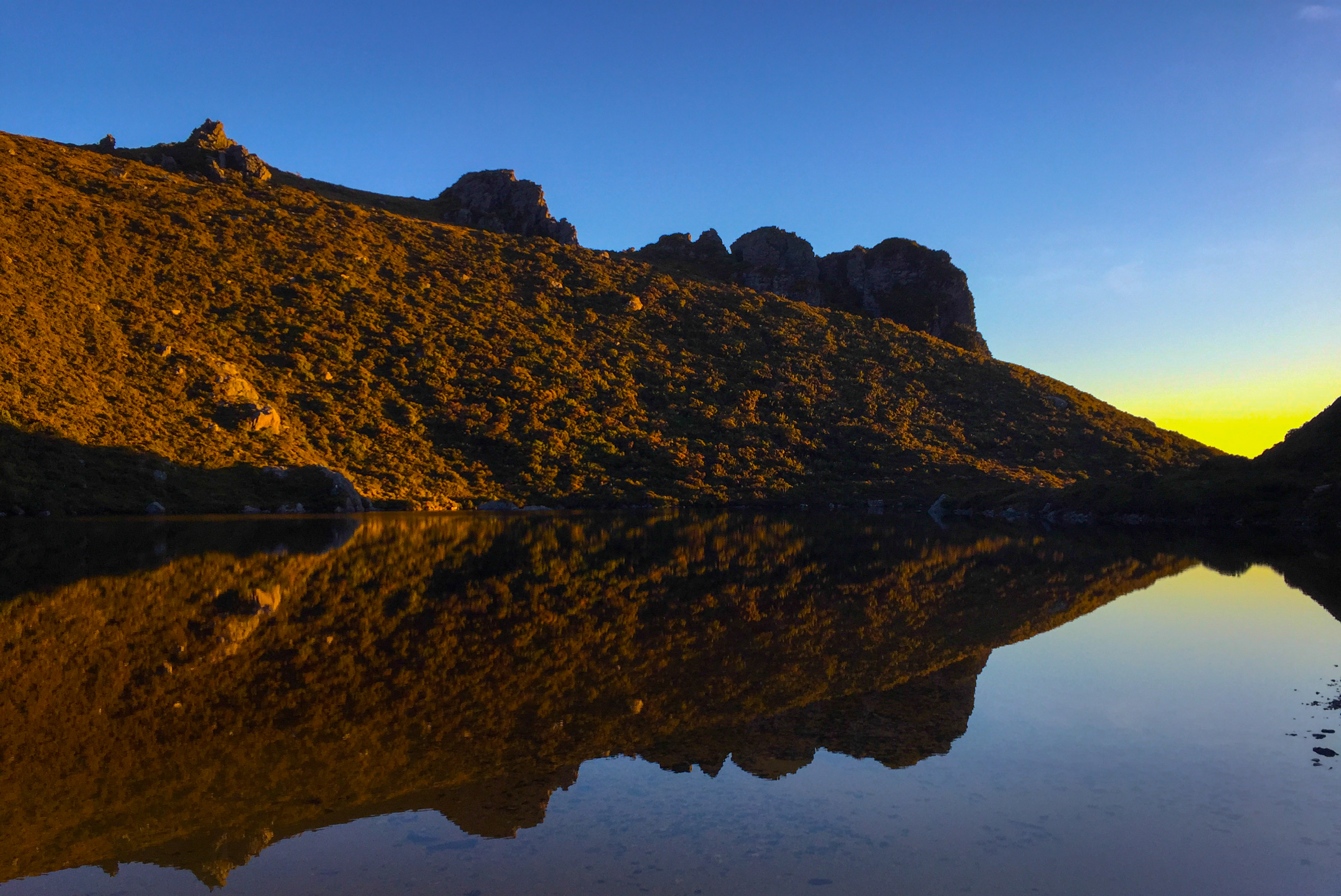
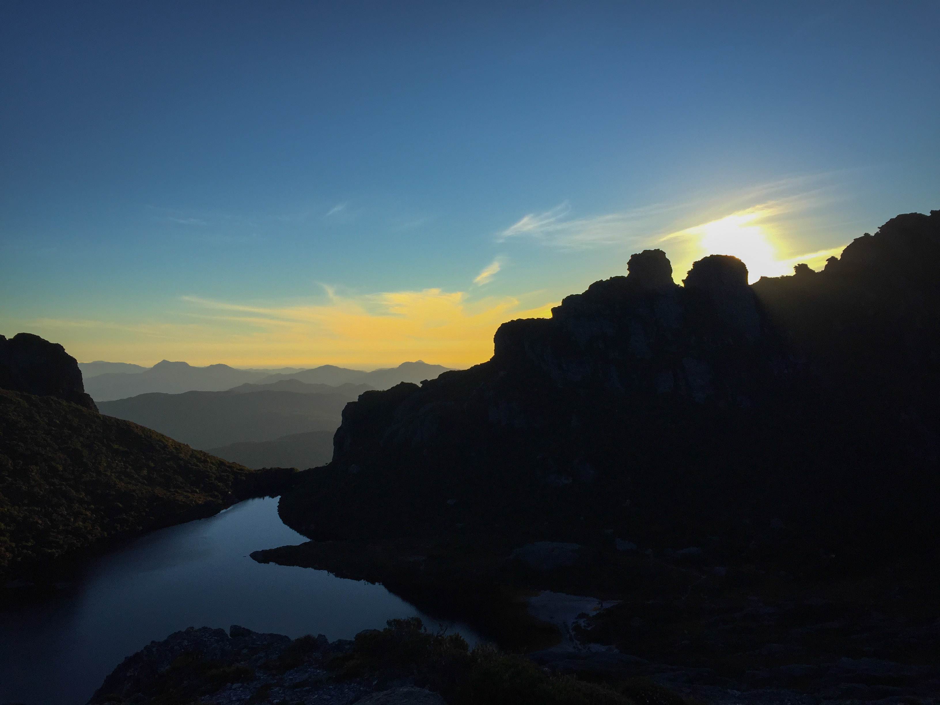
Then it was back to camp. After dinner we walked back up to the ridge line to get a few photos as the sun set.
Though despite the views and the amazing colours, the internet needed checking and messages needed to be sent.
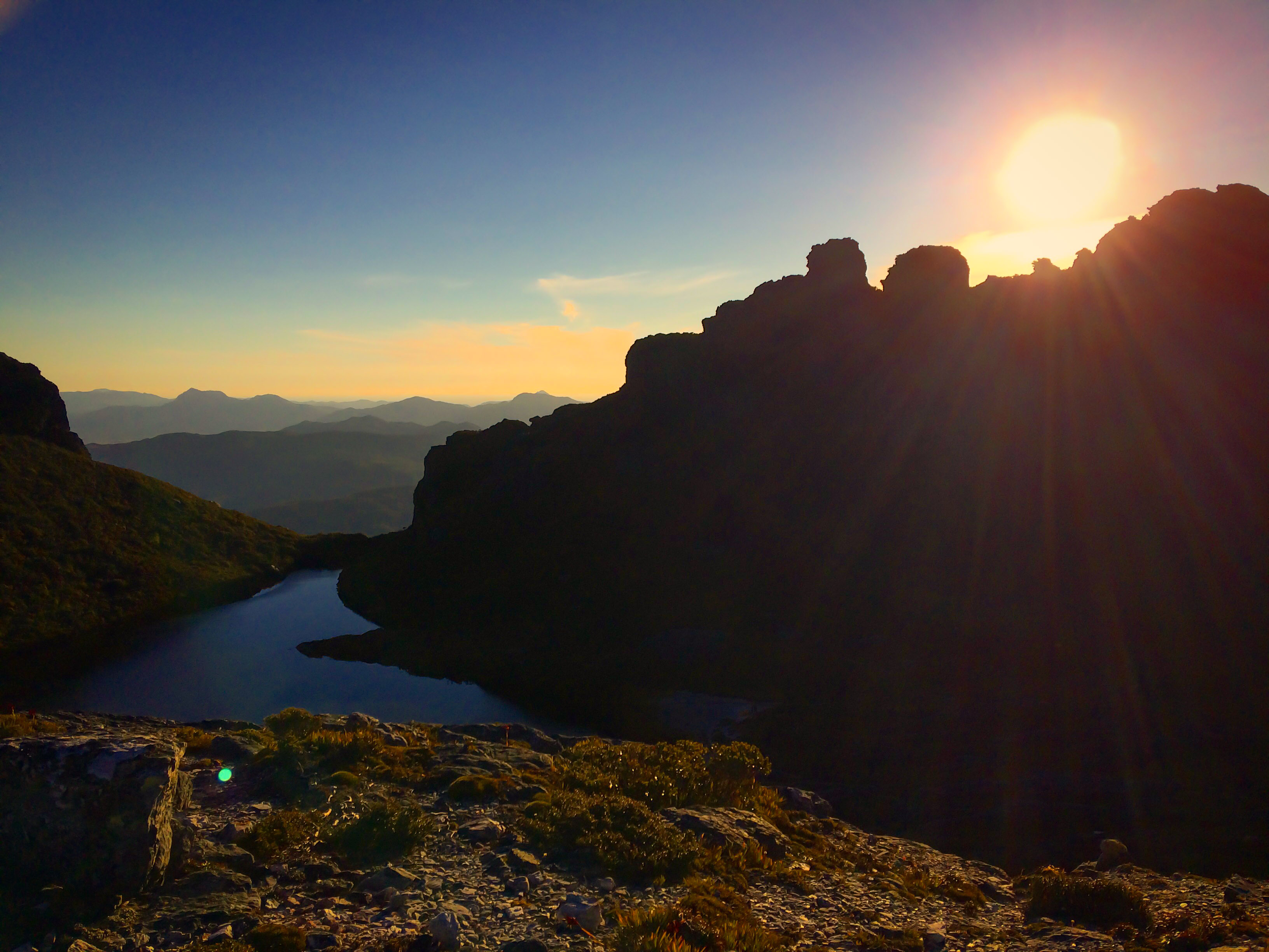
As the light dimmed, it was time for bed on the very cramped platform.
Actually, there was a bit of camp drama on Day 3.
Mid-afternoon, when we were pottering about we noticed a large group appear on the horizon. They all made their way down to Lake Cygnus. Hellos were exchanged, but the group seemed to be a little …. pissed off.
They had taken hours to get to Cygnus. We’re talking 8-9.
The reason for their very long day would soon become clear, both in overheard conversations and later them telling everyone who’d listen.
It appeared that the group usually walked together. They’d flown in from interstate to walk the Arthurs, and at the last minute a person - who’d never travelled with the group before - joined, assuring them he was experienced.
Whether he is or not, I’ll never know. But we eventually caught sight of him some hours later on the horizon, with a huge backpack.
We found out from some of the others, that his original pack was much, much larger.
Half his stuff had been left at Junction Creek, so the story went. More of it had been left on poles along the Arthur Plains. Even then, he’d apparently still insisted on taking things like:
- A pineapple;
- A bag of potatoes;
- A spice rack
I don’t know if the “spice rack” was an exaggeration from a member of the group who was clearly frustrated with the slow-going, and pack hauling the others had done of the guy’s stuff to get them there before dark, but I can’t imagine many of them have been used at Lake Cygnus.
Anyway, an hour and a bit later, the guy had finally made it down the Lake Cygnus hill and was making his way to the beach to set up his canvas hut thing.
I’m not sure how they went, because the next day we had to get off the Western Arthurs, and get back home.
Day 4:
We woke up early, packed everything up, skipped breakfast and took off.
Sometimes going down is worse than going up. Actually, mostly going down is worse that going up.
It’s not always faster either.
7am departure. We walked about an hour, then set up and made some hot drinks and a quick breakfast before pushing on.
It wasn’t long before we came to Alpha Moraine and begun a multi-hour (2-3) decent.
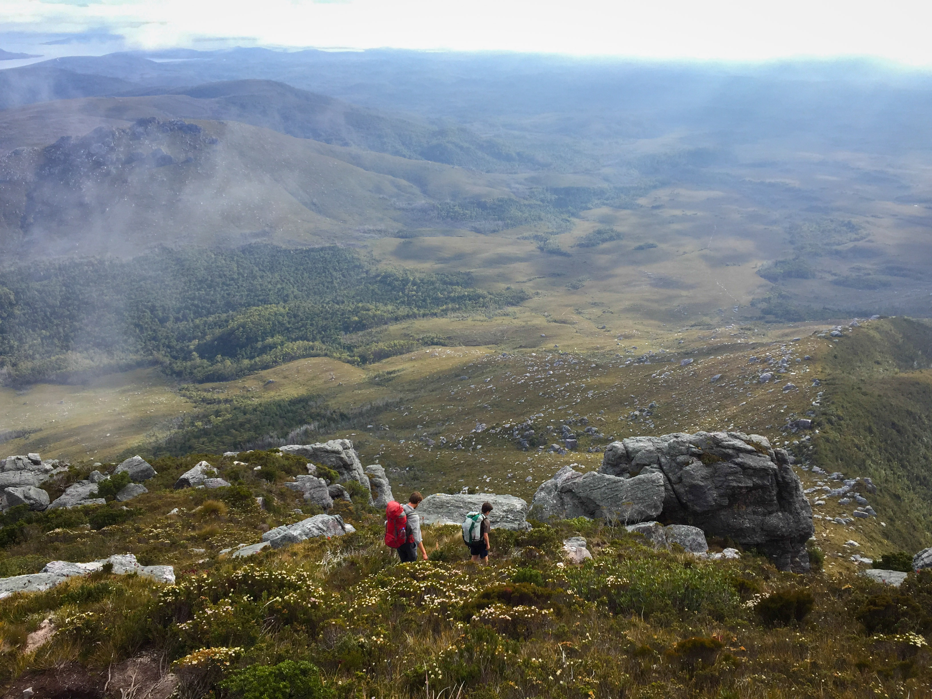
Plod, plod, plod.
Least the views were nice.
Eventually - as expected - we started passing a few people heading up. They looked as tired as we probably did several days earlier.
Finally we made it down, and started along the wonderfully flat Arthur Plains
It was like this for a while. I found some of the stuff from the group before hanging on one of the poles. It looked like a pretty big bag.
We hit Junction Creek, had a snack and started the last 9km.
It was muddy. It was hot. It was slow going.
Oh yeah, the mud. Pete has some fun.
We made it back to the car around 3-3:30pm. It was hot. Water was drunk. We packed the cars up, tore off down to Lake Pedder and had a traditional after bushwalk wash.
What a walk. Stunning, phenomenal, brilliant. All those words. And more.
And we’d had pick of the weather too. Not a drop of rain, mostly clear skies and still days. Couldn’t have been better.
I only wish I had kept going. Anyway, when I got home I called Dash and made the pitch to him: Western Arthurs + Eastern Arthurs + Full Traverse + 2018?
He’s keen. Yes! Can’t wait to go back!
Walk Map
Elevation
Comments
Courtney Dunbabin:
January 6, 2018
So funny I was looking up this hike and your post came up on google! How random! Hope all is well Willo 😉
David Johnston:
November 4, 2018
Hey – I really enjoyed your write up and photos – looked like a great trip (and so lucky with the weather!!
Will:
November 10, 2018
Thanks David. We were very lucky! I’m heading up there next year, for a longer walk, so hoping very much for similar weather.
Michele Ferraraccio:
January 4, 2019
Hi, there is a way most quick to arrive very close with car and walk for some hours and NOT days? thank you and sorry if my question will be silly
Will:
November 28, 2021
Sorry for the very late reply Michele, but to anyone reading this in the future the answer is no. This is not an easy walk and you should be very prepared before setting out. Do not attempt to do this is a day from the car :)