WALK INFORMATION

Date: January 6 - 10 2021
Distance: 60km
Weather: Couldn't ask for anything better
The logistics for this one were different from your usual pre-hike planning.
Sure there was the usual requirement to get food, maps, supplies, etc, but COVID times bring additional challenges.
On this walk, I was to be joined by a friend who has long been keen on walking the Arthurs. The only problem was he lived… interstate.
Now, that’s not usually a problem and it certainly didn’t seem like it was going to be. The borders were well and truly open between NSW and Tasmania.
Well, they were until the Northern Beaches outbreak.
Carrington, who’ll you hear from later, called me as case numbers in Sydney started to rise.
“Get out,” I advised in a very calm and collected manner. “If you want any chance of getting to Tassie, you need to get out of Sydney now.”
Ok I agree it’s a bit narcissistic to quote myself in my own blog post and I can’t really remember if that’s exactly what I said, but it certainly was the vibe.
I was obviously persuasive enough, as Carrington left Sydney that night. It turns out I was also right. Lockdowns of the Northern Beaches were announced, and before long Sydney was added to the NOT WELCOME list of the Tasmanian government.
But because Carrington had left early, we were still in the clear. So long as rural NSW wasn’t added to the list he’d at least have a chance.
(Note: This was all within the regulations and rules at every step of the way. I have no interest in trying to break COVID rules just to go for a walk.)
So did he make it? Yep, thanks to a long stay with his parents over Christmas and a bit of luck.
And with that out of the way, the excitement was over and we did a walk in the Western Arthurs and that was that.
Thanks for reading.
Sorry, oldest joke in the book. Ok, on with the walk now.
Day 1 (Jan 6): Carpark to Lake Cygnus. A trudge to Junction Creek.
Day's quick notes:

Distance: 19km
The start bit (and end) of the Western Arthurs sucks.
Ok that’s a bit extreme, but let me explain.
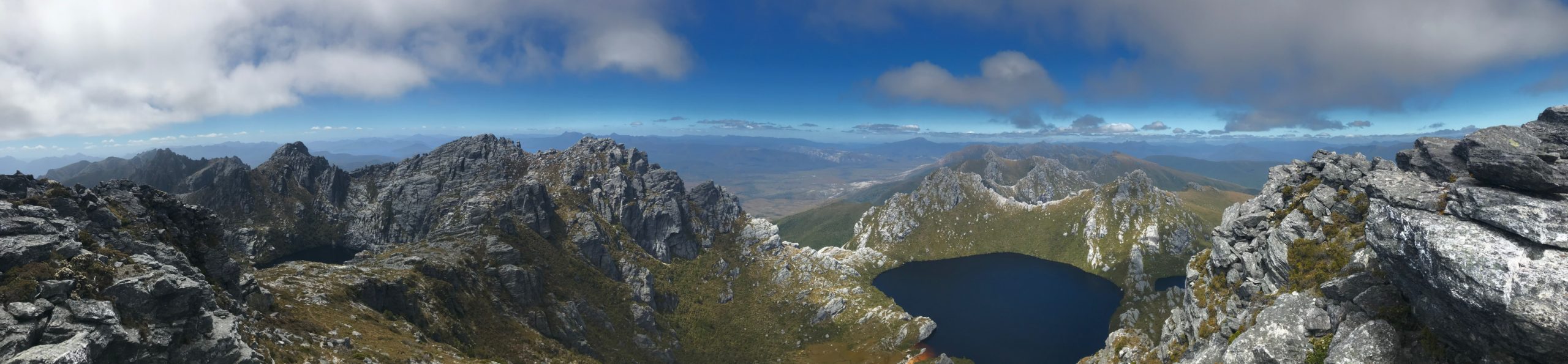
I’ve walked along the track to Junction Creek a few times now, and it’s fine. I think its main problem is that it feels like it’s getting in the way of something so much greater.
The Western Arthurs are just so spectacular it’s hard for the poor track that leads to them to compare.
Yet here I am writing about them for some reason, so lets move on.
The walk in was fine, and before long we were climbing up Alpha Moraine. I’ve been up it once before and it certainly helps knowing what’s coming.
From Junction Creek, it took us 1 hour, 10 minutes to get to the next junction where the Port Davey track peels off and you start up Alpha Moraine. From there it was about another two and a half hours to the top.
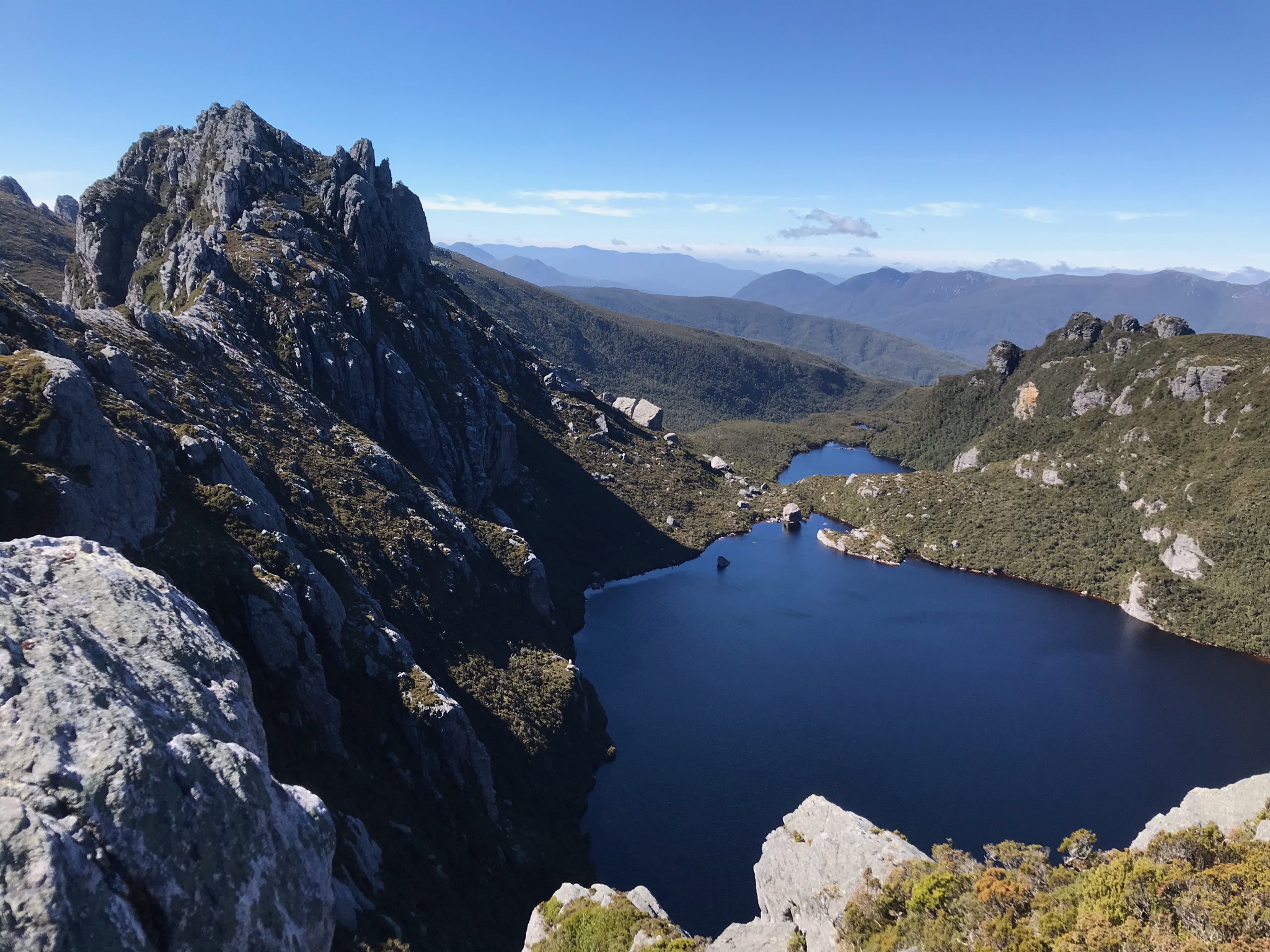
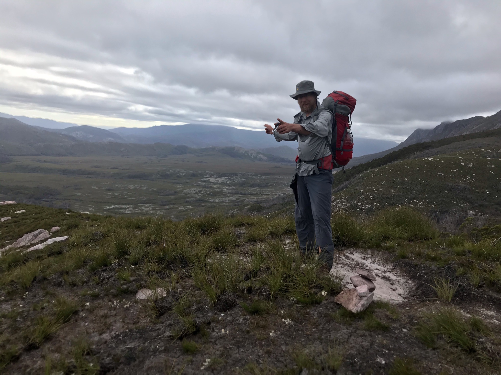
Another hop, skip and a jump and we found ourselves at Lake Cygnus.
A lovely day for it
Now it’s normally just me that writes these blog posts, but I thought Carrington would like to add some recollections too. So everyone, this is Carrington. Carrington, meet everyone:
Carrington’s recollections:
As Will noted, the journey to get even get into Tasmania proved to be a bit of a journey in its own right. The allure of the Western Arthurs was strong enough for me to do the necessary work to make it down.
Will had done his best to make sure I was well aware of the potential difficulties in doing the hike. I would in no way claim to be an expert hiker. I’ve done a few multi day walks including the Overland Track, Tiger Leaping Gorge in southern China and Macchu Pichu in Peru but I knew this would be much tougher ask.
I’d given myself a significant amount of time in Tassie. I’d pencilled out three weeks in total (I’d lived in Tassie in 2019 so was fortunate to have a few people who seemed ok with hosting me when I wasn’t walking).
We knew the tracks relative difficult (and our enjoyment in doing it) would likely be highly correlated with the weather. The hope was, Will would spot a kind forecast and we’d set out then. Boy, did we ever.
I arrived in Tassie and was able to scrounge together a great set of kit from a few different friends. The only missing piece was a high quality, super warm sleeping bag. I ended up renting one and it’s worth the investment. We had fantastic conditions and I was still super thankful for the warmth of the sleeping bag. You don’t want to skimping on your sleeping bag.
As Will has noted, the walk from the car park in Alpha Moraine is definitely not one of the highlights of the trip. I mean, it’s fine.
Being in nature is normally pretty good, but it’s not what you’d describe as spectacular. In saying that, I love the excitement of starting off on a big hike. Getting away from the confines of normality and setting off on an adventure into the unknown. Untethered from technology. Excited to talk to my friend about a broad range of topics (there’s much less chatting on the way out. Friendship remains firmly intact but when you’re trudging out, you want to save your oxygen for the march).
Hitting Alpha Moraine is when you know this is a serious walk. It’s the first serious climb.
I was in pretty good fitness going into the walk though I hadn’t done any long walks for a while. At this point I wished I’d done some more mountain climbs recently to put some extra work into those specific leg and hip muscles that only seem to get activated by this activity.
Alpha Moraine will test many, but it’s nothing on what comes on later. There will be a heaps of false peaks to both excite and then disappoint you. When we ascended there was still a bit of cloud cover hiding the peaks (this was basically as close as we got to bad weather the entire time).
It gradually lifted as climbed and we had basically uninterrupted views of the valley below. One of the great joys of the Western Arthurs (as would become apparent through the rest of the trip) is that each peak ascent seemed to bring a new and spectacular vista. Alpha Moraine is the first taste of that.
The descent into Cygnus was gorgeous – although again just a taste of what is to come.
Carrington’s thoughts - day 1
Day 2 (Jan 7): Cygnus to Oberon (with fun side trips!)
Day's quick notes:

Distance: 6km (not including side trips - I didn't take the GPS!)
I’m known for my love of starting early.
After all, an early start means an early finish (sometimes) and I think it just feels good to get things done early.
At least I used to think that. We started day 2 around 9:45am and it was glorious. Time to have a nice sleep in, time to spend making a good coffee, time to take time.
Does it mean I’ll convert to starting late from now on? Hell no. But it was nice.
We set off at started the short walk to Oberon.
In my opinion, this is a really nice part of the track. It’s easy walking, but the view just changes every time you pop up over a new ridge.
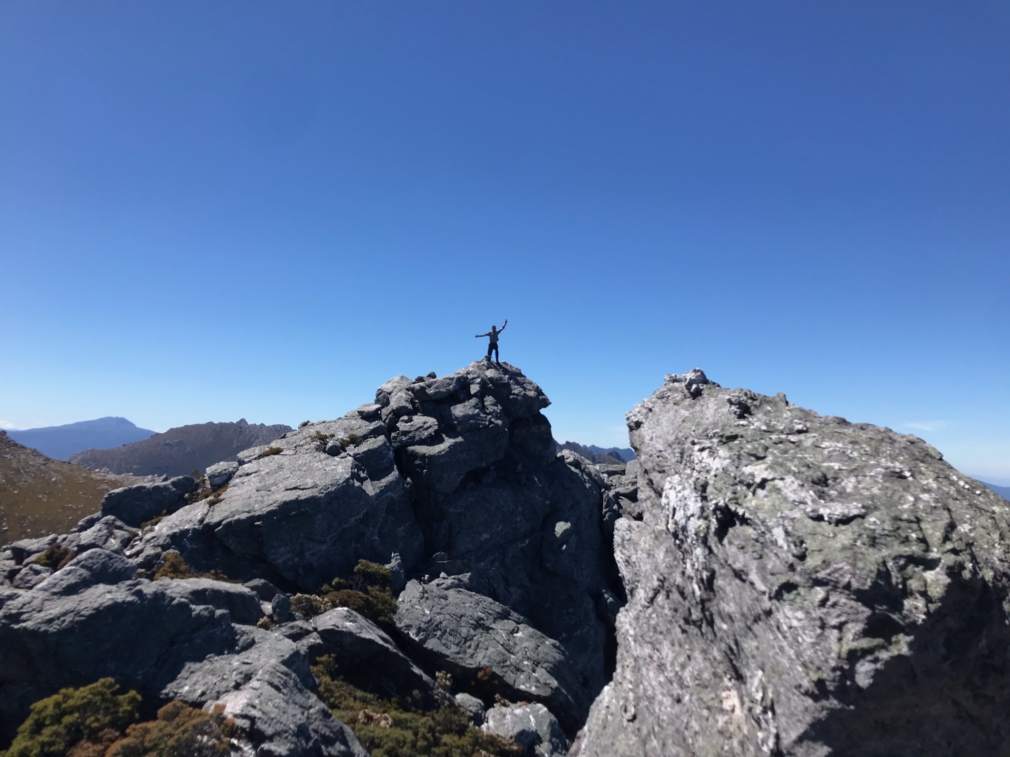
Wasn’t too long before we got to the junction for Mount Hayes. A bloke the day before had told us that it was hard to find ones way up Hayes, but we just followed the piles of rocks.
Three years ago I wrote that Hayes was “on the list for next time”, and indeed it was. Before long we were at the top.
Don’t have a picture because I forgot to take one.
Doesn’t matter. Hayes isn’t bad. The views are great. But the real highlight of the day was Mount Sirius.
Last time, I’d climbed Orion. Of the two, Sirius is the clear winner.
The views down to Oberon and along the range are just phenomenal.
We stayed up on Sirius for quite a while, just soaking in the view (and also the sun).
All up, the detour took us more than an hour, and we could have stayed longer.
But it was getting on (well, in my mind it was. In reality it was 3:30pm) so we made the trek down Sirius and over to the start of the decline into Oberon.
Time to head back down, and around, and down to Oberon
This was as far as I’d been on my previous trip.
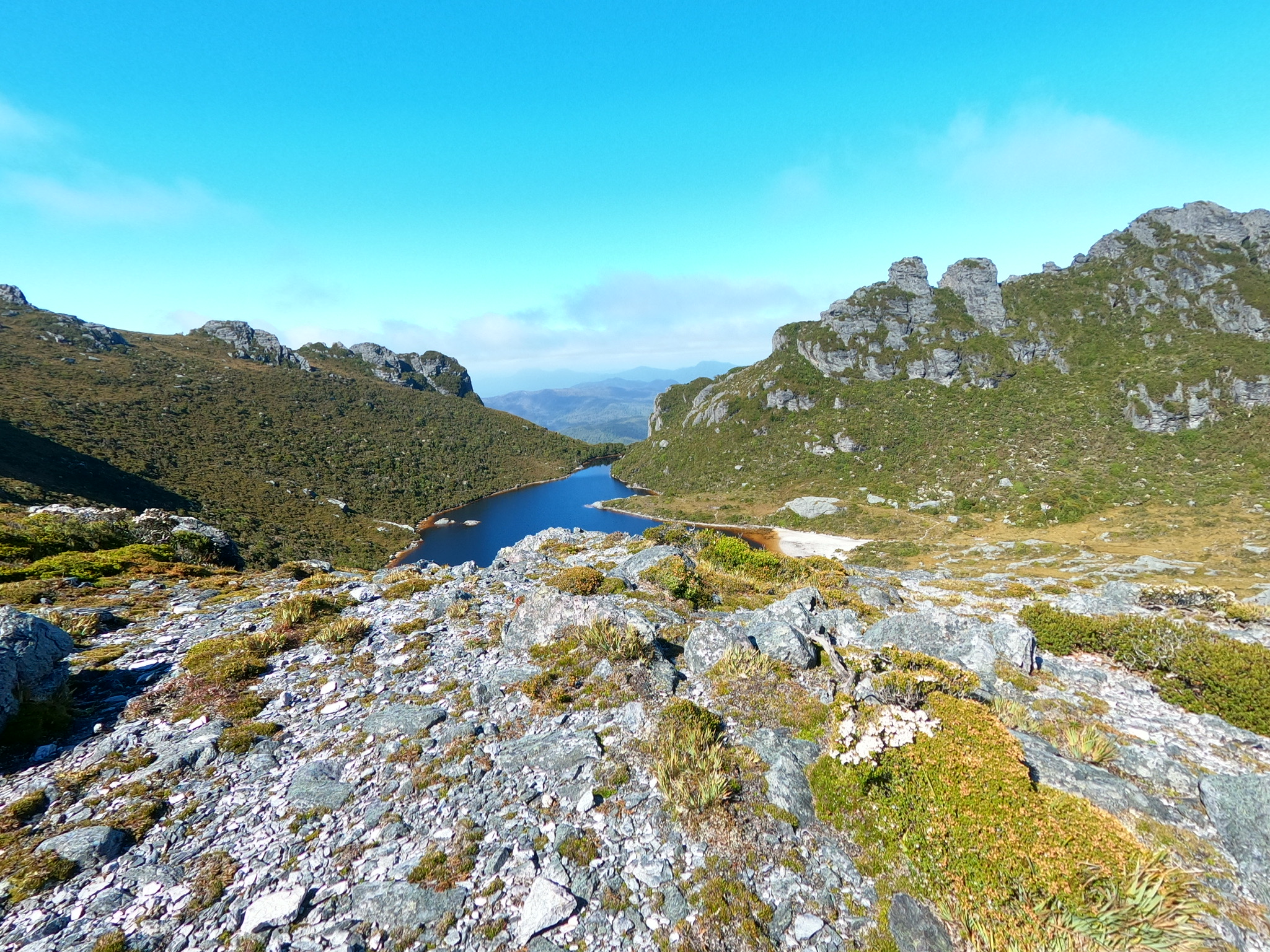
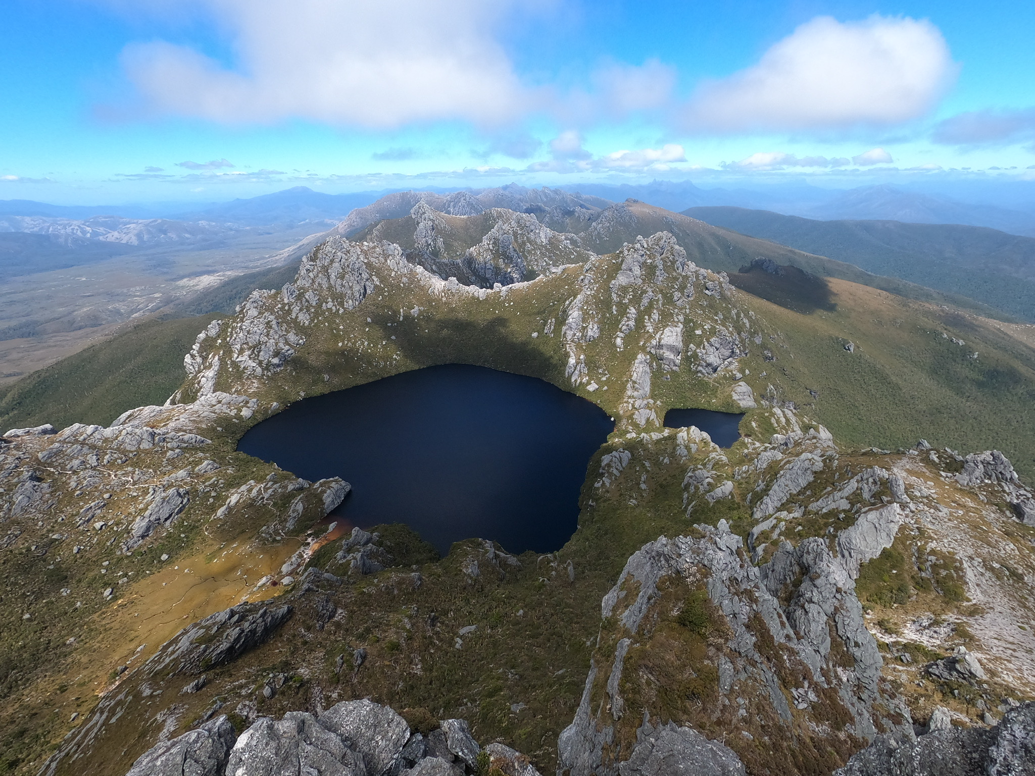
We scampered down from Sirius, then dropped down into Oberon. We had a pick of camping platforms (they filled up later that night), and the late afternoon/evening was stunning.
We went for a swim!
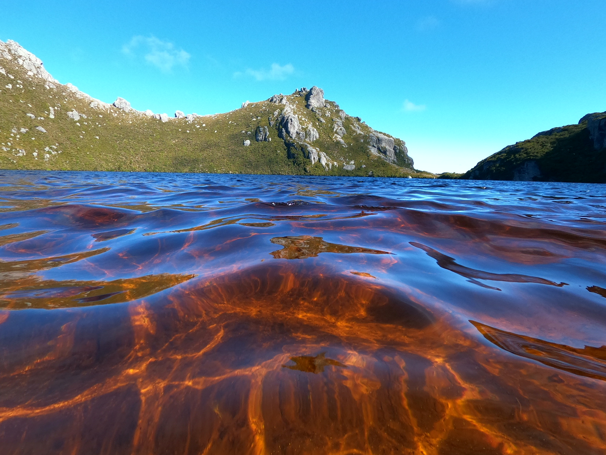
The cool waters of Lake Oberon
Oberon really is a magical place.
Day 3 (Jan 8): Oberon to High Moor. The packs come off and the rope comes out.
Day's quick notes:

Distance: 7km (not including side trips - I didn't take the GPS!)
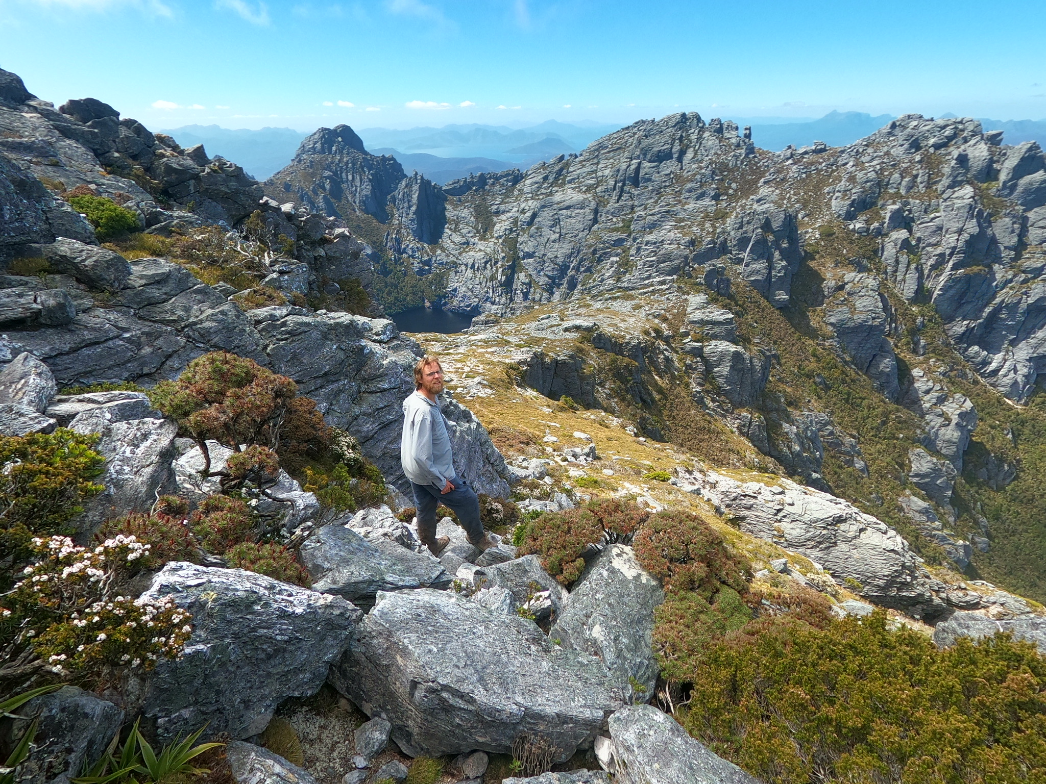
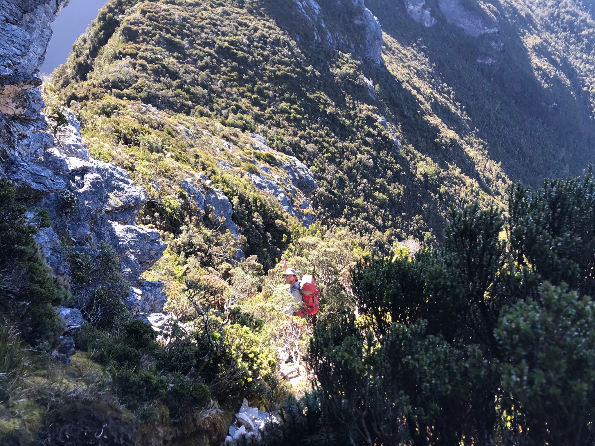
Past Oberon is where the track gets a bit less refined and the obstacles get slightly tougher.
Climbing out of Oberon, you’re greeted with a lovely little wander around a few rock forms before coming to a small cliff requiring a scramble.
I’m sure many people can just rocket up the very small cliff thing, but this was the first of many pack hauls for us.
I’d recently learnt to tie a bowline after all these years of not knowing, and before long we were up and at our next obstacle of threading our way up a small hole through boulders.
Easily cleared, we found ourselves at the next side trip for the trip.
Mount Pegasus.
Wasn’t a bad little trip up and had a nice view from the top (which ones don’t?) - but as choices go along the range wasn’t the highlight.
Which raises an interesting point. What makes a peak a “highlight”? Is it the view? The effort in getting there? The weather or company? Or a mix of all of the above?
Sirius from the day before was definitely a highlight. But like most of the peaks along the Western Arthurs it was easy to get to (once you were there). It had a great view over Oberon as we peered down the lake hundreds of meters below. It’s also a bit bigger than the others around it so you can see it for longer. It acts as a marker of how far you’ve got to go and then how far you’ve come.
And Aldebaran was a highlight too in my mind (coming up later), but I think that was less about the view from the top (while lovely), and more about the interesting trip up from Haven Lake.
Don’t get me wrong. It’s not that I hate some peaks, it’s just I like some more than others. I suppose beyond a certain point it’s all somewhere on a continuum from “yeah this is nice” to “I love this peak for some unknowable reason”. Anyway, I digress.
Anyway the peak was nice. We got a few pictures (of other peaks) and headed back to our bags.
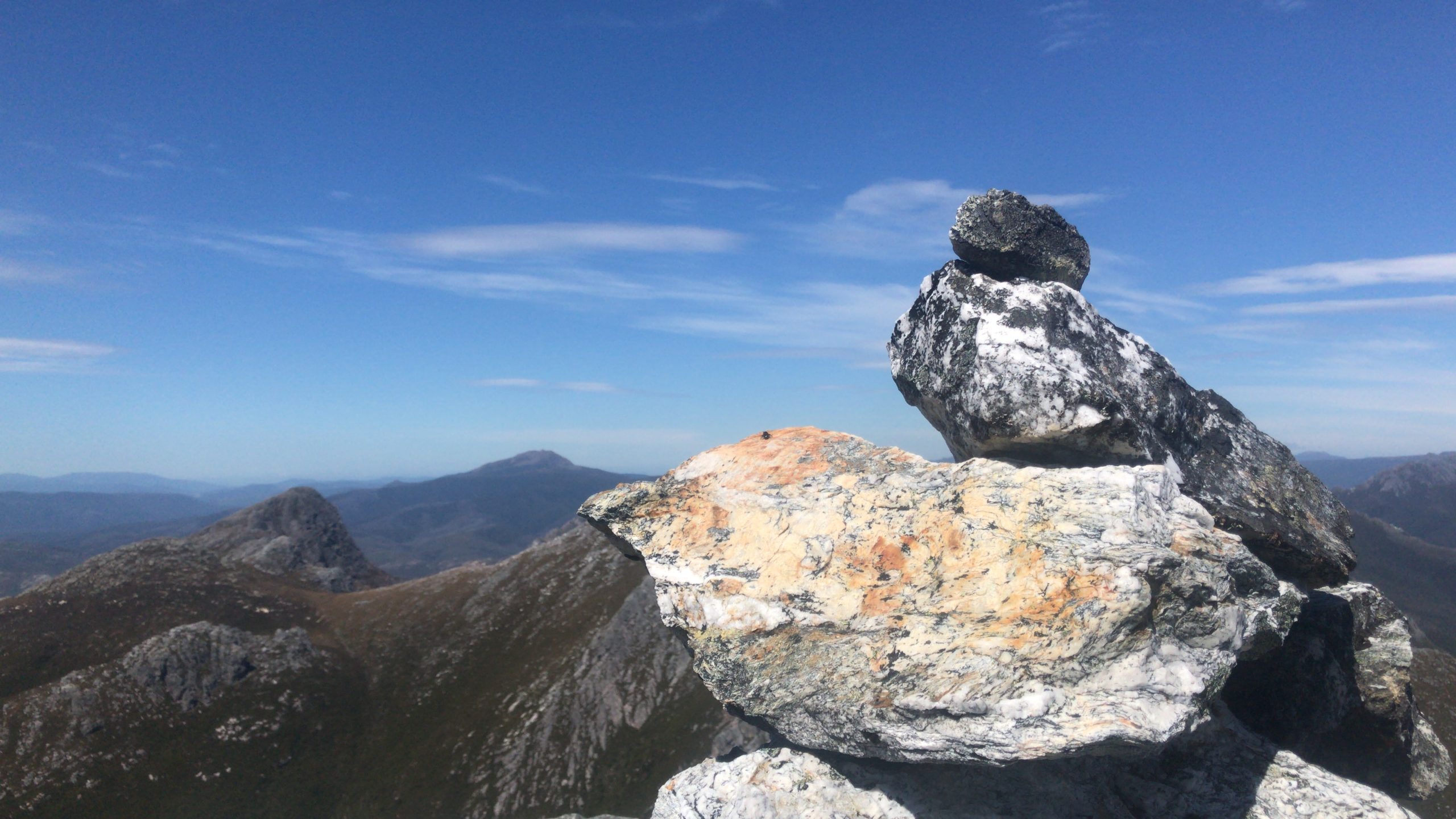
Sooner or later we were up Mount Capricorn…
Yes yes you’re on top of a mountain very clever
… and headed down some steep af slopes, finding ourselves in a nice little rest area just below the towering mountain we’d just come down.
It’s an area of the track that is pretty eroded as hundreds of hikers - including us - go up and down it.
From our resting spot it’s not too far to High Moor, through some relatively thick scrub. We didn’t make the side trip to Dorado - but I would next time. Just to see where I’d place it on the peak continuum.
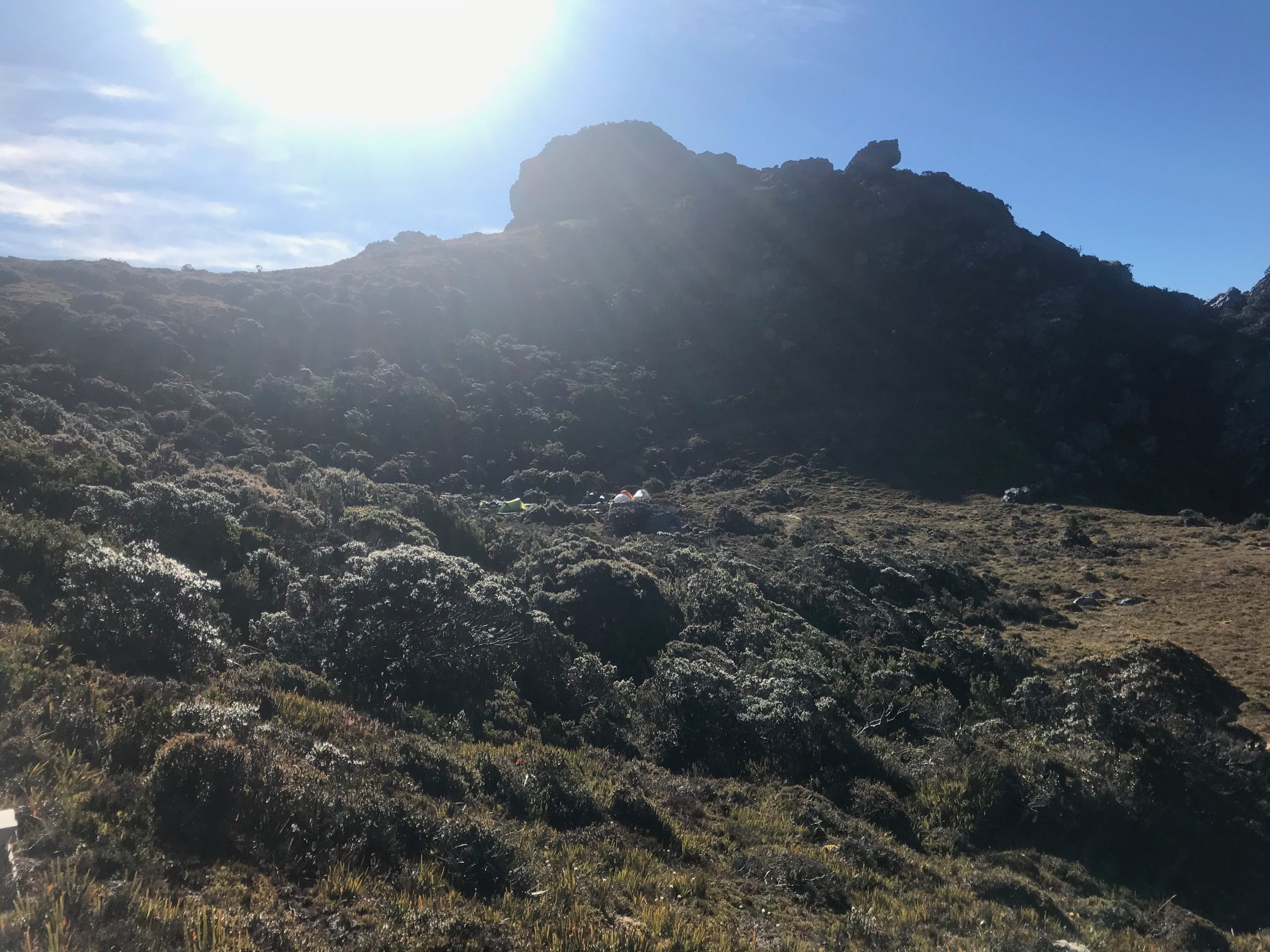
Before long we’d squeezed our tents onto the platform (we were first to arrive but knew it was going to be a tight night with several groups behind us) and started up Mount Columba.
Looking north, there was another hill thing. So we walked back up it too and got a great view of where’d we’d come that day.
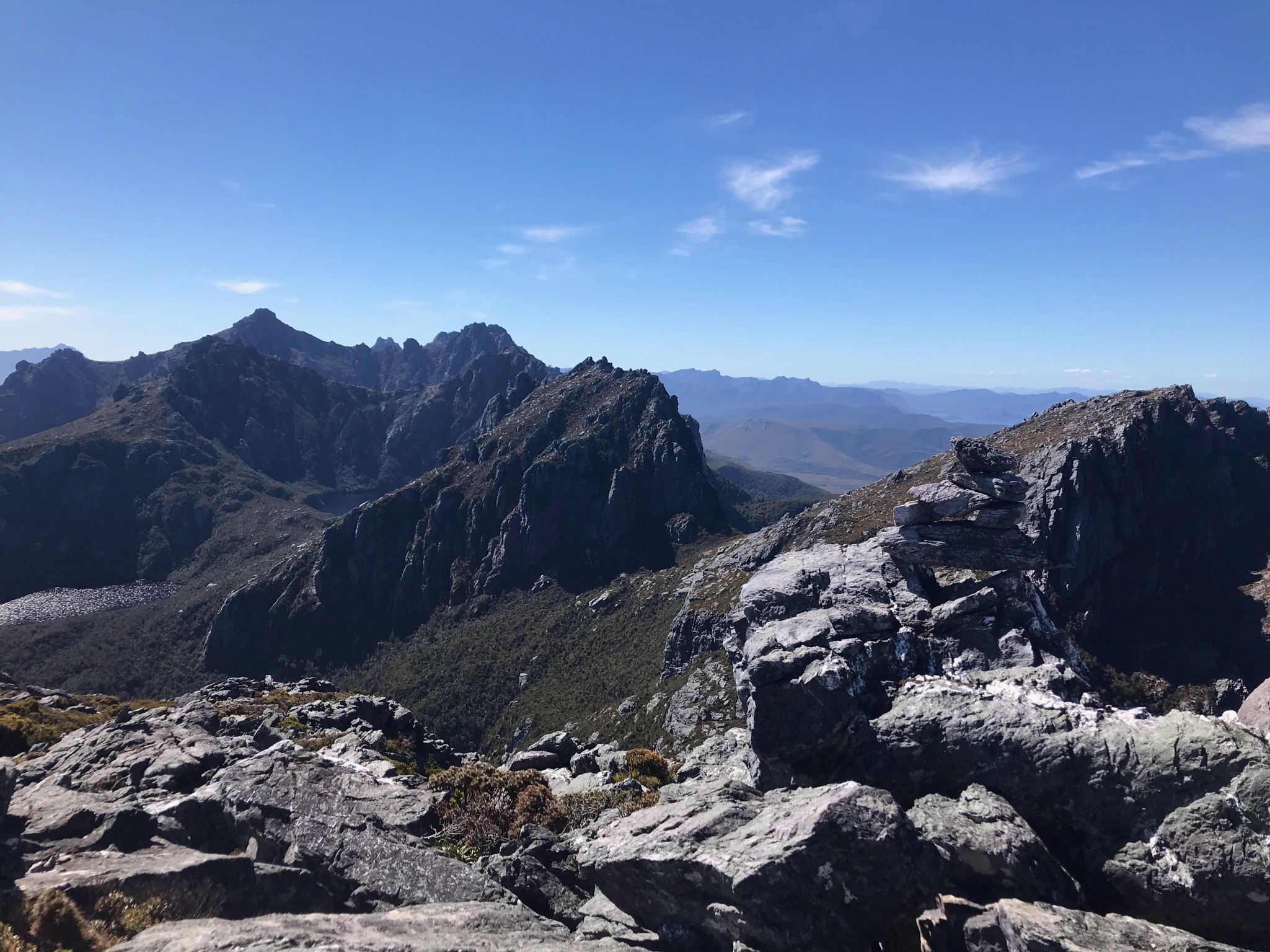
Looking back towards Capricorn (in the middle) and Dorado Peak (off to the right).
High Moor is the only campsite that’s not next to a lake so water can be an issue. It was pretty dry when we were there but we still could scoop some up from the very small little trickle near the platforms.
The night was … restless. With such a tight squeeze, it was like sleeping in a hostel dorm room.
Day 4 (Jan 9): High Moor to Haven Lake (and a side trip up Aldebaran)
Day's quick notes:

Distance: 9km  including side trips - I did take the GPS up Aldebaran!)
I woke up spinning.
As I turned over sometime in the early hours of the morning, I felt like I was falling off the earth.
A bizarre feeling of dizziness that I can’t remember happening before.
“Oh uh,” I thought.
The dizziness persisted through breakfast and coffee. It persisted while I packed up - staggering about with the lightest of heads. And it persisted through much of the day, though it did get slightly better, or I just got used to it.
A bit of a bugger really, considering some of the near vertical drops we’d have to negotiate.
High Moor to Haven Lake requires walking the Beggary Bumps - a series of big hills which one must go over, or around. It’s quite scrubby - when compared to other parts of the walk and when you’re down in the bush it can get quite warm.
Water is a bit limited too, so have a big drink before you leave.
It’s also a bit more technical - lots of things to climb over and roots to avoid. But all in all, fun walking. Even with a spinning head - which had improved slightly since breakfast.
Wasn’t long before we were walking up the big spine to the top of Mount Taurus - a mountain with two peaks that stick out like the horns on a bull.
Given the astronomical naming scheme that is heavily used along the Arthurs (pity they stick with Arthur Ranges), I presume that’s what they were going for.
It was back in 1967 when it was officially named Taurus (a far better name than its previous name of Peak 24).
Meeting 121: PRESS STATEMENT. Members agreed that the astronomical nature of the Western Arthur’s names, was of particular interest, and warranted a press statement.
Gazetted as TAURUS, MOUNT 1967 Jun 21.
- Placenames Tasmania database entry
After Taurus, you go down and down - and there’s a few unexpected cliffs to climb down. We pack hauled the packs again, before maneuvering down a crevice.
Then it’s a hop, skip and a jump down to Haven Lake.
Now I’ve heard that Haven Lake isn’t much of a Haven, but it was the day we were there. Fresh from a sticky walk, it was mere minutes before we were in the lake going for a very lovely swim.
But it wasn’t the end of the day. Alderbaran called.
A mountain of 1107 meters, Alderbaran takes about 2-3 hours return up a fairly simple to navigate rock/low-scrub ridge.
The peak brings lovely views of where we’d come from, and Lake Mars down to the east.
This is one of the six or so pictures I took the whole trip…. I’m getting a better camera. I need to improve.
After half an hour it was time to head back for dinner. I went to bed and the spinning started again, which was annoying.
Tomorrow was also going to be a big day. We’d decided to haul out to the car park in a day and I knew there was a long way to walk.
Day 5 (Jan 10): Haven Lake to car park
Day's quick notes:

Distance: 25km
We didn’t know if we could get to the car park in a day, but we were going to try.
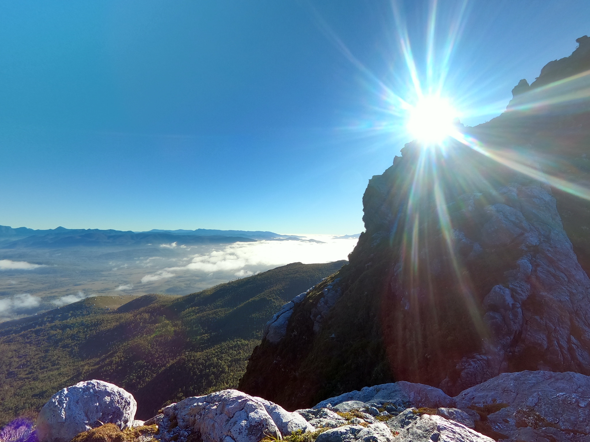
I woke again spinning, a real shitter. But nothing I could do but keep the head down and trudge along.
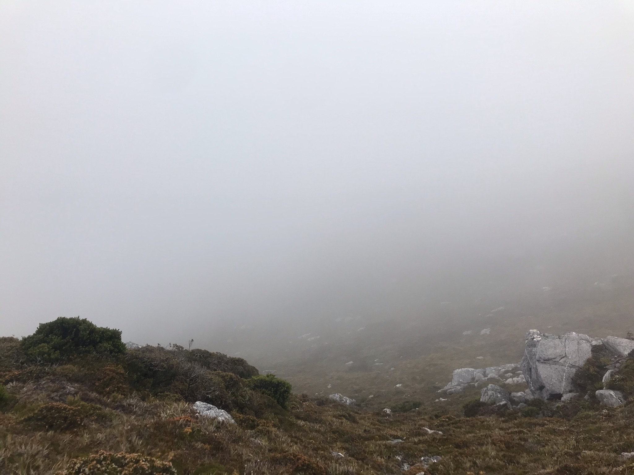
The weather in the morning had also turned slightly, and we had a little bit of cloud that obscured the view. It was the first cloud we’d had the whole trip, so can’t complain.
Before long we were at Lake Sirona, and a little after that at Scorpio.
We forgot to go to the top of Scorpio, even though we passed just meters from the summit. Never mind, one to visit another day.
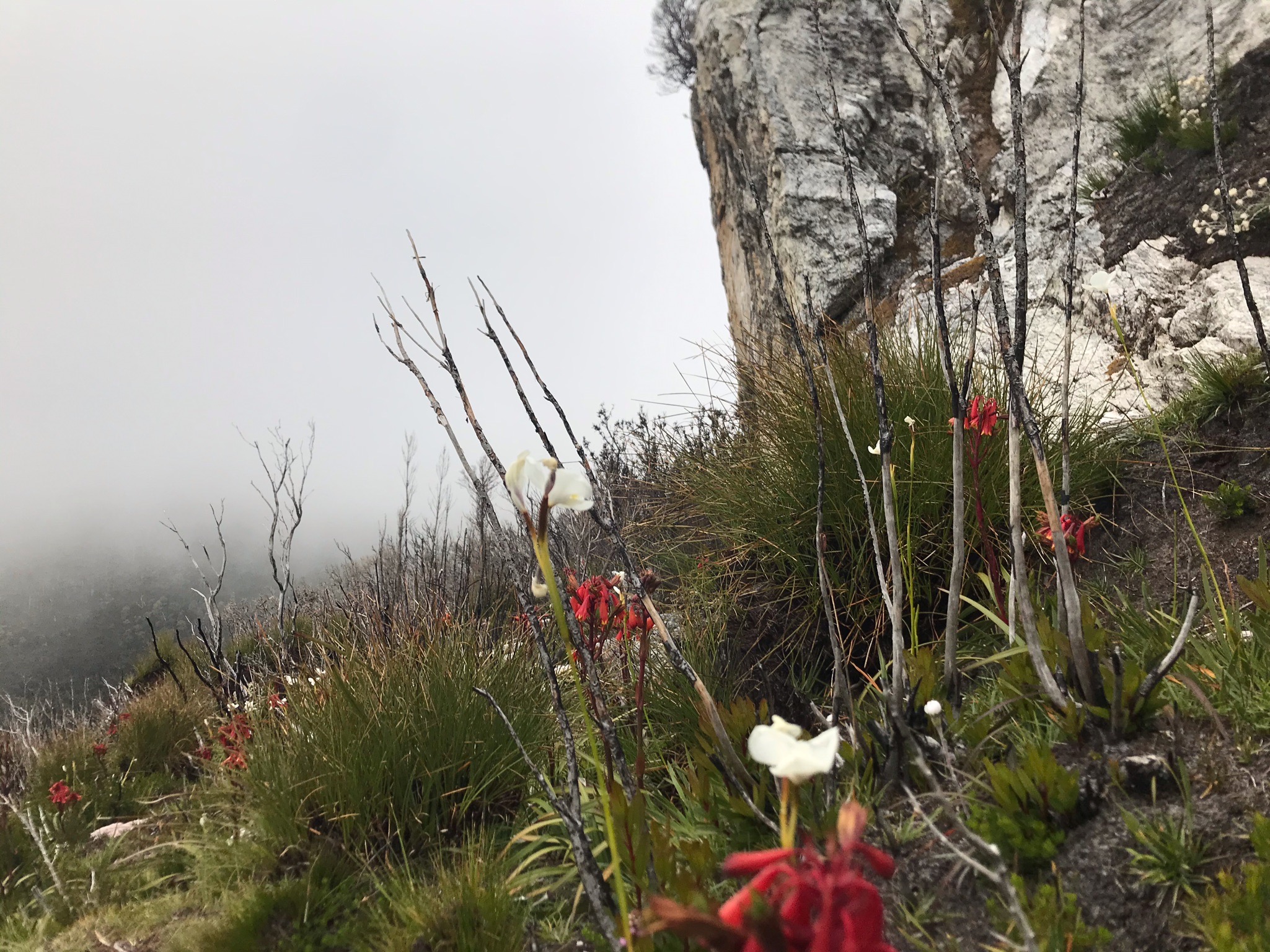
Coming off Scorpio, we started to see the results of the horrible fires a few years back.
Some vegetation has slowly started to return, but it’s going to be a long recovery.
We were keen to tryout the shortcut we’d heard about, which seems to be becoming “The Way” now. You can see a pretty large pad from up high, and it’s quite obvious which way to go.
It shaves off a few hours though, and with fire (I think) burning out what used to be much heavier scrub it’s very easy walking.
The turnoff is right where I thought it would be
There’s not really much else to say from here.
We crossed over Seven Mile Creek and hightailed it to Junction Creek.
From there, we trudged out in the rapidly warming day ending up at the car park just before 4pm.
It was a long day (about 9 hours, 30 mins all up) but we’d made it out.
What an awesome trip. We’d been so lucky with the weather. So lucky with having relatively few people about and so lucky to have such good company.
It’s a walk I’ve long wanted to do, and finally it’s done! And now I can’t wait to get back again.
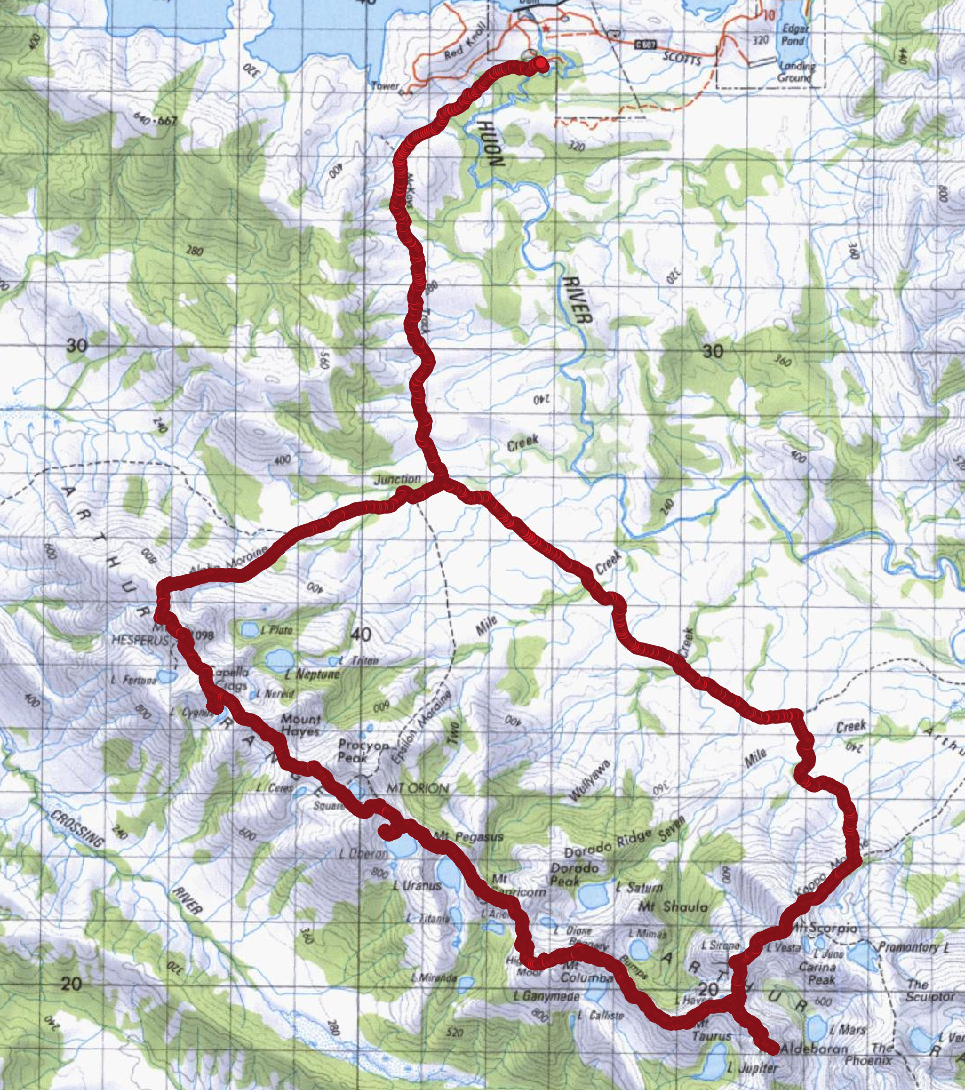
Walk map: