This walk happened a few years ago, but I’m only getting around to writing it up now in 2025. Memory is a bit fuzzy, but some things stick. I was in the area for running and decided to use the opportunity for a quick out-and-back the day before. The weather wasn’t great—mostly grey skies—but I figured a short adventure was better than none.
I started around 10am, thinking it would be a quick wander, but it ended up taking a bit longer than expected. I was back around 5ish.
Curvier Valley Track
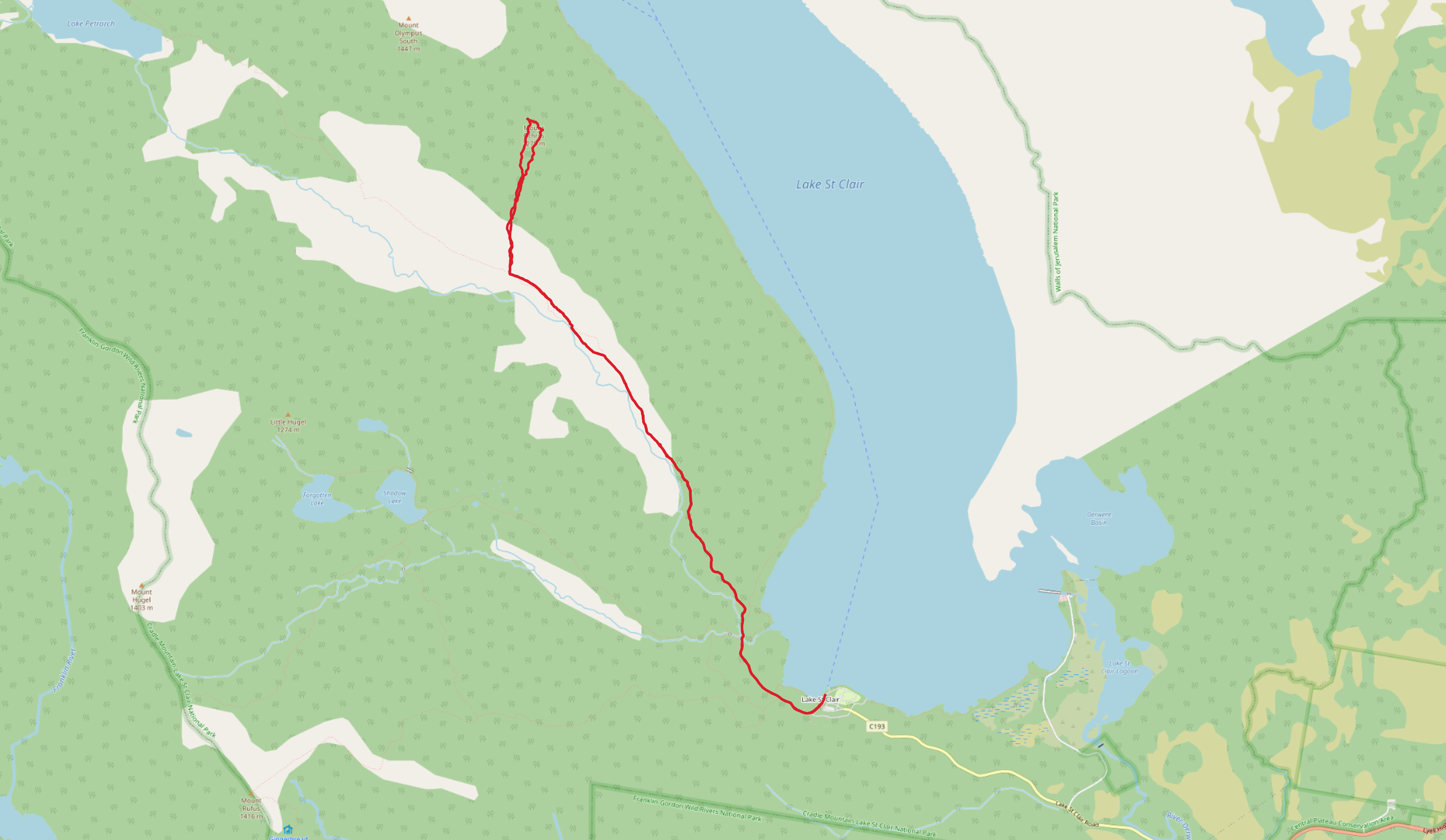
For the first time, I walked down the Curvier Valley Track.
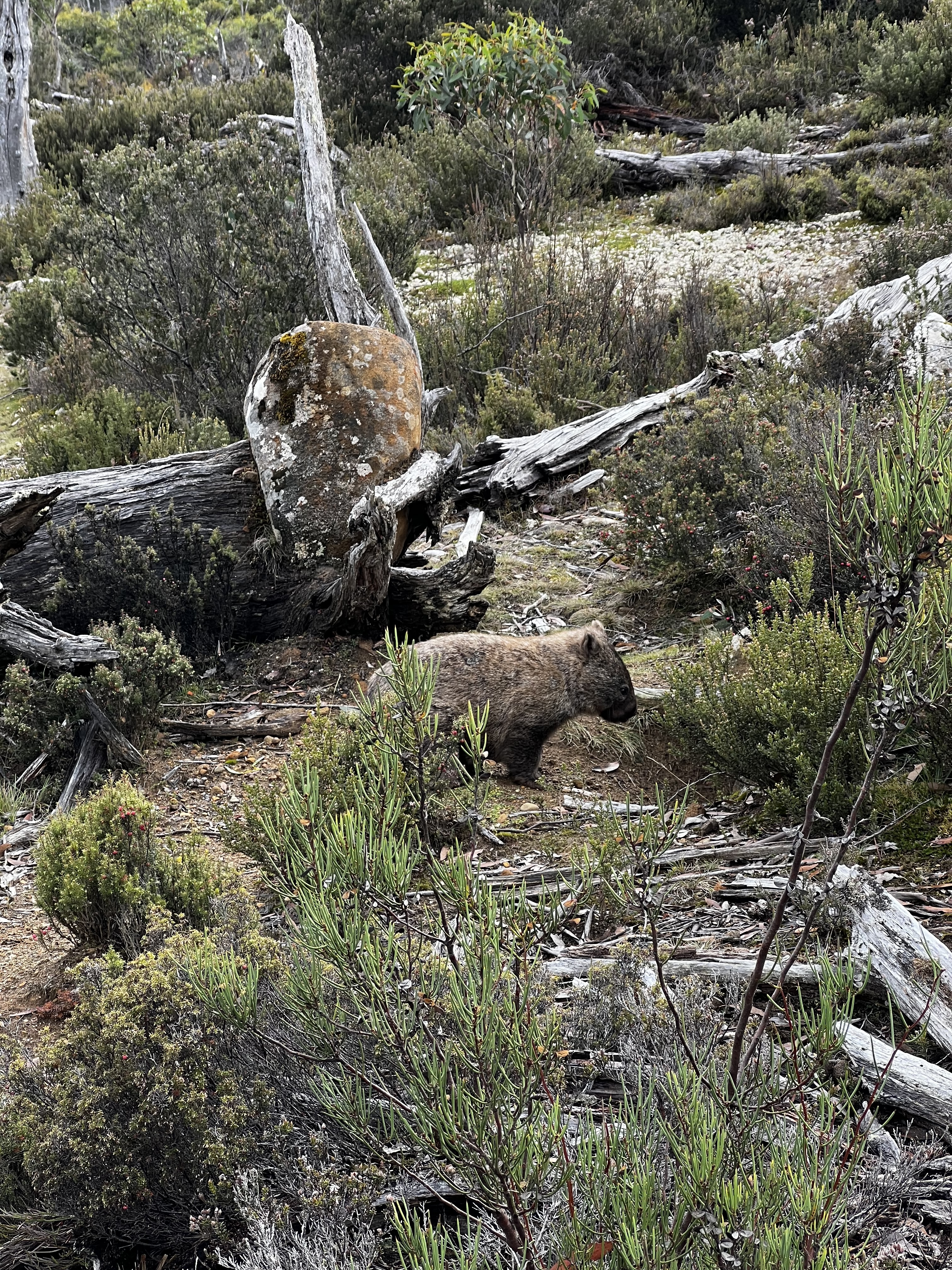
It’s a lovely section, following the Curvier River with plenty of wildlife to watch along the way. There’s something quietly satisfying about rivers on overcast days: the soft light, the sound of water over rocks, the occasional movement of a bird or wallaby or wombat.
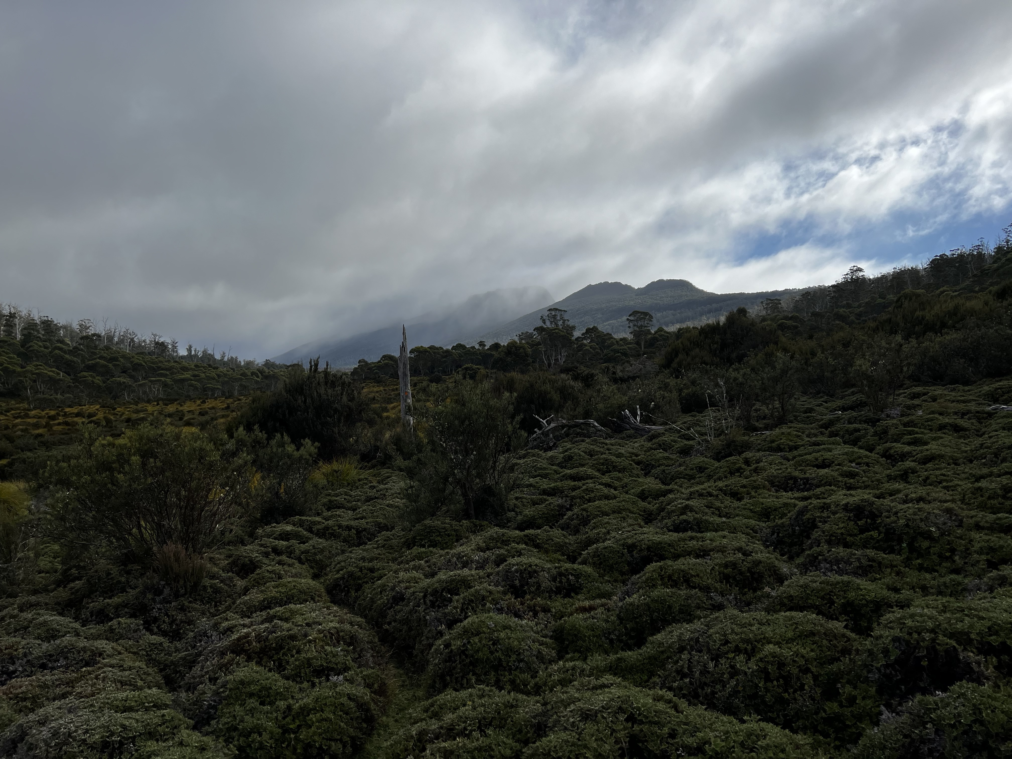
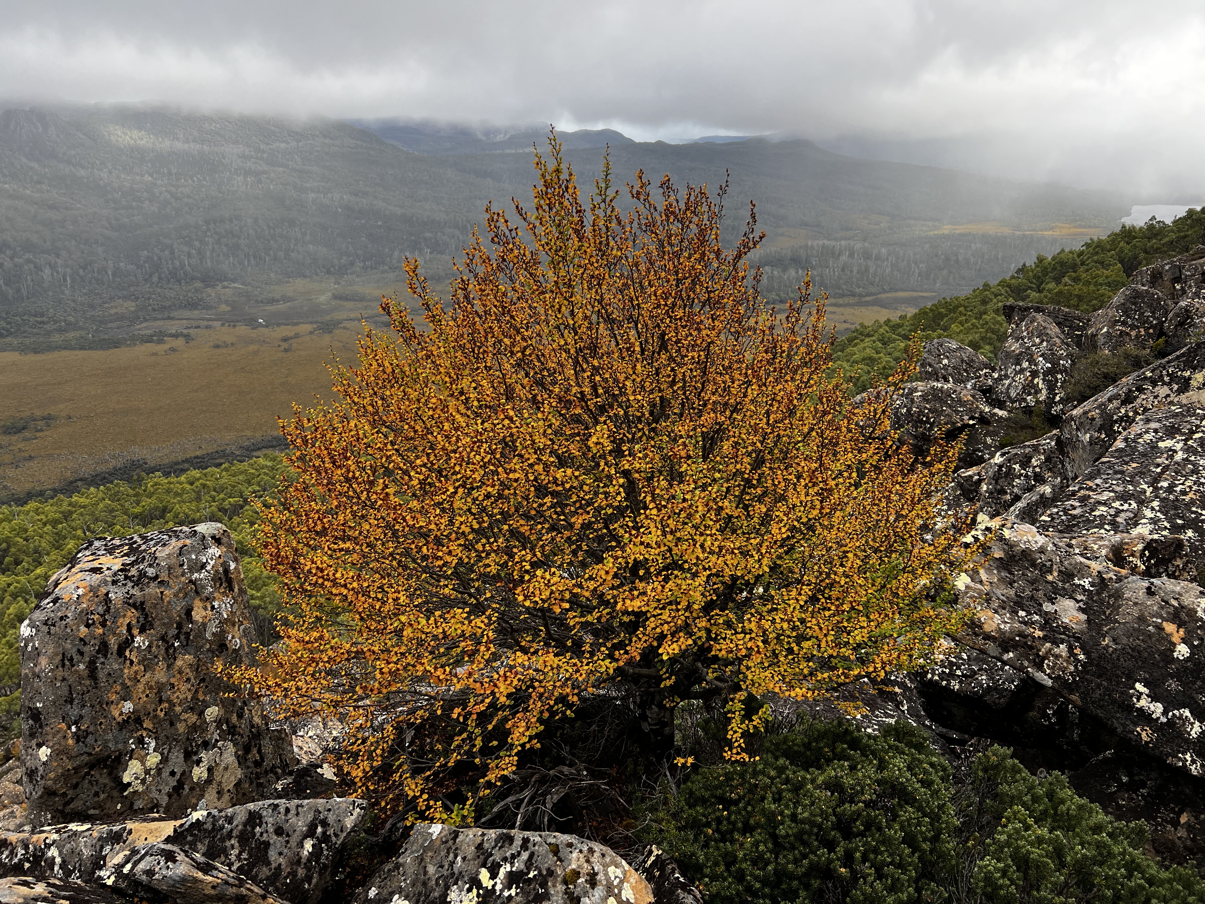
After an hour and a half, I turned right to cross the plains and begin the ascent toward Mount Othrys. The slopes were starting to hint at autumn: the fagus were just beginning to turn, which was lovely to see. I came across an amazing bush on the way up and stopped for a while just to sit and take it all in.
The Climb
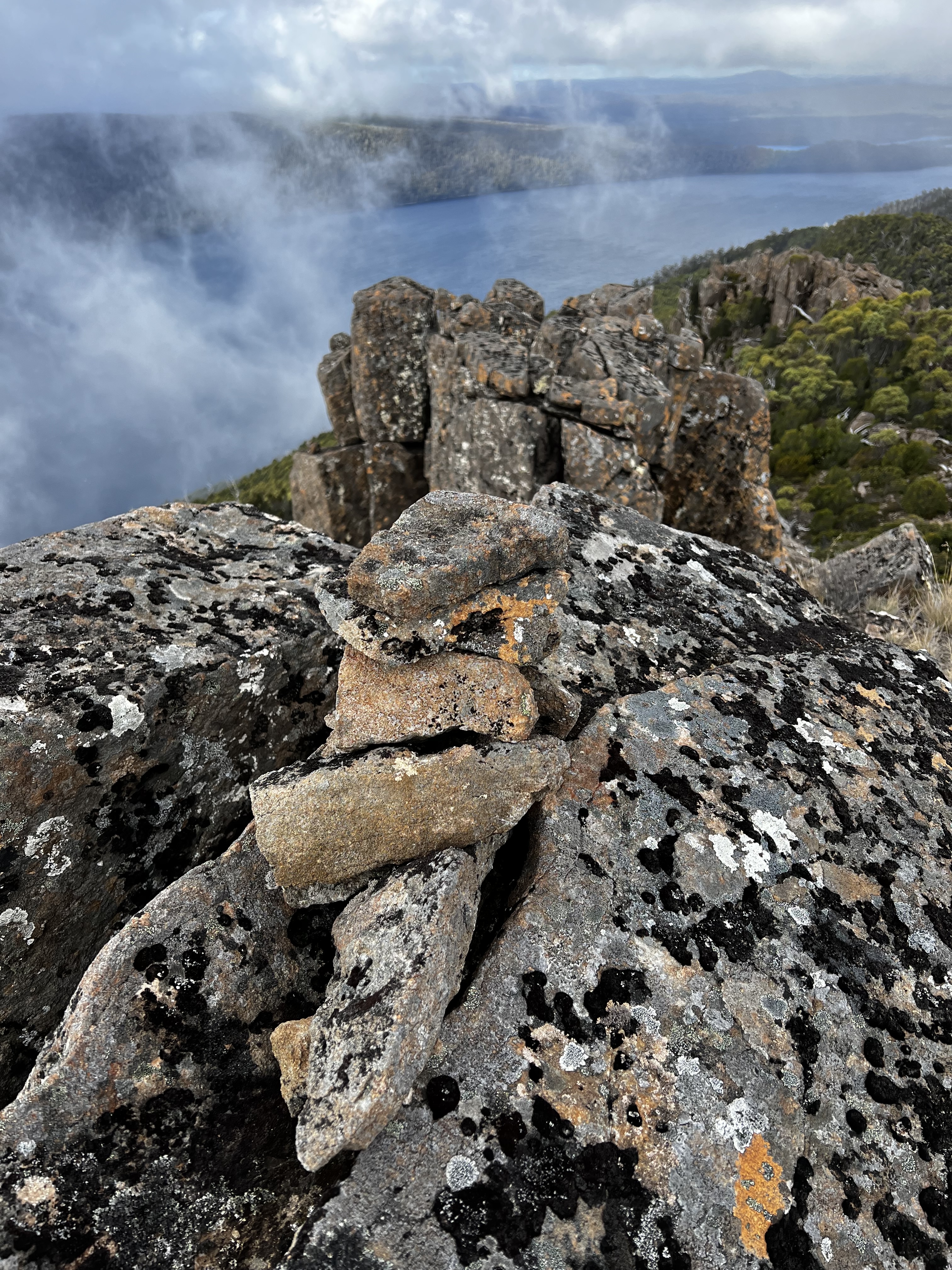
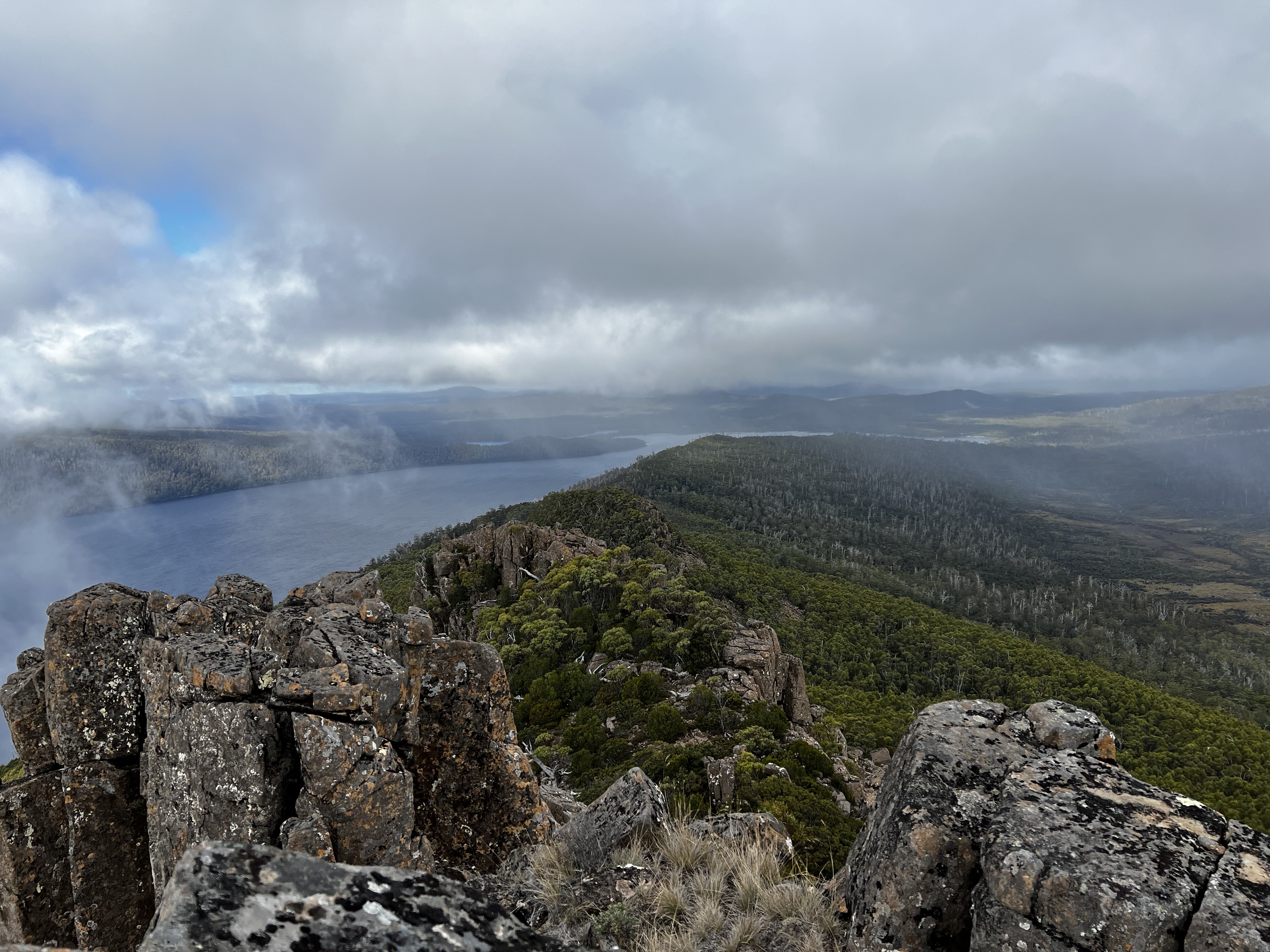
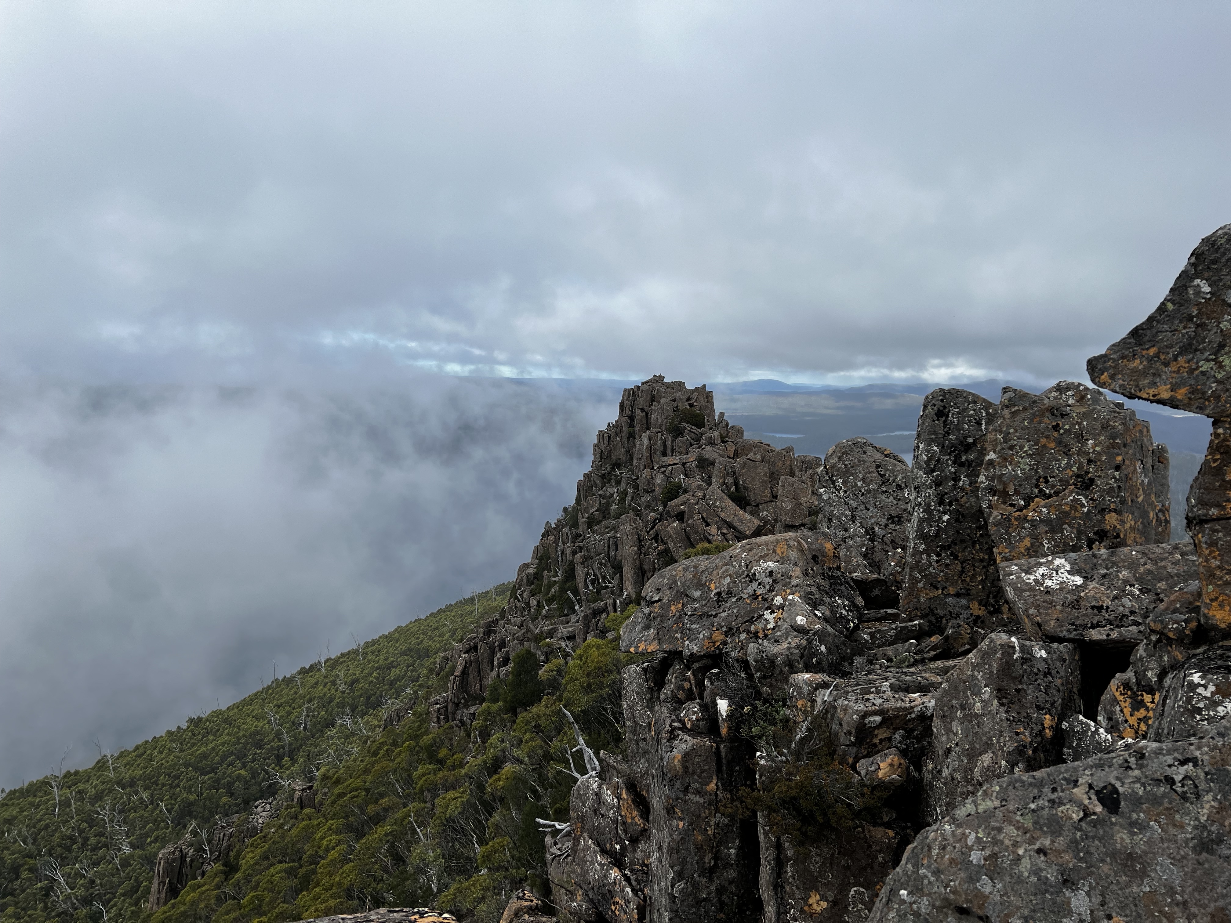
The ground became a bit rougher in places, and eventually I scrambled upward. The climb wasn’t straightforward, but it was rewarding. I wasn’t sure which of the summits was the true peak, so I made a point of visiting both. From the top, Lake St Clair stretched out below. Clouds hung low, but there was still plenty to see, and it was worth every step.
Heading Back
Scrambling back down was straightforward enough, and I made my way back to the start along the same route. It was a long day, especially for what had started as a quick trip, but the chance to be out in that part of Tasmania—even under grey skies—was a treat.
Mount Othrys might not be as famous as some of the surrounding peaks, but it’s a beautiful spot with a lot to offer, even on a less-than-perfect day.
Trip map1