We woke to rain… well, not specifically rain but it was certainly threatening it.
It was misty and wet.
We’d camped at the Vale of Belvoir near Lake Lea and while it was a nice spot, it was a bit … leechy.
So we quickly packed up and headed back to the Cradle area - we needed to get into the park before 8am so we could drive down to Waldheim.
From here I could walk out to Brewery Knob, and then loop back around to see Mount Kate.
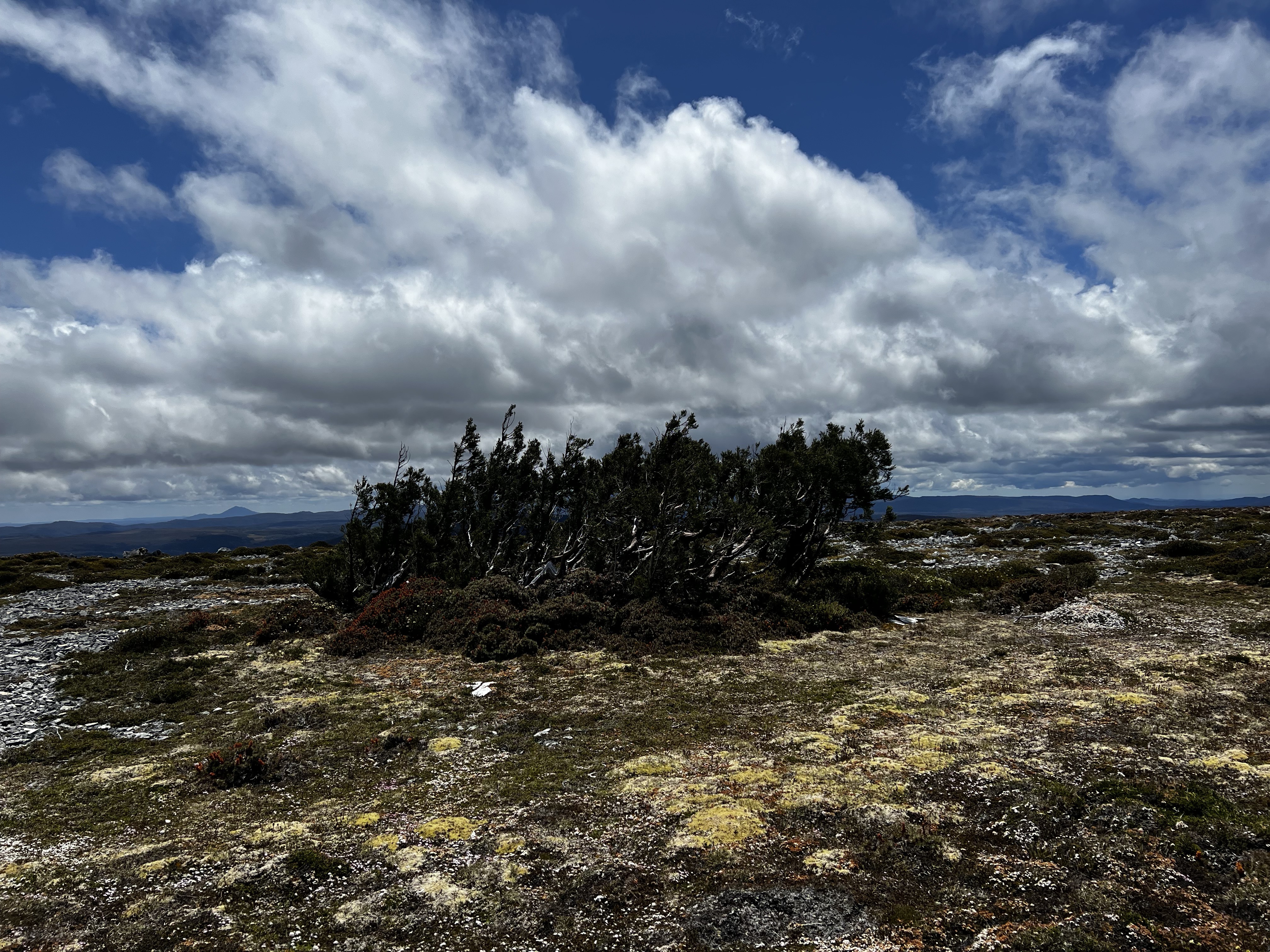
Brewery Knob
I wasn’t really sure how long it’d take me to walk out of Brewery Knob, so gave myself four hours return.
Turned out it was done a bit quicker that that.
I started the trek to Brewery from near the Waldheim huts near the end of Connells Avenue.
I started by taking the Hounslow Health Track, firstly walking up the hill then along the top of the plateau.
It was a really nice walk through Weindorfers Forest as I skipped over tree routes and tried my best to avoid getting my feet wet.
But the forest was wet, and it wasn’t long before I too had soaking trousers and thus soaking wet socks. Ah well.
Sadly, most of the views from the plateau were obscured by fog - but it was still a nice walk. Easy going and pleasant.
Eventually, I turned off the Hounslow Health Track and headed up towards Brewery. It was still foggy, so I couldn’t see anything.
At the top, I headed towards the small knob that was the peak.
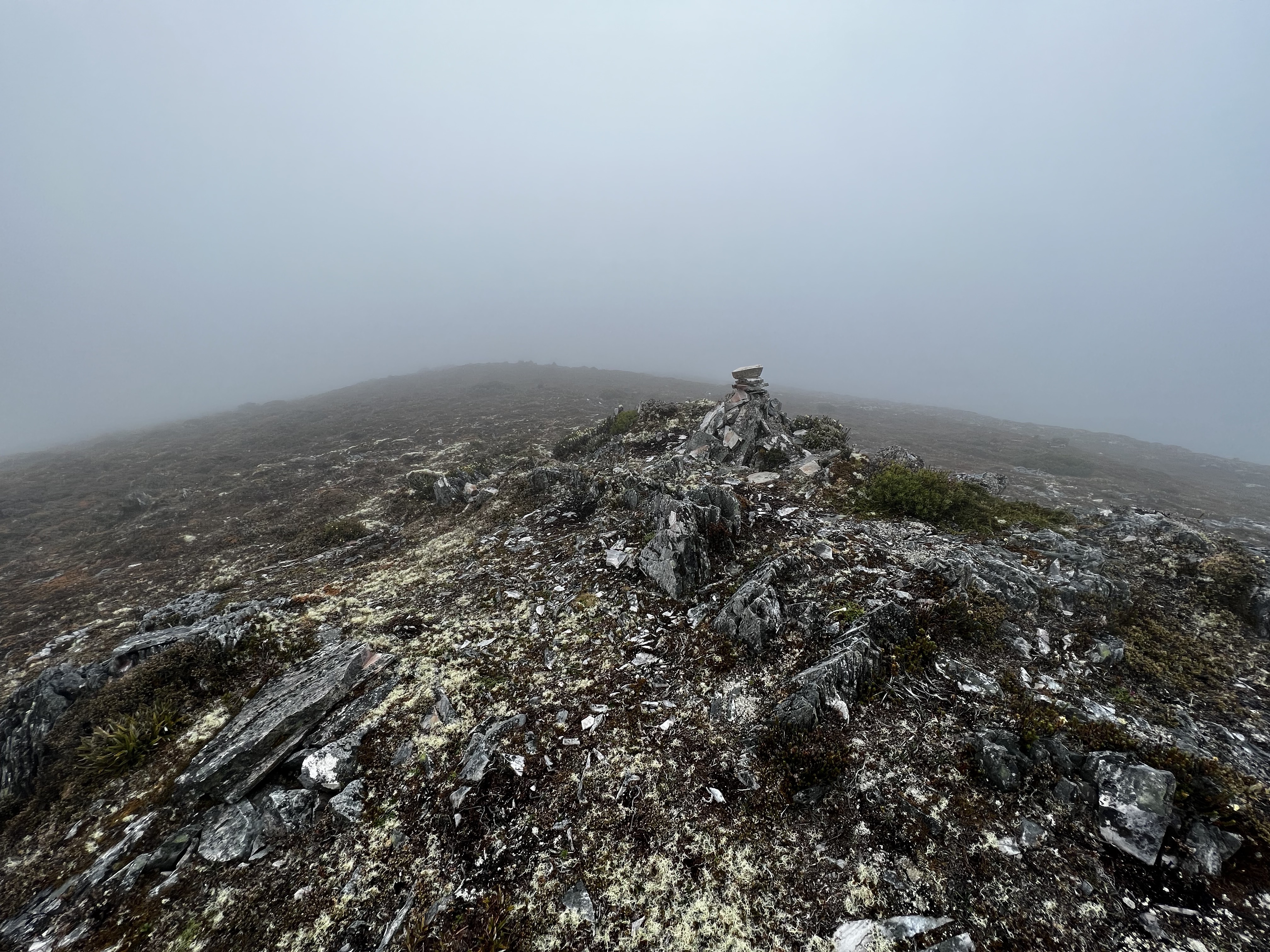
Again, I visited a few of the other tall looking knobs in the area, just to be sure - and began the walk back to Waldheim.
But this time I took the Maryland Track back - it loses elevation quickly then meanders down the Cradle Vally back to the start of the Overland at Ronny Creek.
All in all, it took me about an hour to get to the peak. Much quicker than the two I’d given myself. I got back to the carpark in 55 minutes.
And when I got back, it was straight across the road to go pay a visit to Mount Kate.
So many more mountains!
Find all the walks from that series here
Mount Kate
It was straight across the road, a quick nibble and then off up the mountain.
The track starts towards Mount Kate House and the Blandfordia Alpine Club, but then quickly sidles around the mountain before rising sharply.
It’s a pretty easy to follow track once you’ve found your way through the initial bush at the start.
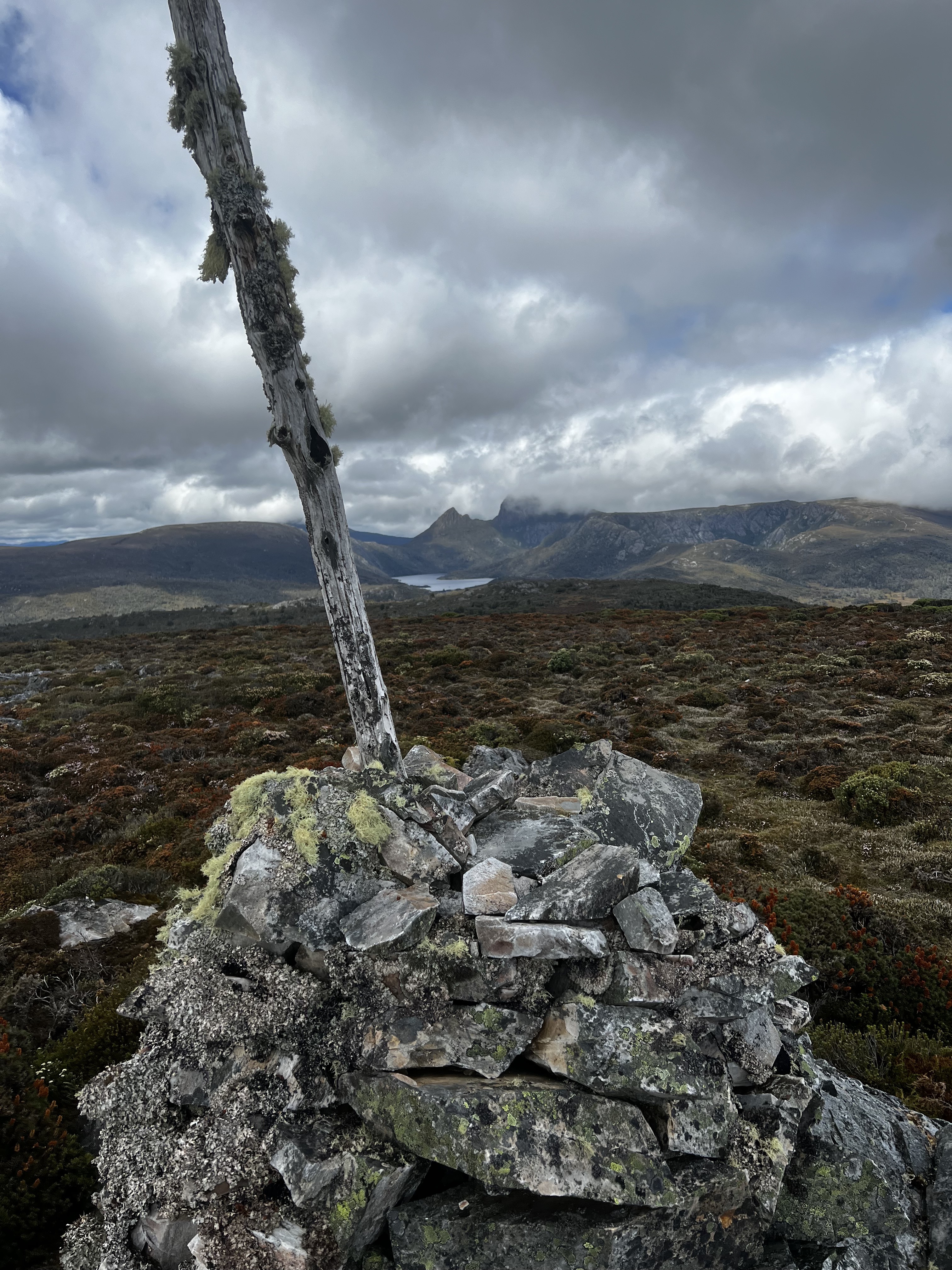
Once you get to the first high point, there’s a saddle to cross to get to Mount Kate proper.
Not much to say on this one, apart from it being an interesting enough walk. And didn’t take too long either.
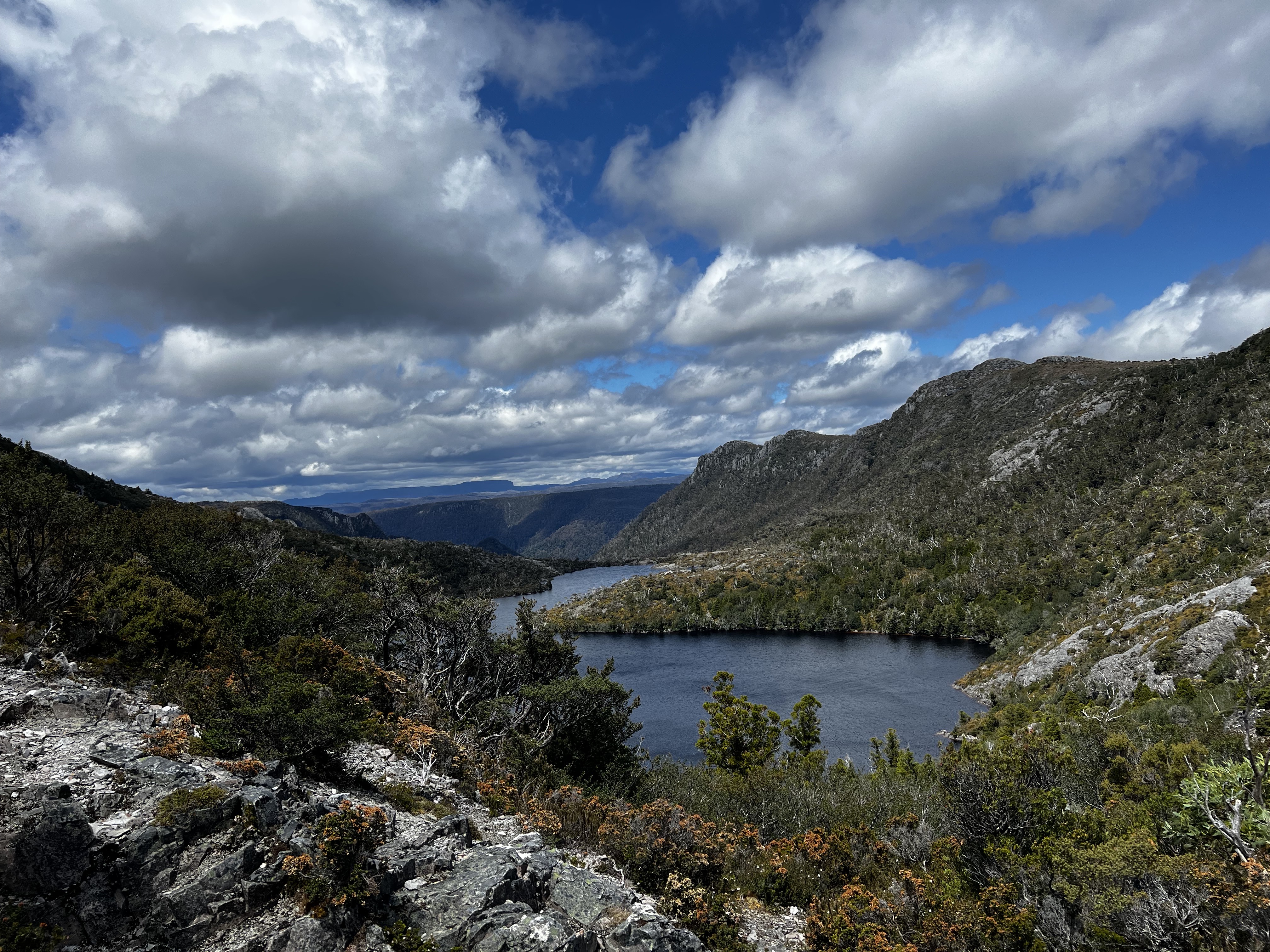
Good views from the top too. The fog had finally lifted!
Roughly 55 minutes to the top and 45 minutes back down.
A nice little walk, but I had to get a move on because I had a bus to catch.
Mount Campbell
I had to wait for the bus to Dove Lake, which gave me about 20 minutes or so before I set off.
Once the bus got to Dove Lake, I was off.
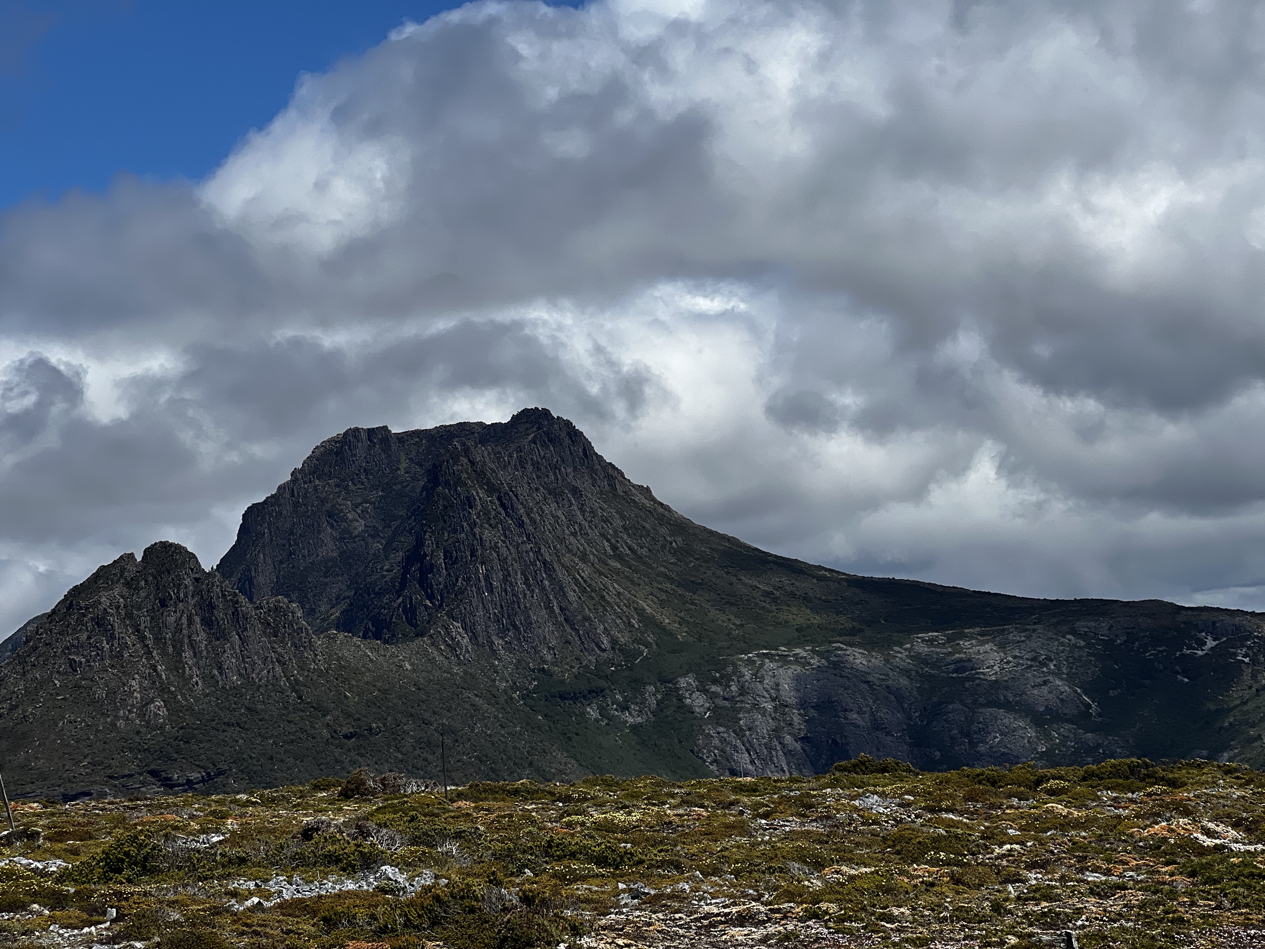
Mount Campbell is as easy to find as they come. Down the track, past Glacier Rock, up the Twisted Lakes Track and up the spur.
There are very cool views of Cradle that you don’t see from the other side of the lake.
I spent a little bit of time looking around on the top.
I could see back to where I’d come from and the previous climbs of the day.
And while it was a lovely day up there, I suspect it’s not always quite that nice.
After a little bit of time, I headed back down and walked a bit more up the track to check out Lake Hanson.
And then it was back on the bus, and back to the car. Three mountains done for the day.
I wish it was that easy all the time. But that’s a story for tomorrow.
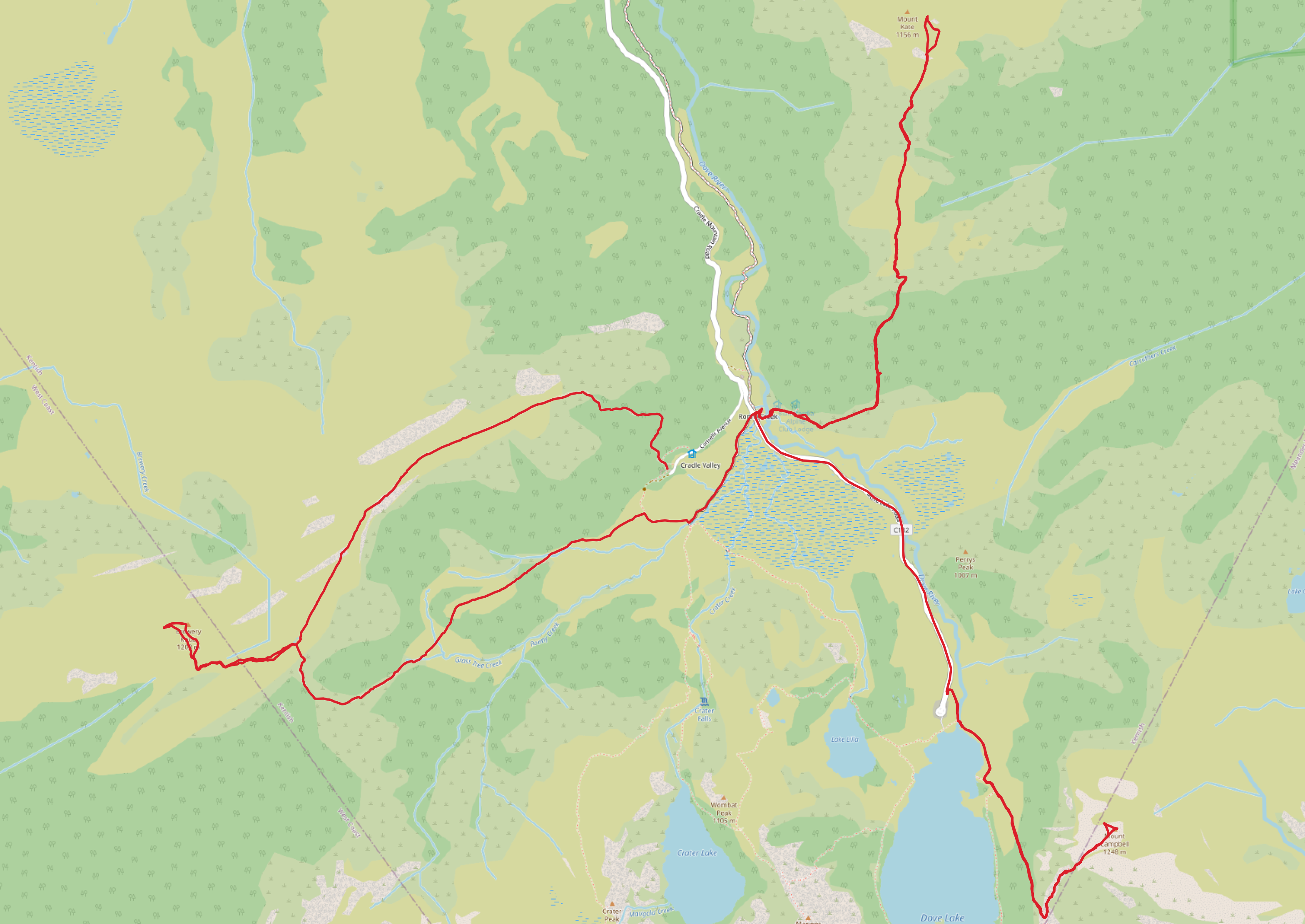
Trip map1
Brewery Knob timings/info:
- Total time: 2 hours and a bit.
- About 8 km total distance.
- 1:00 out, 55 minutes back
Mount Kate timings/info:
- Total time: 1 hour 45 mins
- About 6.5 km total distance.
- 55 minutes out, 45 minutes back
Mount Campbell timings/info:
- Total time: 1 hour 10 mins
- About 4.5 km total distance.
- 35 mins out, 35 minutes back
Elevation map
