We pulled into the Little Fisher Track carpark on Sunday evening, just before 9pm.
It’d be a fairly long journey to get there. “Dinner” at Mood Food had been pretty underwhelming, and there’s always navigational issues in the various twists and turns in the search for Lake Rowallan.
The drive to Lake Parangana and Rowallan always takes longer than you remember, and when you finally get there it seems to go on and on and on.
But eventually, we’d found our way up the (well maintained) Dublin Road, through a few Y junctions and came to the big boulders placed on the road that very simply imply “you shall go no further”.
With the driving done, it was time to get some sleep.
I pitched my tent in what can only be described as a ditch and Dad pitched his in the middle of the road. Well it was more of a side road but it was the best bit of flat ground around so no arguments there.
Day 1
Regular readers will be keen to read how Dad manages to get lost, as that is fast becoming a traditional Clive activity, but not this time.
It was because he had no opportunity. He was dropping me off as he had to be in Ulverstone at 10am on Monday morning.
So after packing up we said our goodbyes and he drove away leaving me to the Little Fisher Track, and a few worrying clouds.
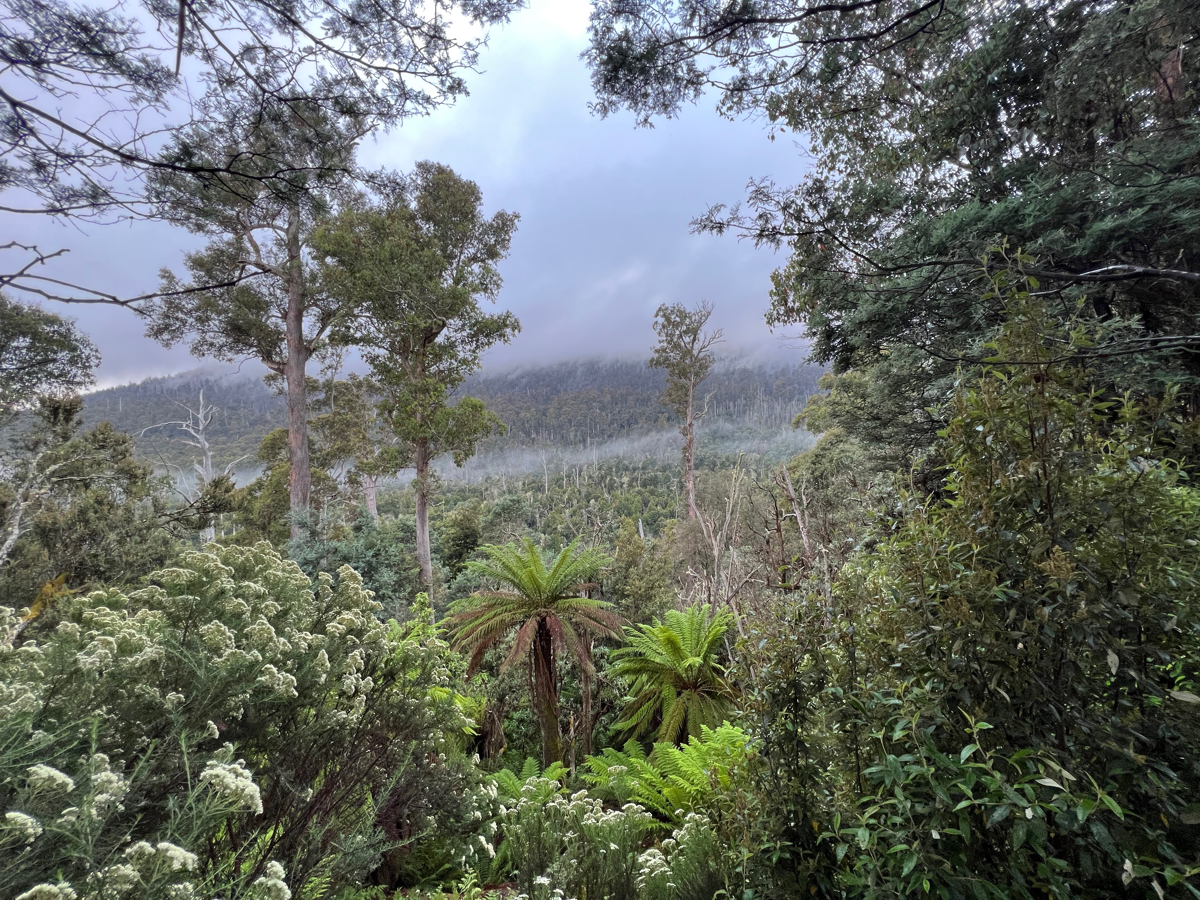
But I need not have worried too much, as the day went on the clouds lifted and a wonderful weather day appeared.
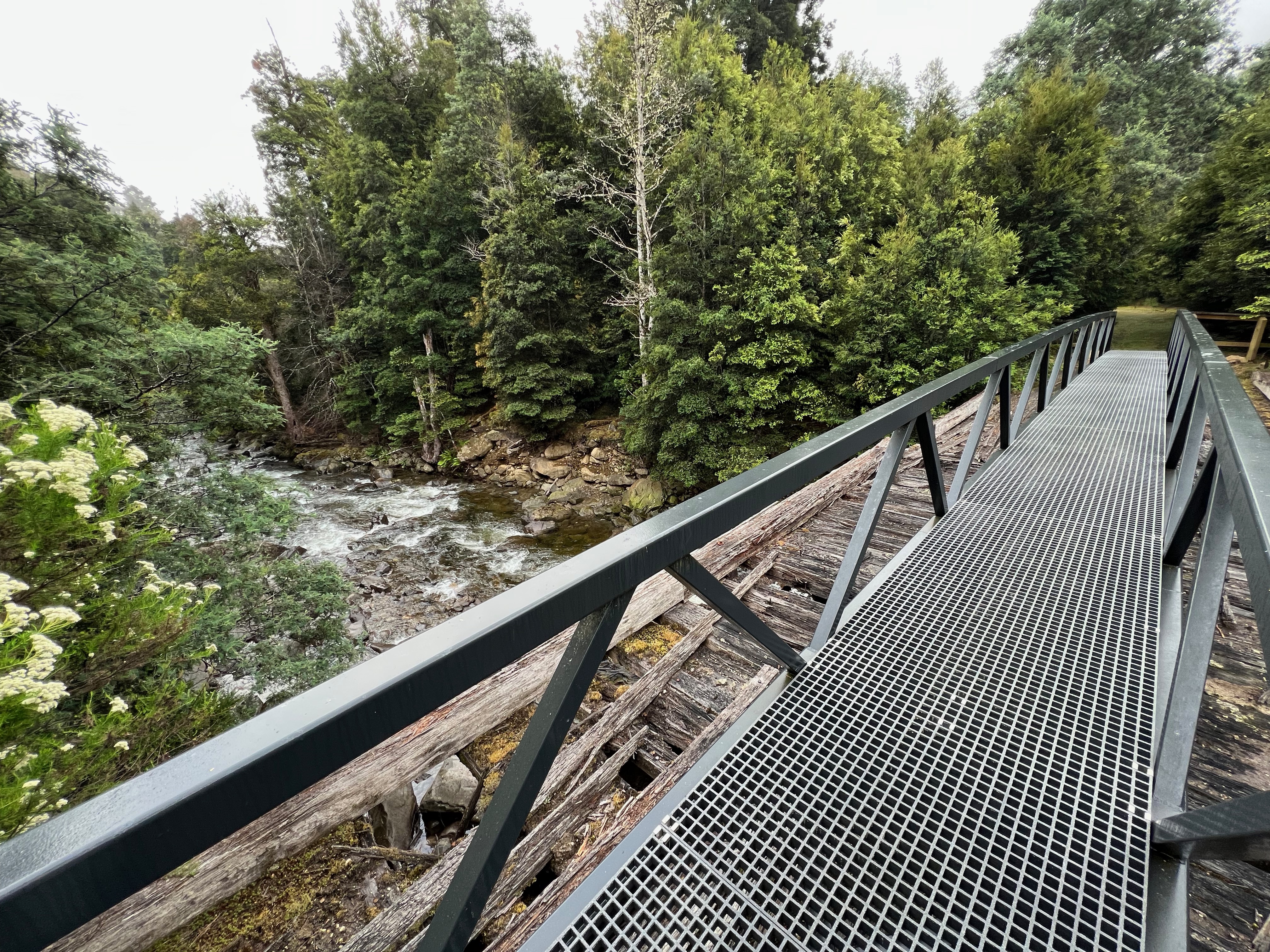
I walked down a former road, that is now walking only until I got to a fancy new bridge crossing the Little Fisher River.
It was very pleasant walking.
After a while, I came to the log book and signed in.
I do like log books, especially seeing how many people are around and where they’re heading.
This route hadn’t been especially popular recently, with the most recent log dating back three or so days and only a smattering of other walkers before that.
Most were also on day trips to Rinadena Falls, a rather spectacular waterfall several hours up the track.
So with the log book done, I continued my walk up the disused 4WD track, slowly gaining elevation as I followed the Little Fisher River along the side of the valley.
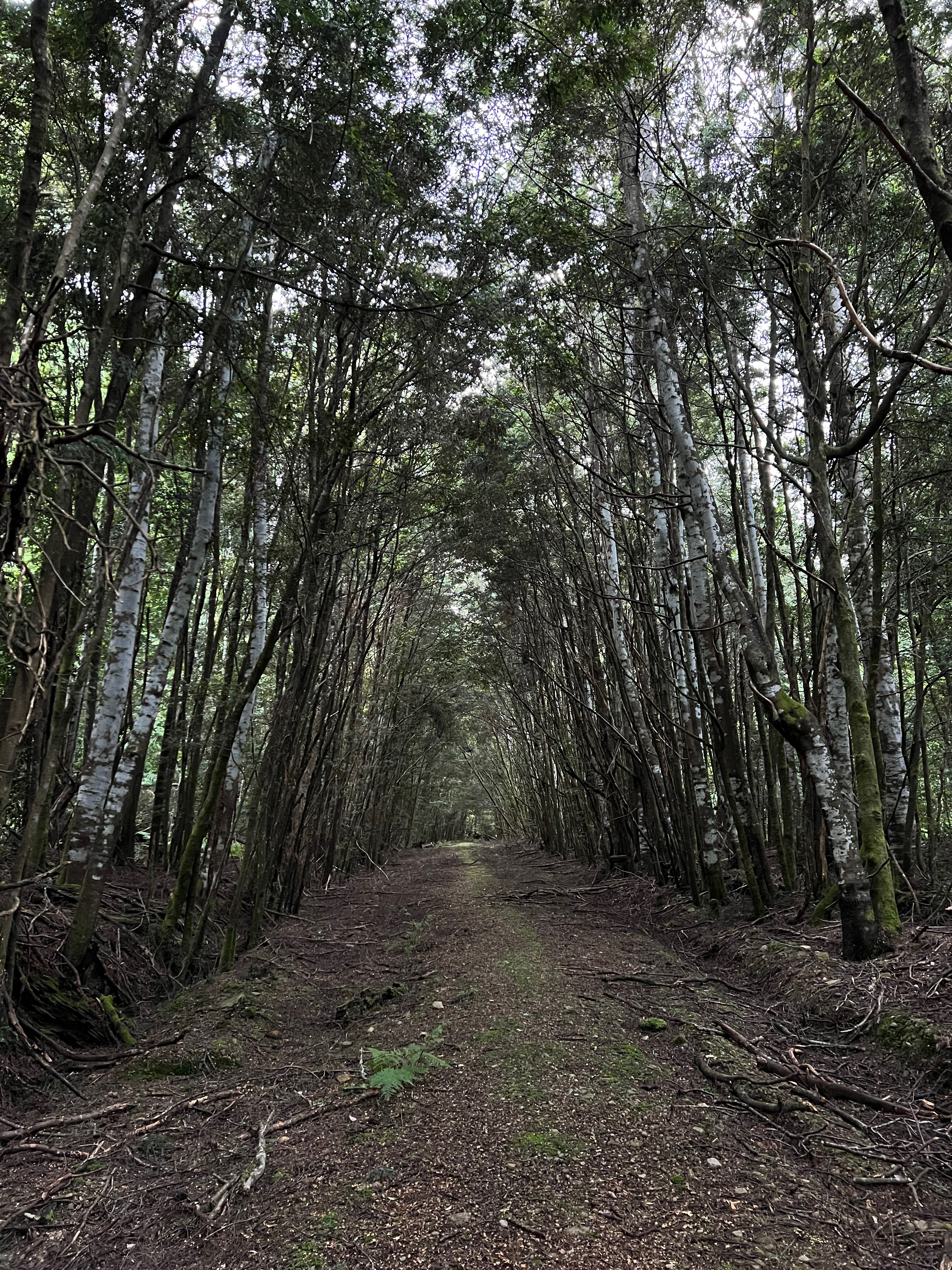
Navigationally, it’s pretty easy though it does get a little hard to follow in some sections. But if you keep your wits about you and don’t just follow everything that looks like walking track and keep an eye out for the tape, I think you’d be fine.
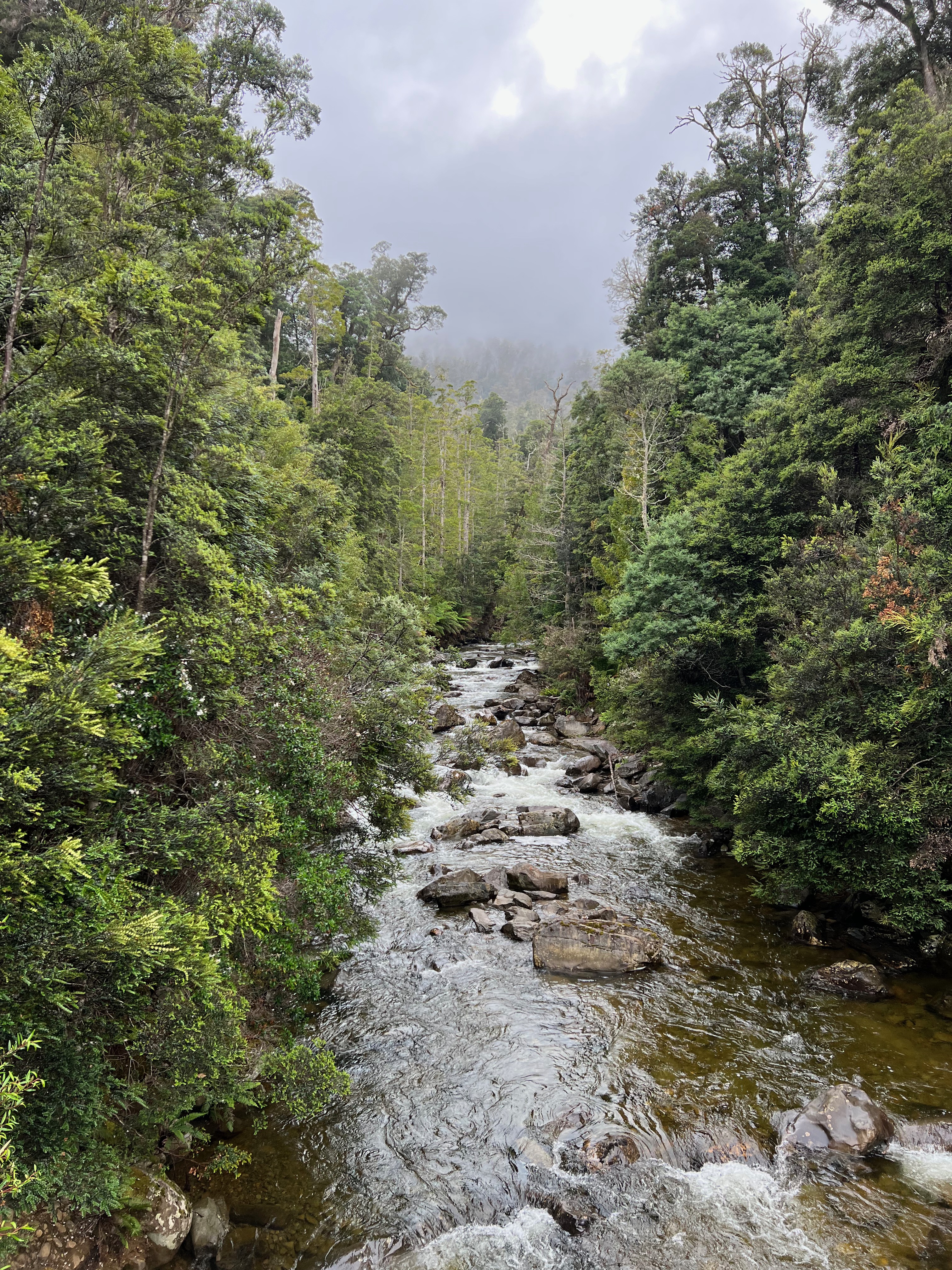
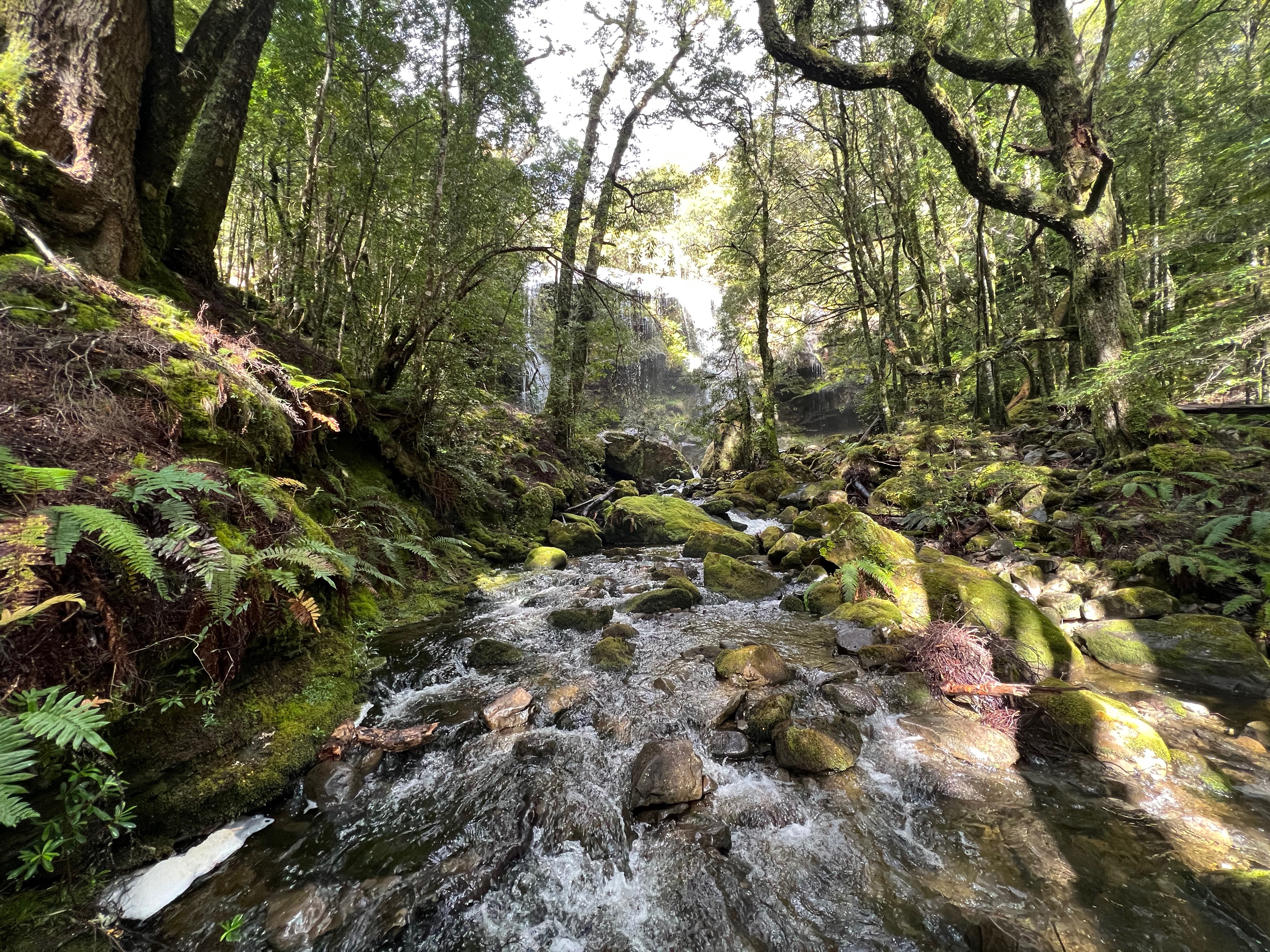
After a few hours, Rinadena Falls seems to just pop into view.
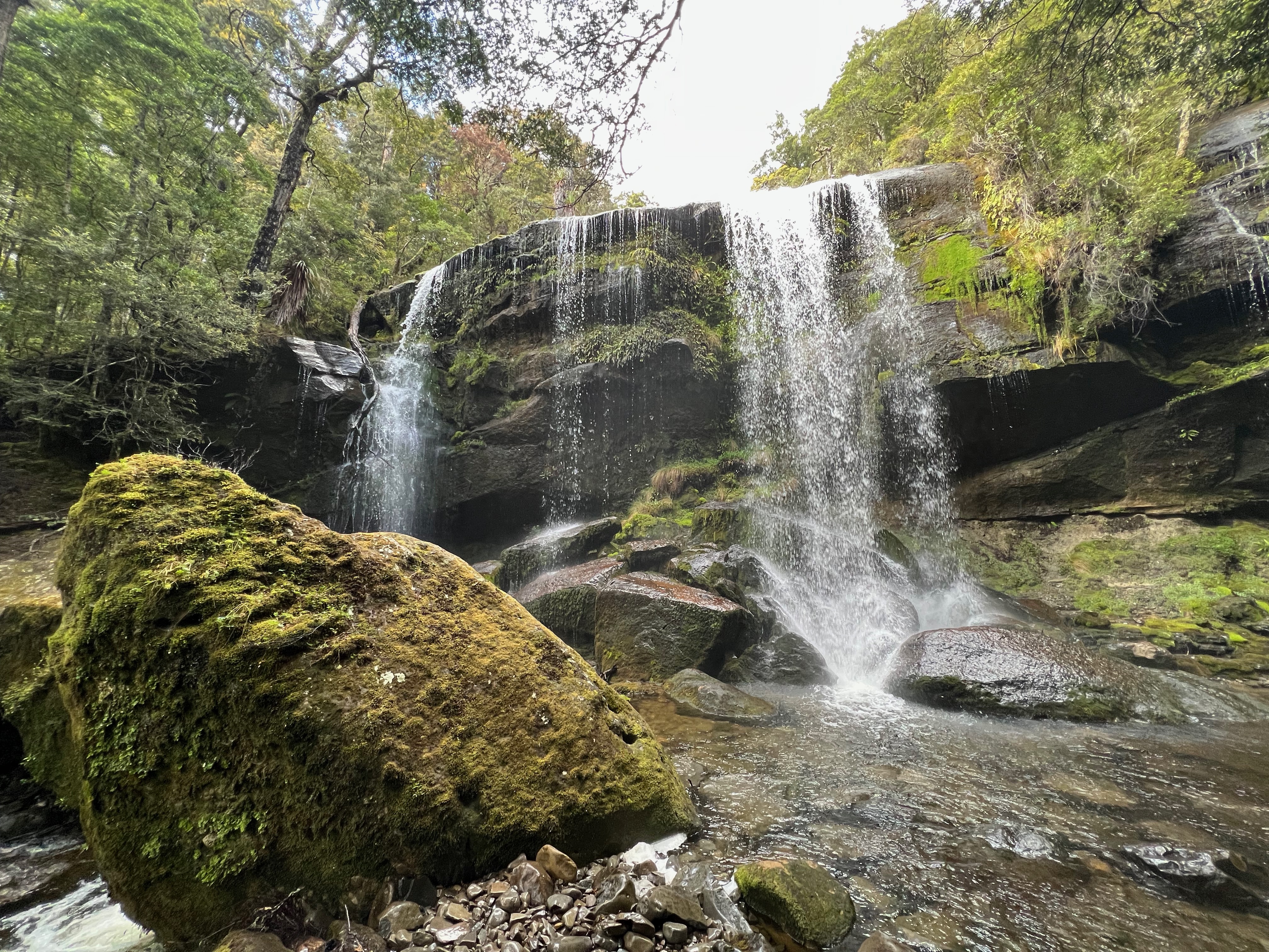
I’m not usually a huge waterfall fan (unsure if this was caused by our failed attempt at Vanishing Falls), but I’ll admit I was quite taken by this one.
After stuffing around trying to get good picture of the waterfall (and realising the very first one I took was probably the best.
Though I do like this one too:
I crossed the river (carefully) and got a bit lost. I headed up the wrong river, where as I should have just thought about it a bit and kept a better eye out for the tape which would no-doubt be there if I looked a bit harder.
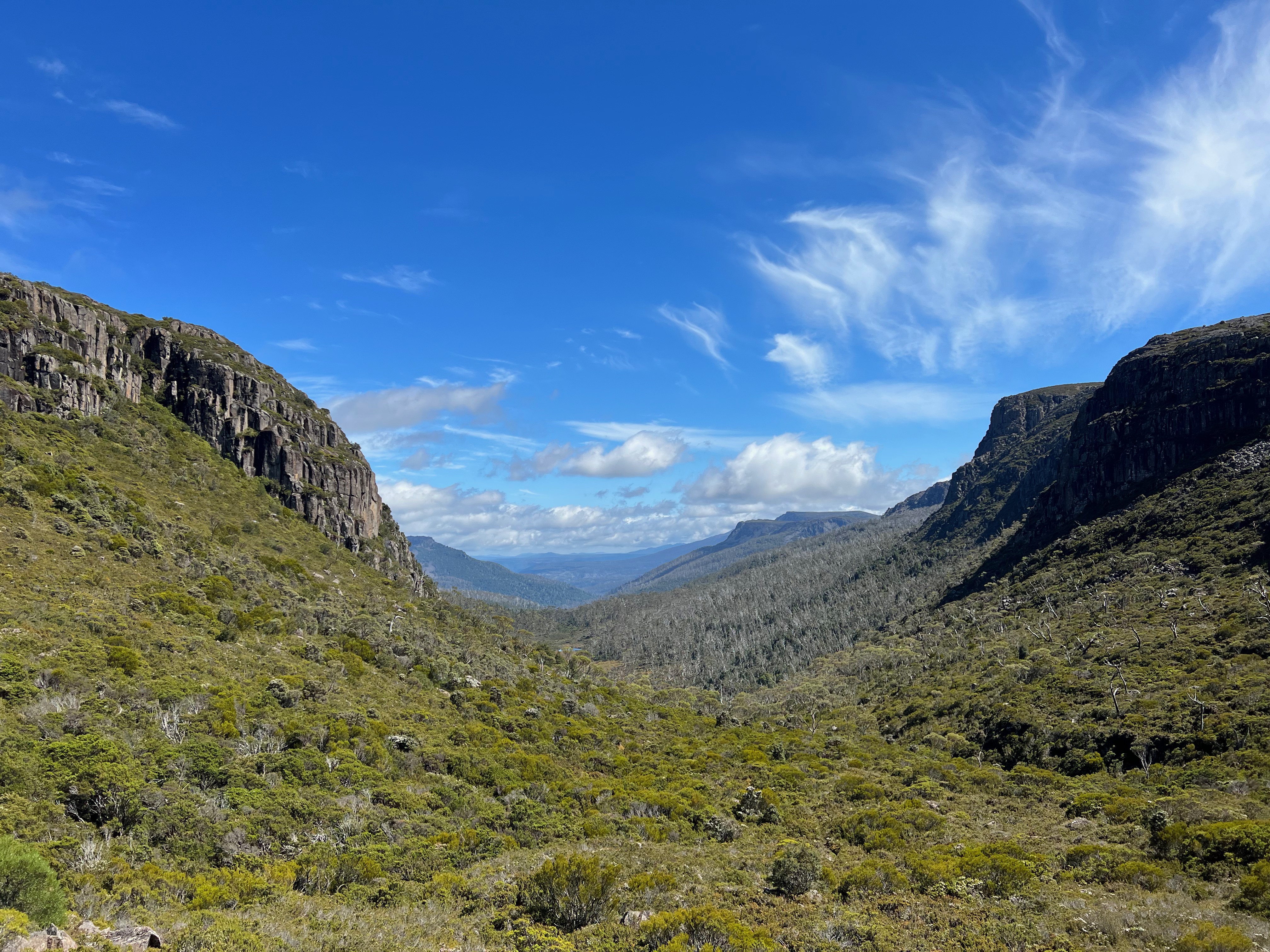
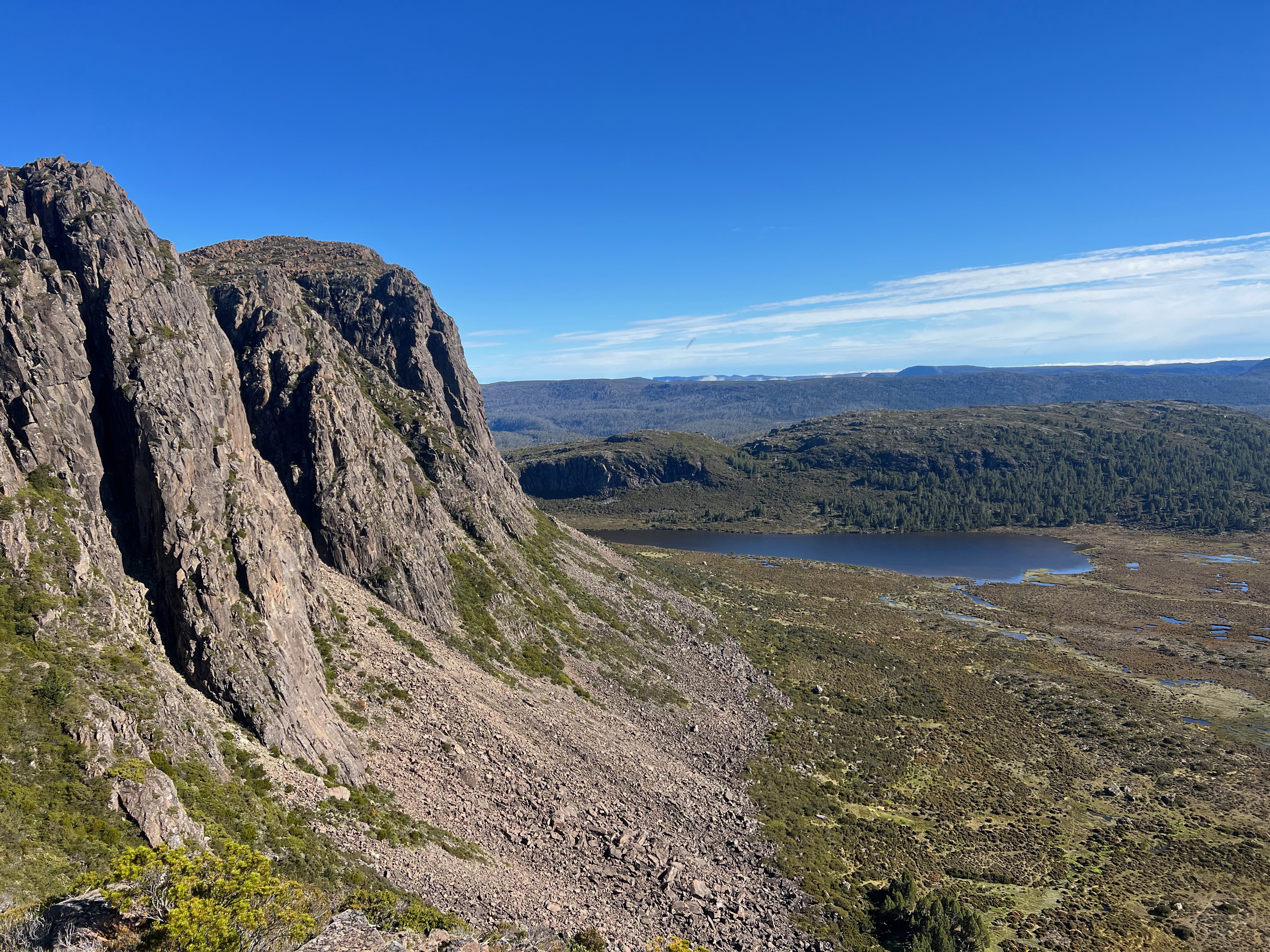
I wandered about trying to get my bearings, but eventually found my way back to the track and climbed out of the forest in the valley into the saddle between my next two destinations: Mersey Crag and Turrana Bluff.
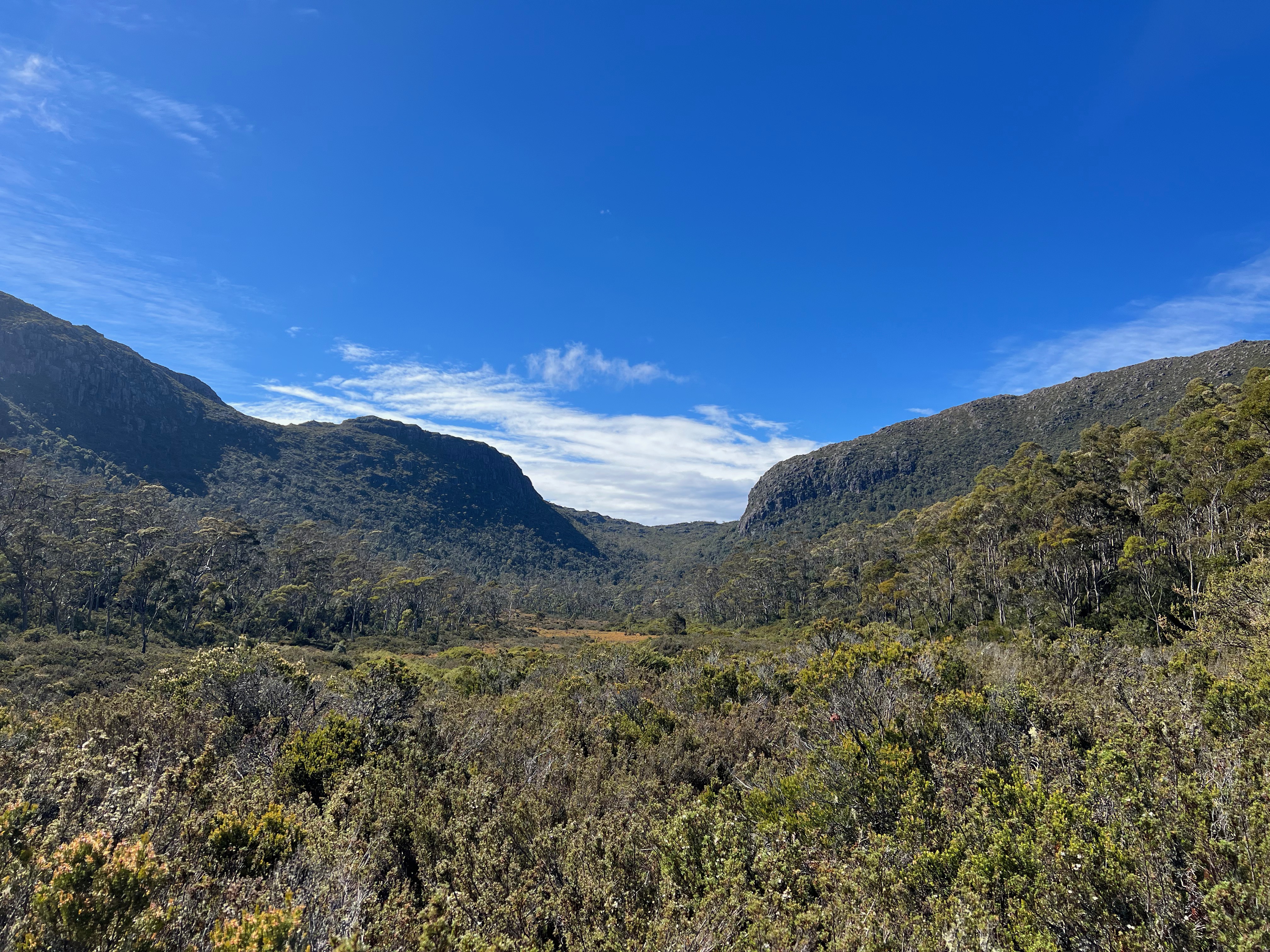
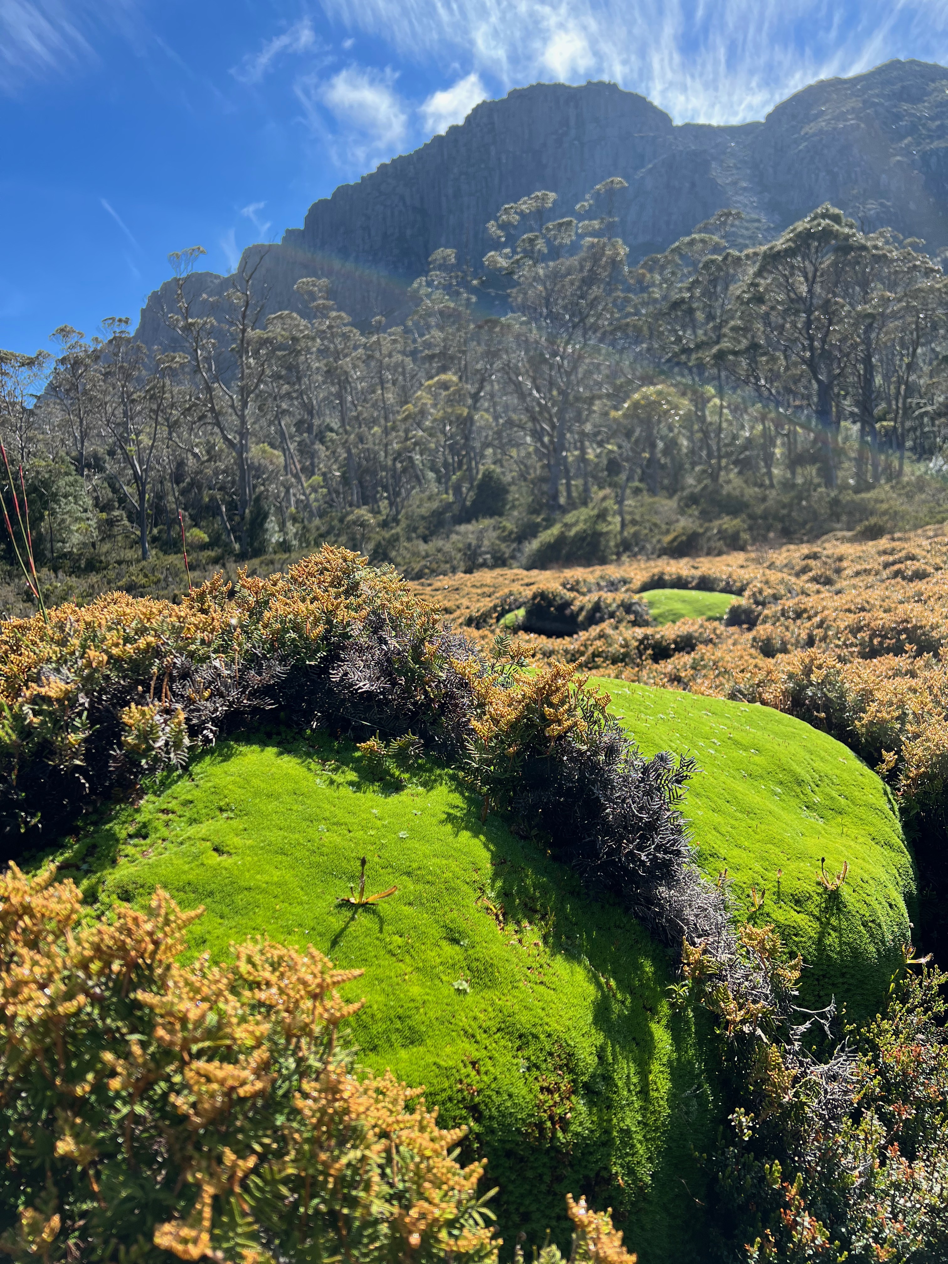
It’s a gorgeous little area, and the sunny warm weather made it all the more inviting. The bush was still wet from the small amount of rain overnight, but I dried off quickly.
It’s an area very strong on the ’little pools of water surrounded by cushion plants flowing into forest and towering cliffs’ vibe.
Eventually you make it high enough into the valley to get a superb view back from where you came, and a taste of the mountains to come.
It was just before 11am, so I decided I’d aim for Mersey Crag before lunch.
It was scrubbier than I would have liked, and was a bit of a battle up the hill to the crest.
After a slow start, it did get easier up the top and after about 55 minutes I was at the peak.
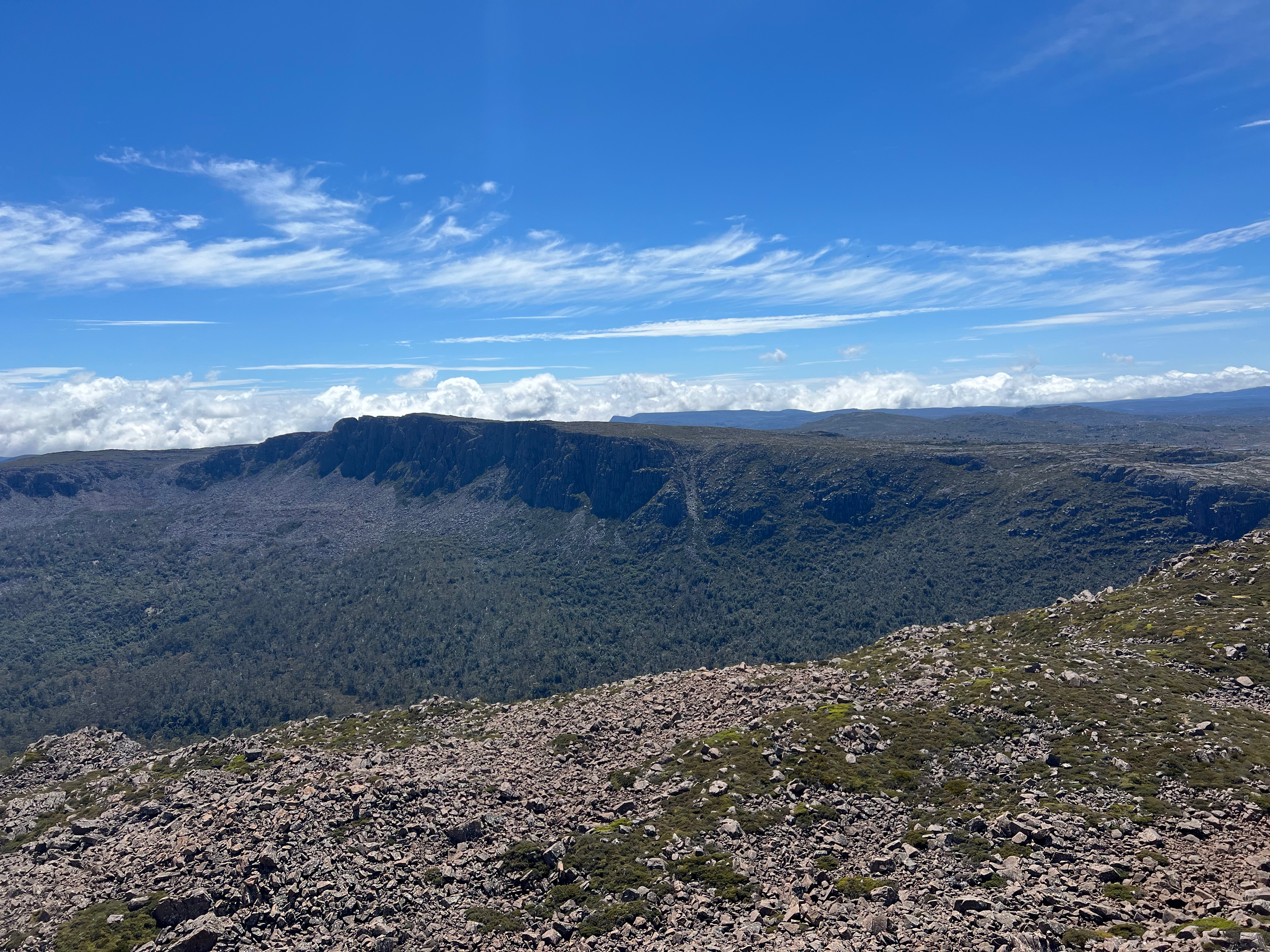
As usual, there were lovely views all around me, with Mount Jerusalem and King Davids Peak off into the near distance. The mountains closer to the Overland/Lake St Clair area further away still.
After spending some time taking photos, it was time to head back for some lunch.
The walk back took about 45 minutes. I think I picked a better route.
After lunch (the same old wraps, which I am now very sick of), Turrana Bluff called.
The walk up to the escarpment was relatively tough. I wasn’t sure if there was a better way up, so I again battled through scrub, climbed the occasional rock ledge and tried to pick the best way through.
After you get onto the top bit though, the going gets easier as you jump from rocky outcrop to rocky outcrop and through low-lying scrub.
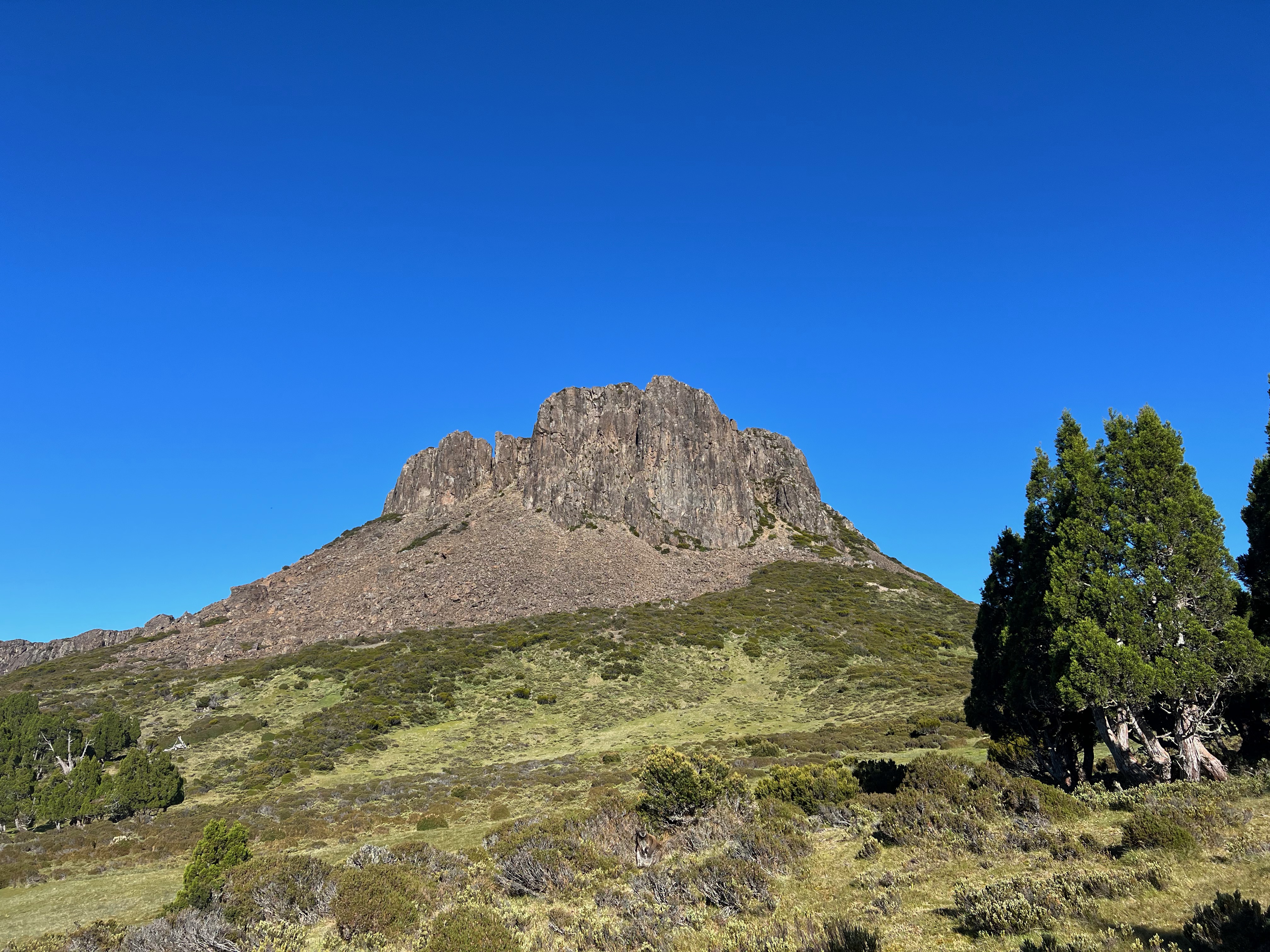
It also took about an hour to the top, but picking exactly what “the top” is seems to be harder than it seems.
The offical TasMap 1:25000 has the peak at 1454 meters, and there’s a pile of cairns on it to mark that.
But reading a few other accounts1, the true peak seems to be a big wedged rock (or chockstone) making up the high points of one of the three summits a little further to the north.
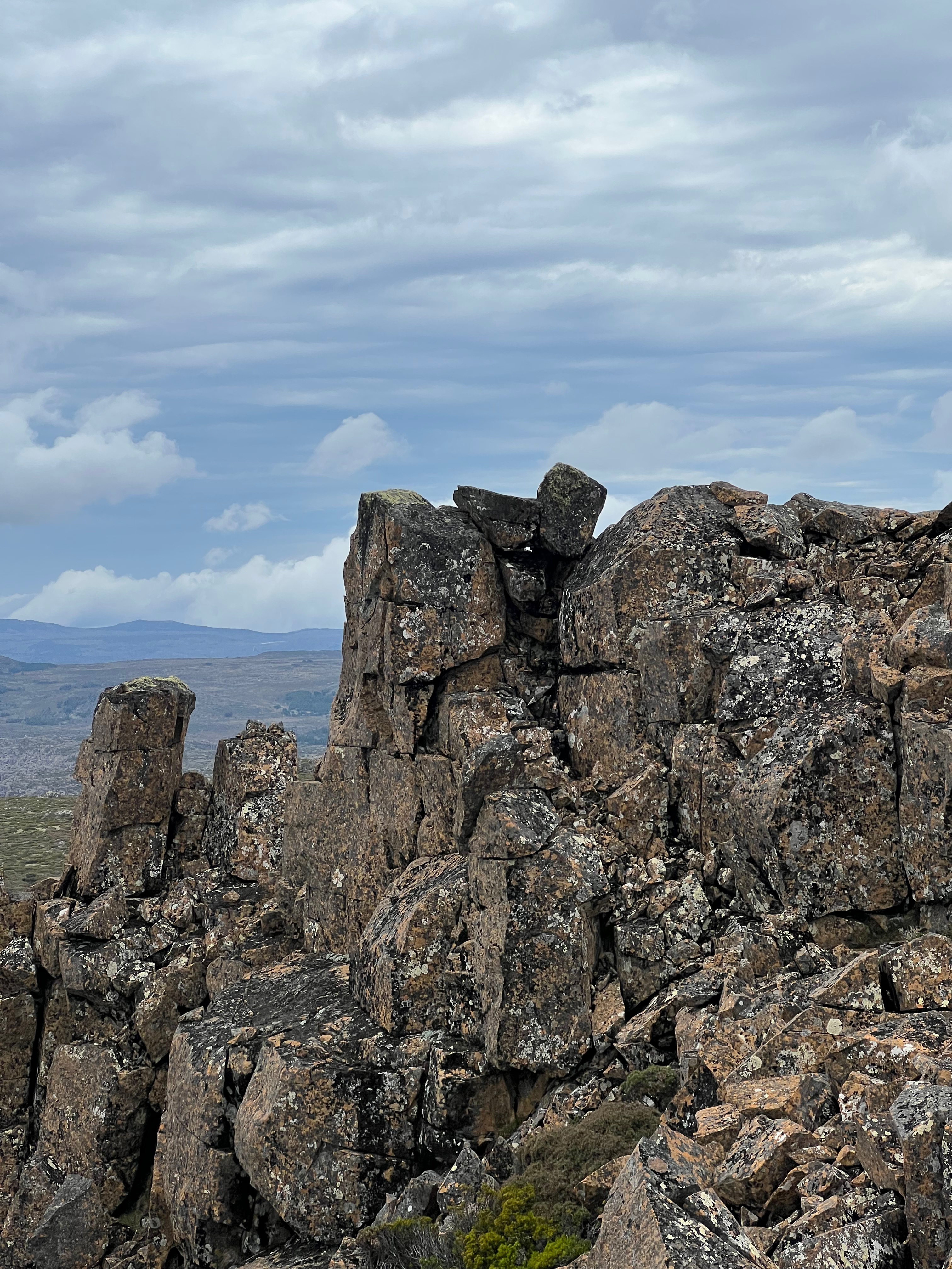
Anyway, I visited all three just to be sure, and was very mindful of the cliffs just below me.

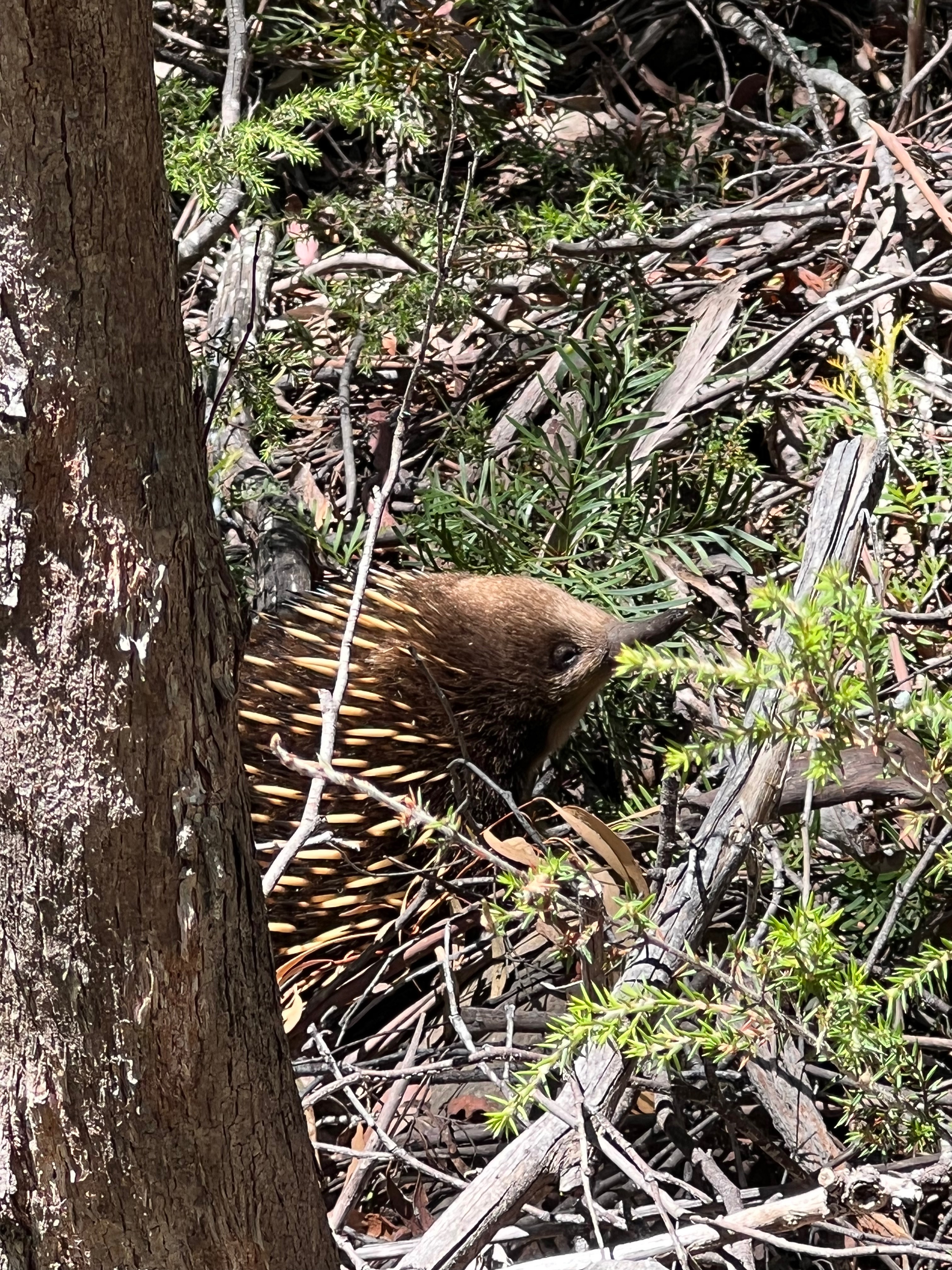
On the way back down, I saw an echidna (always a pleasure) and picked another terrible line off the escarpment back to my bag.
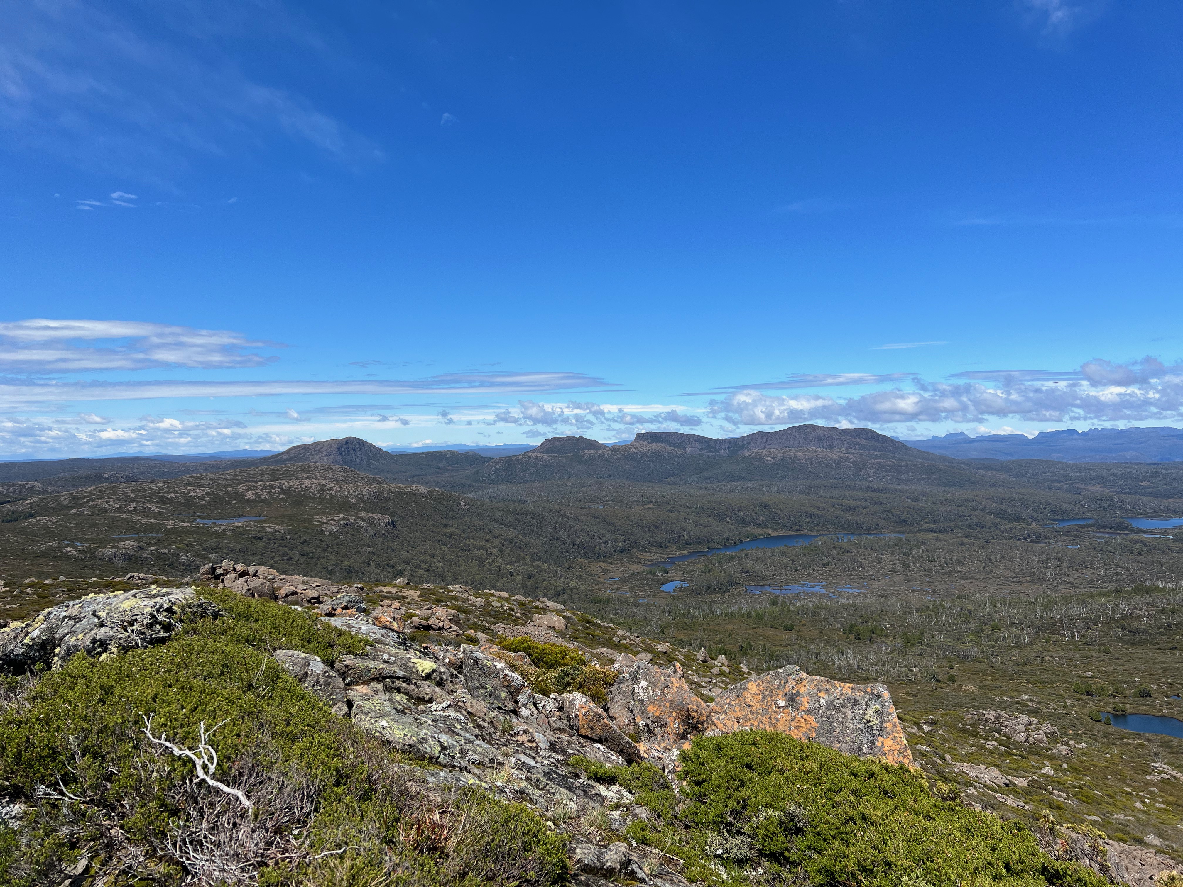
It was still early afternoon, and I was keen to walk to Lake Thor several kilometers away for the night. It would mostly be a slog.
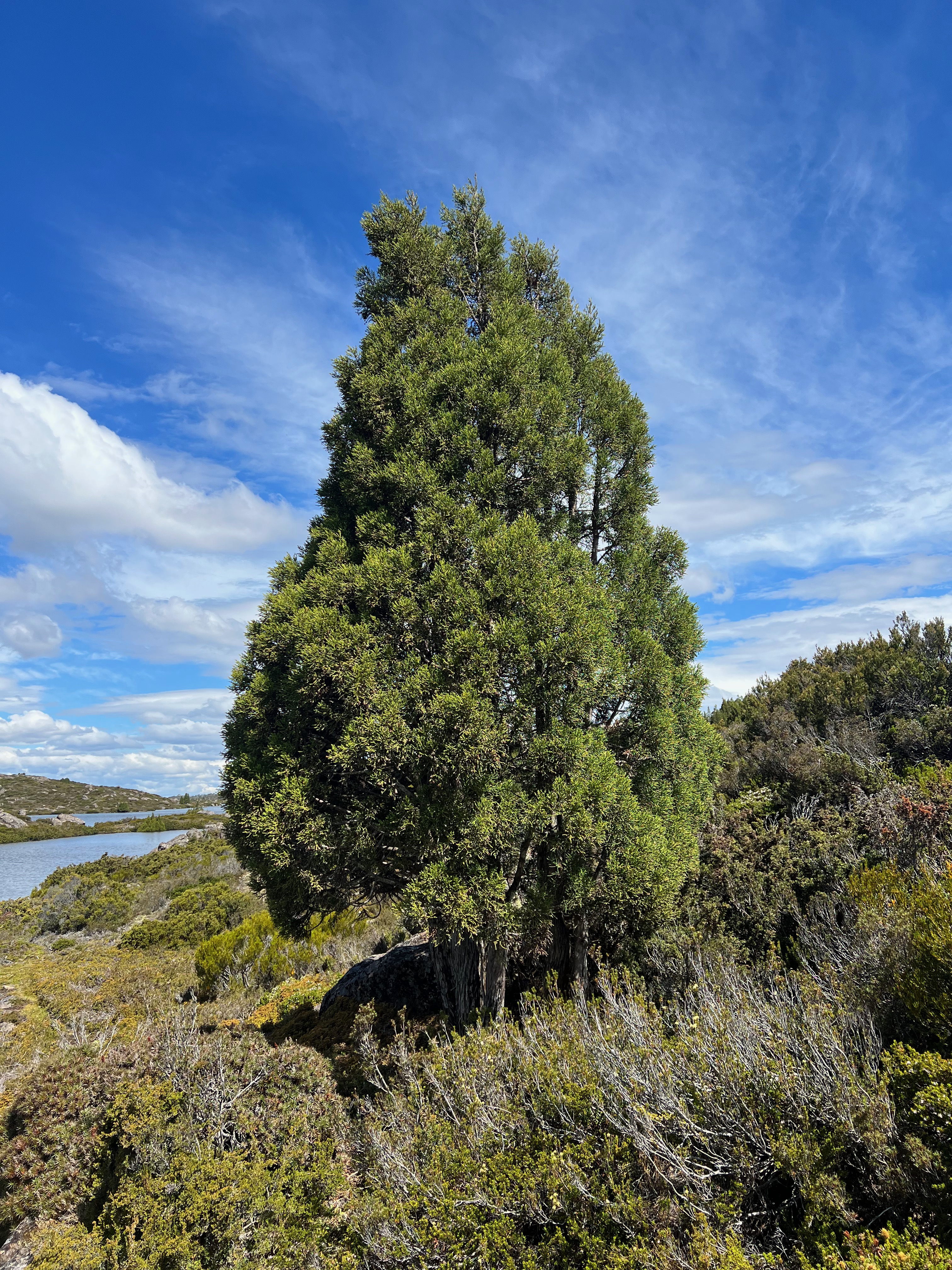
The walk up to and along Long Tarns was incredibly lovely, with pencil pines popping up along the way.
But after Long Tarns, the going got harder. I was probably tired, and made a few dumb route choices which found me in thicker scrub than I wanted.
I made my way over Richea Ridge, down to Daisy Lakes, threaded through the middle and then over the hill (bad choice?) to Lake Thor.
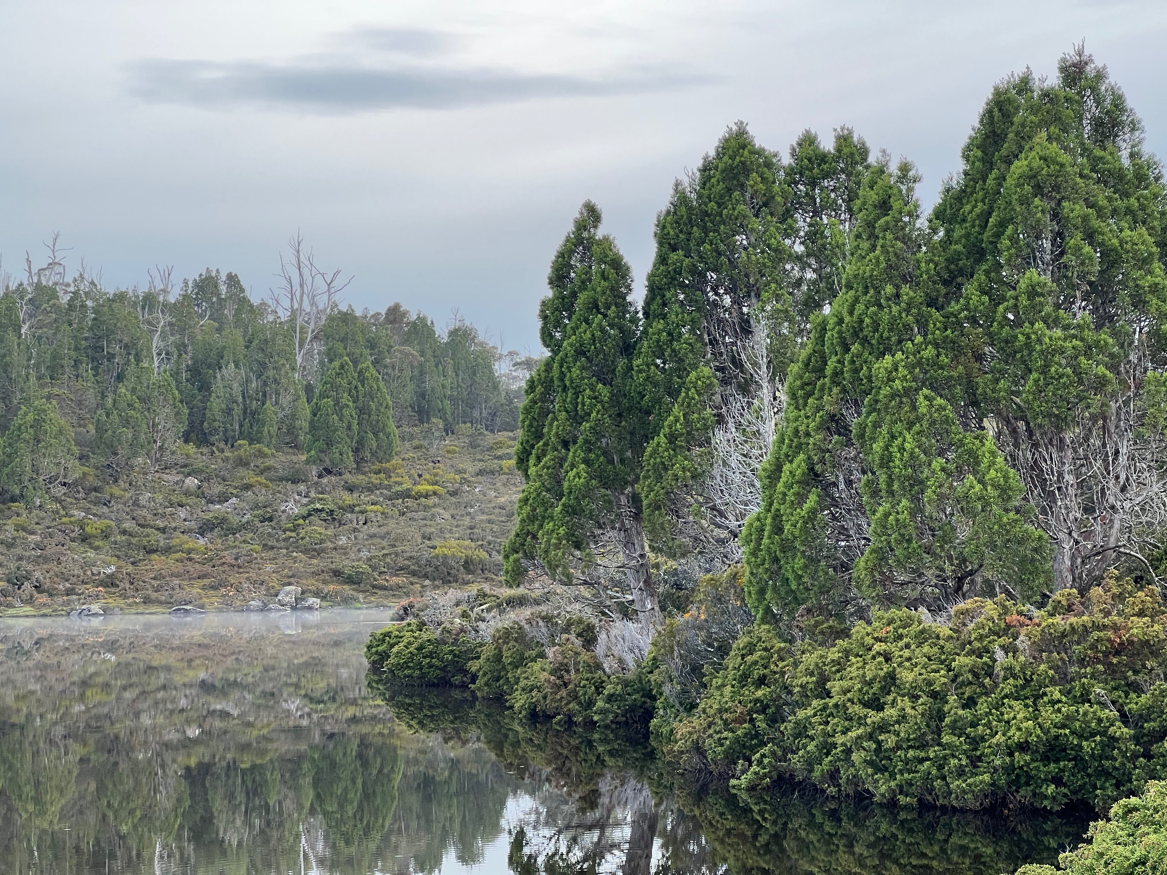
I did find a lovely walking track on the eastern lakeside of Thor, which led me to my eventual campsite.
From Long Tarns the walk was about 2 hours 15 mins. The day all up? 11 hours and 30km! I was stuffed.
A quick dinner then into bed by 7:30pm. The wind died off and it was a beautifully still night. Bliss.
Day 2
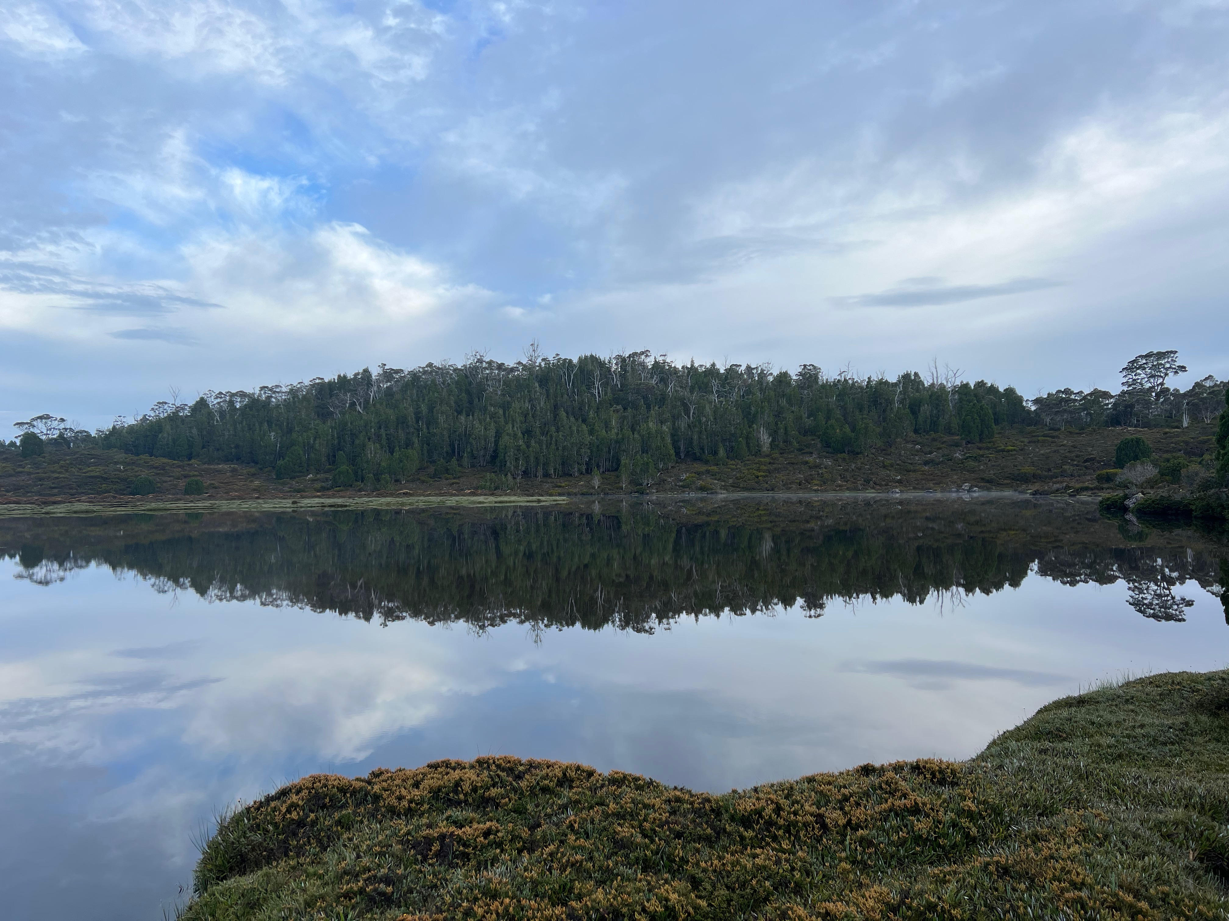
I awoke to a very still lake, and more beautiful scenery.
Today would be easier than the day before.
I was going to the peak of, well, King David and then out via the Walls of Jerusalem track.
But I still had to get up to Dixon’s Kingdom. I quickly found my way over Officers Creek and found a track taking me up the Valley of Hinom towards Jaffa Gate.
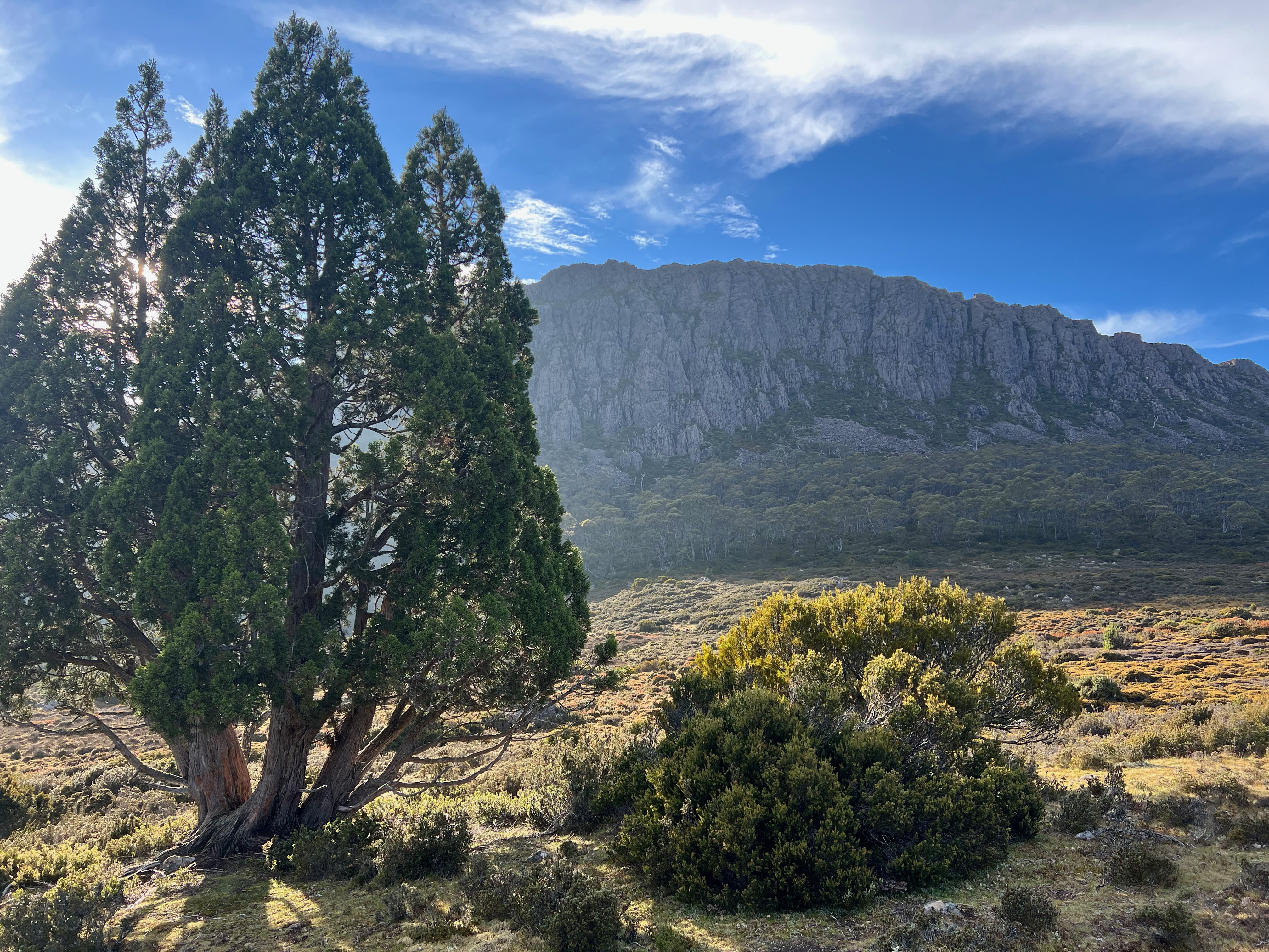
The sun was coming up next to Mount Jerusalem and the weather was warm. What a stunning place of the world this is.
When I got to Dixon’s Kingdom, a few people were already packing up and I was keen to see if possums were still the true kings of this area.
And after one bloke told me about his night fighting possums, I think it’s safe to say that yes, yes they are.
I’d walked through the Walls several times before, but I had never walked along the top of them.
So I climbed Solomons Throne…
…and began following the well marked track to King Davids Peak.
It took about 1 hour 15 minutes to get to the top of King Davids Peak from the bottom of Solomons Throne.
And from the peak, it was pretty much all down hill to the carpark. I had heaps of time to spare, so I just ambled along.
Down and down I went. Trappers Hut came and went. Down and down some more.
I met a few people coming up. After a quick chat, down and down I went some more.
Saw another echidna…
… and before I knew it, I was back at the (now, much expanded!) Walls of Jerusalem carpark to wait for Dad to swing by and collect me.
He’d been on a day walk of his own too. He’d gone up the track to Lake Bill which takes you past Nescient Peak and towards Mount Ragoona… but that’s a track for another day.
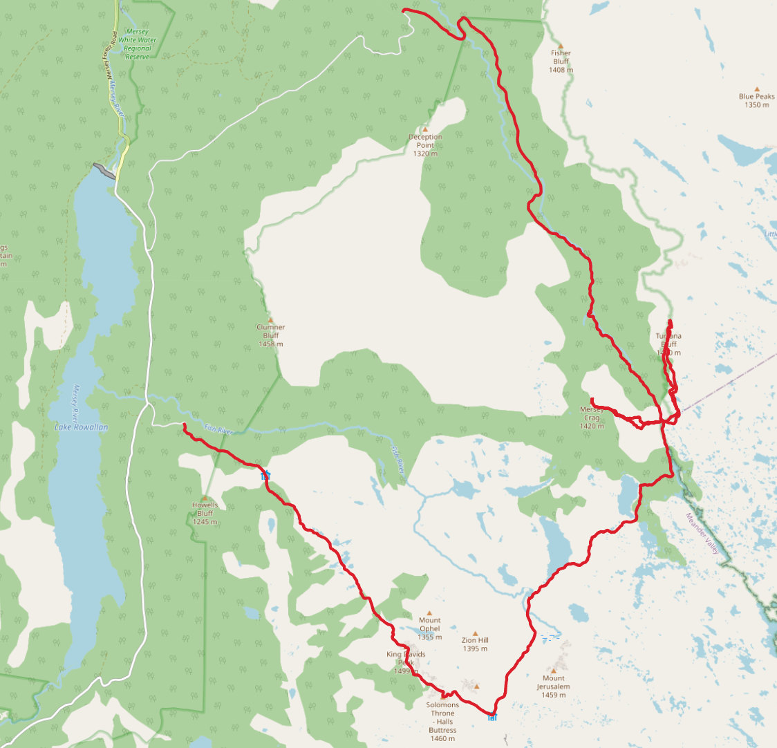
Trip map2
Walk dates: 10th January 2022 - 11th January 2022
- Day 1 (10th January):
- 11 hours walking. 30km. ~1700m ascent
- Day 2 (11th January):
- 5 hours walking. 14km. ~500m ascent
Further reading
- A lovely pictorial journey: Off-track adventures: Turrana Bluff, Mersey Crag & Clumner Bluff
- Mersey Crag, Turrana Bluff and Mt Claude: 11 November 2013
- Turrana Bluff - 8th December 2019